
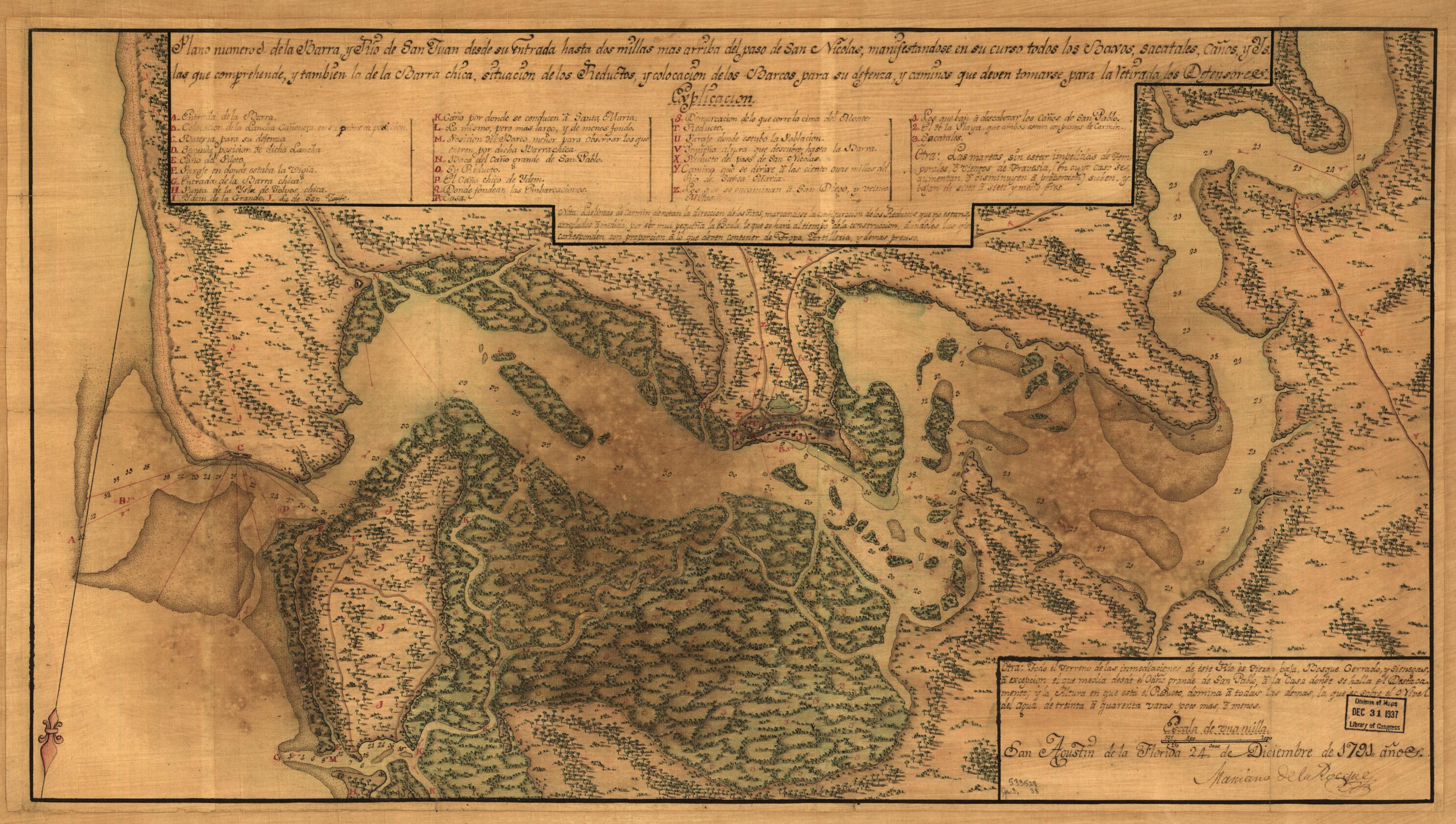
Plano Numero 1. De La Barra, Y Rio De San Juan Desde Su Entrada Hasta Dos Millas Mas Arriba Del Paso De San Nicolas, Manifestandose En Su Curso Todos Los Baxos, Sacatales, Caños, Y Ys. Las Que Comprehende, Y Tambien La De La Barra Chica, Situacion Do...
- Regular price
-
$70.95 - Regular price
-
$65.95 - Sale price
-
$70.95
Shipping calculated at checkout.
Buy one map, get one map 50% off!
Couldn't load pickup availability
About This Map
Old map of Florida, Jacksonville Metropolitan Area, Saint Johns River Region, United States.
Created by Mariano De La Rocque in 1791.
Created by Mariano De La Rocque in 1791.
- Covers Saint Johns River and environs from Atlantic coast to current site of Jacksonville, Florida.
- Relief shown pictorially. Depths shown by soundings.
- Shows defenses and fortifications.
- Also shows vegetation pictorially.
- Bar scale incorrect.
- Oriented with north toward the lower left.
- Pen-and-ink and watercolor.
- Map backed with cloth.
- Includes notes and index.
- This map has some imperfections: darkened and stained. We'll do our best to restore the image before printing.
Map Sizing Information
- For the best legibility, order your map in the original size or larger. Most maps have intricate detail and small text that is best appreciated when the print size hasn't been reduced.
- Sizes labeled "Fits a Standard Frame" will drop right into any frame that you purchase in that size. The sizes that we offer are commonly available online and at most retail stores.
- Our standard sizes are recommendations based on the aspect ratio of the original map, but still may require some added "white space" in one dimension to fit.
- Non-standard sizes will require custom framing, and we suggest taking your print to the frame shop of your choice after you receive it for the best results.
- Custom sizes are available, simply contact us for a quote.
Below is an approximation of the scale of a few standard sizes, and how they might appear in your space.
