
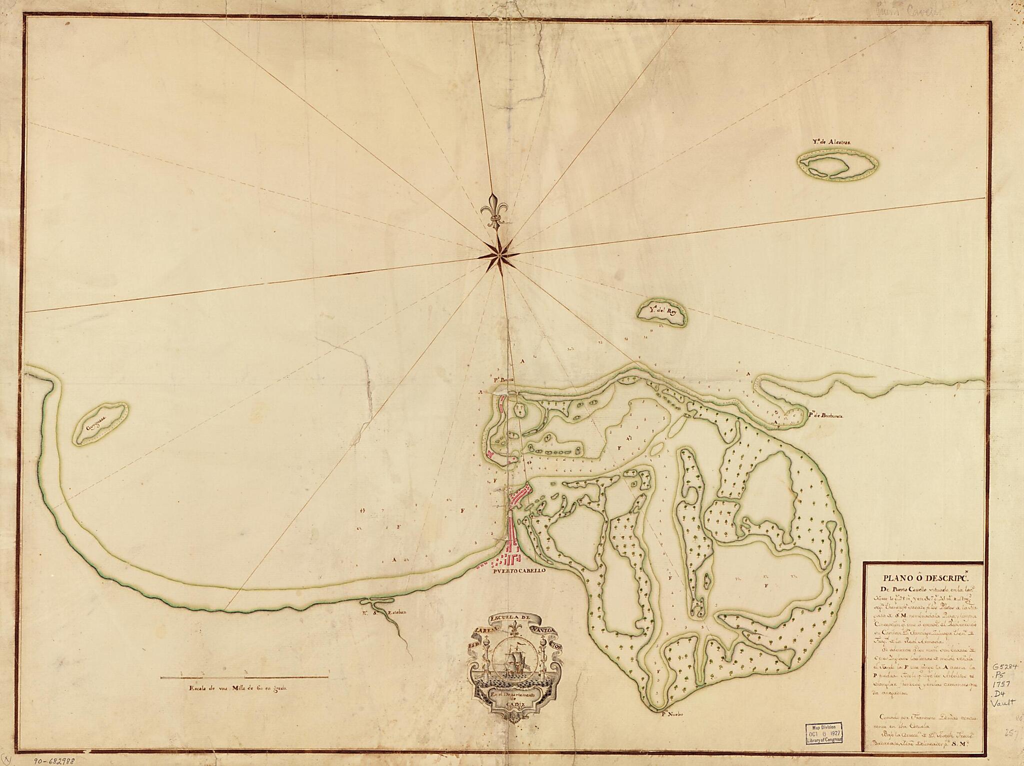
Plano O Descripcn. De Puerto Cavello Situado En La Latd. Norte 10 Gs. 28 Ms. Y En 307 Gs. 25 Ms. De Longd. Segn. Thenerife Sacado Pr. Los Pilotos De La Fragata De S.M. Nombradala Pura Y Limpia Concepción Qe. Vino a Operaces. Del Real Servicio Su Capi...
- Regular price
-
$68.95 - Regular price
-
$63.95 - Sale price
-
$68.95
Shipping calculated at checkout.
Buy one map, get any other map in our collection for 50% OFF! Add to cart to see discount.
Couldn't load pickup availability
About This Map
Old map of Atlantic Coast, Puerto Cabello, Venezuela.
Created by Francisco Denias, Spain) Real Escuela De Navegación (Cádiz in 1757.
Created by Francisco Denias, Spain) Real Escuela De Navegación (Cádiz in 1757.
- Shows coast of Venezuela in the vicinity of Puerto Cabello.
- Depths shown by soundings.
- Prime meridian: Tenerife.
- Watermarks: IV; and, Strasburg fleur-de-lis.
- Pen-and-ink and watercolor.
- Mounted on cloth backing.
- Includes note.
- Maggs number annotated in pencil in lower right margin: 257.
Map Subjects
Atlantic Coast
Atlantic Coast (Venezuela)
Coasts
Early Works To 1800
Manuscript Maps
Maps Manuscript
Puerto Cabello
Puerto Cabello (Venezuela)
Venezuela
Francisco Denias
Spain) Real Escuela De Navegación (Cádiz
1757
Map Sizing Information
- For the best legibility, order your map in the original size or larger. Most maps have intricate detail and small text that is best appreciated when the print size hasn't been reduced.
- Sizes labeled "Fits a Standard Frame" will drop right into any frame that you purchase in that size. The sizes that we offer are commonly available online and at most retail stores.
- Our standard sizes are recommendations based on the aspect ratio of the original map, but still may require some added "white space" in one dimension to fit.
- Non-standard sizes will require custom framing, and we suggest taking your print to the frame shop of your choice after you receive it for the best results.
- Custom sizes are available, simply contact us for a quote.
Below is an approximation of the scale of a few standard sizes, and how they might appear in your space.

