
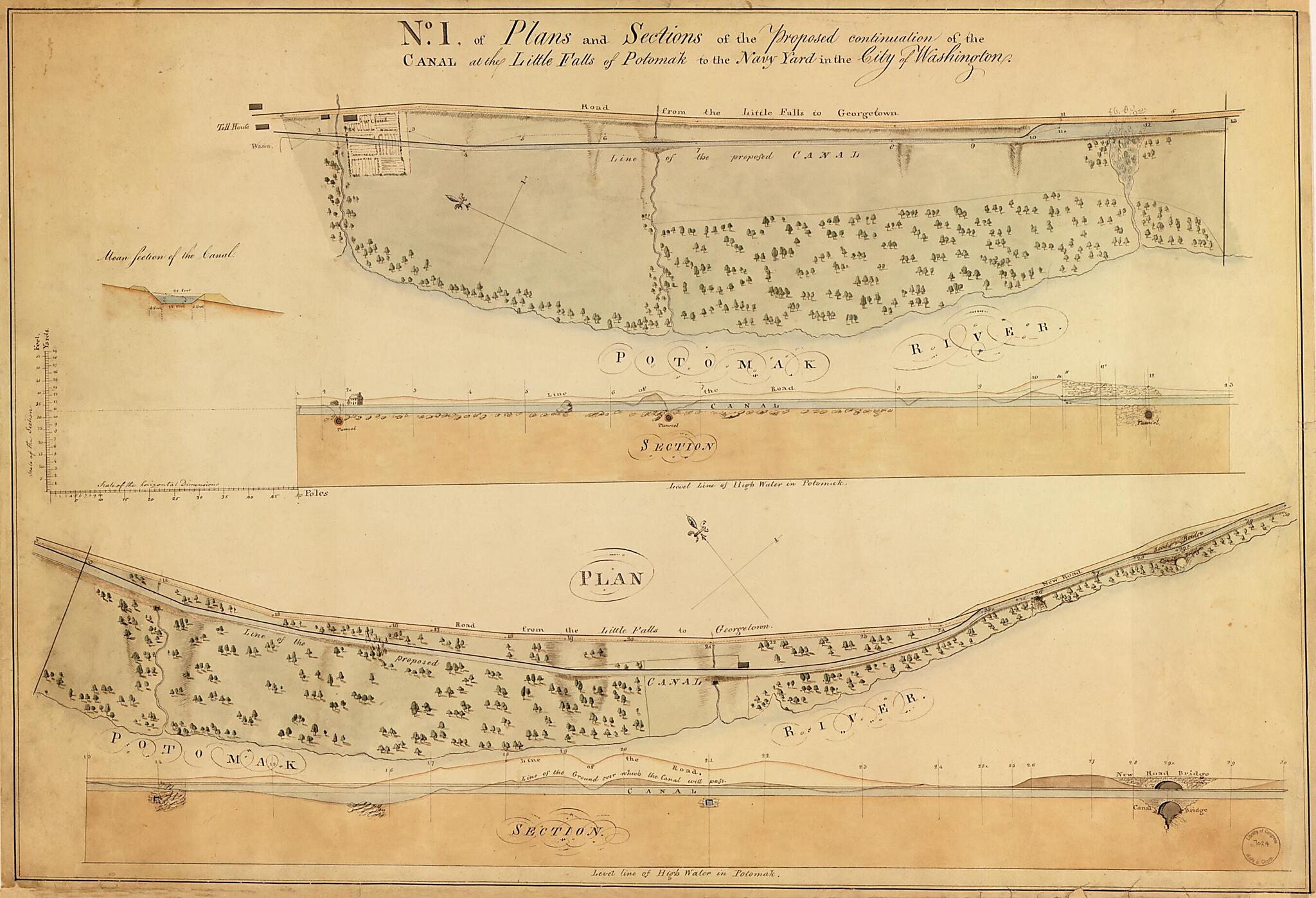
Plans and Sections of the Proposed Continuation of the Washington Canal from Rock Creek to Little Falls of the Potomac, Washington D.C. 1802
- Regular price
-
$79.95 - Regular price
-
$74.95 - Sale price
-
$79.95
Shipping calculated at checkout.
Buy one map, get any other map in our collection for 50% OFF! Add to cart to see discount.
Couldn't load pickup availability
About This Map
Old manuscript map of Chesapeake, Chesapeake and Ohio Canal, District of Columbia, Georgetown, Georgtown, Maryland, Ohio Canal, United States, Washington Canal, Washington D.C..
Created by N. (Nicholas) King, Benjamin Henry Latrobe in 1802.
Created by N. (Nicholas) King, Benjamin Henry Latrobe in 1802.
- Section III also covers lower part of Georgetown.
- Drawn by Nicholas King.
- Pen-and-ink and watercolor.
- Map no. I drawn in 2 sections and oriented with north toward the upper left.
- Mounted on cloth backing.
- Some maps include text, inset, or 1 or 2 longitudinal sections of canal.
- Phillips. Washington 74
Map Subjects
Chesapeake And Ohio Canal
Chesapeake And Ohio Canal (Md. And Washington D.C.)
District Of Columbia
Georgetown (Washington D.C.)
Georgtown
Manuscript Maps
Maryland
Planning
United States
Washington Canal
Washington Canal (Washington D.C.)
Chesapeake
Georgetown
Ohio Canal
Washington D.C.
N. (Nicholas) King
Benjamin Henry Latrobe
1802
Map Sizing Information
- For the best legibility, order your map in the original size or larger. Most maps have intricate detail and small text that is best appreciated when the print size hasn't been reduced.
- Sizes labeled "Fits a Standard Frame" will drop right into any frame that you purchase in that size. The sizes that we offer are commonly available online and at most retail stores.
- Our standard sizes are recommendations based on the aspect ratio of the original map, but still may require some added "white space" in one dimension to fit.
- Non-standard sizes will require custom framing, and we suggest taking your print to the frame shop of your choice after you receive it for the best results.
- Custom sizes are available, simply contact us for a quote.
Below is an approximation of the scale of a few standard sizes, and how they might appear in your space.
