
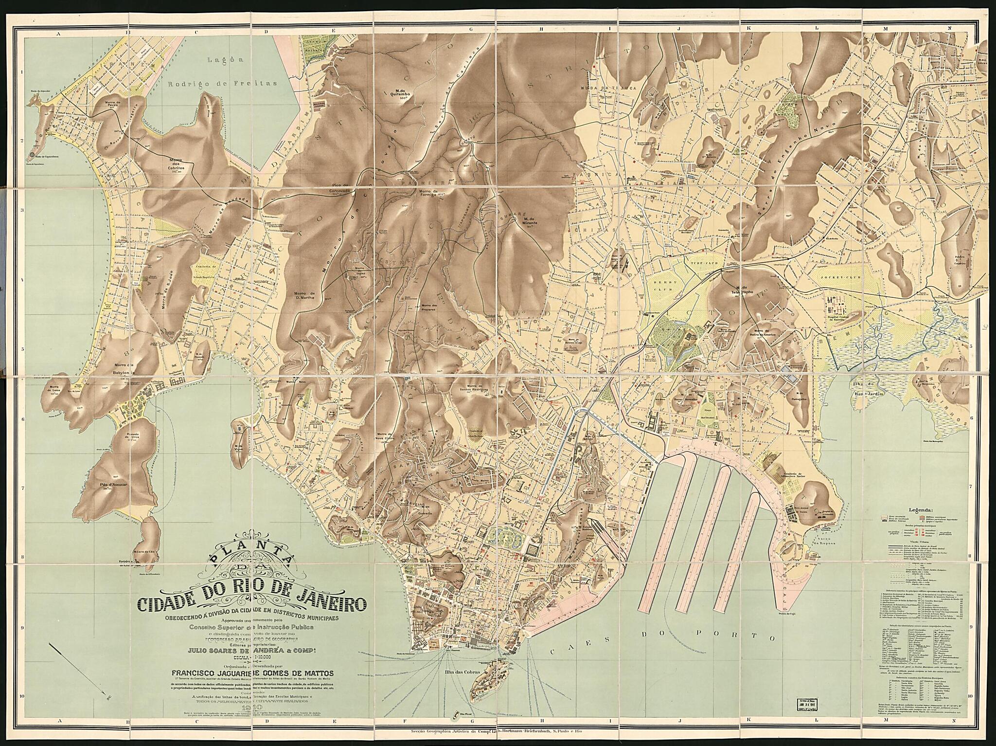
Planta Da Cidade Do Rio De Janeiro : Obedecendo á Divisão Da Cidade Em Districtos Municipaes in 1910
- Regular price
-
$226.95 - Regular price
-
$221.95 - Sale price
-
$226.95
Shipping calculated at checkout.
Buy one map, get any other map in our collection for 50% OFF! Add to cart to see discount.
Couldn't load pickup availability
About This Map
Old aerial view / topographic map of Brazil, Rio De Janeiro.
Created by F. Jaguaribe Gomes De Mattos in 1910.
Created by F. Jaguaribe Gomes De Mattos in 1910.
- Relief shown by shading and pictorially.
- Title from cover.
- Oriented with north toward bottom right.
- Includes notes.
Map Subjects
Aerial Views
Brazil
Rio De Janeiro
Rio De Janeiro (Brazil)
Streets
Topographic Maps
F. Jaguaribe Gomes De Mattos
1910
Map Sizing Information
- For the best legibility, order your map in the original size or larger. Most maps have intricate detail and small text that is best appreciated when the print size hasn't been reduced.
- Sizes labeled "Fits a Standard Frame" will drop right into any frame that you purchase in that size. The sizes that we offer are commonly available online and at most retail stores.
- Our standard sizes are recommendations based on the aspect ratio of the original map, but still may require some added "white space" in one dimension to fit.
- Non-standard sizes will require custom framing, and we suggest taking your print to the frame shop of your choice after you receive it for the best results.
- Custom sizes are available, simply contact us for a quote.
Below is an approximation of the scale of a few standard sizes, and how they might appear in your space.

