
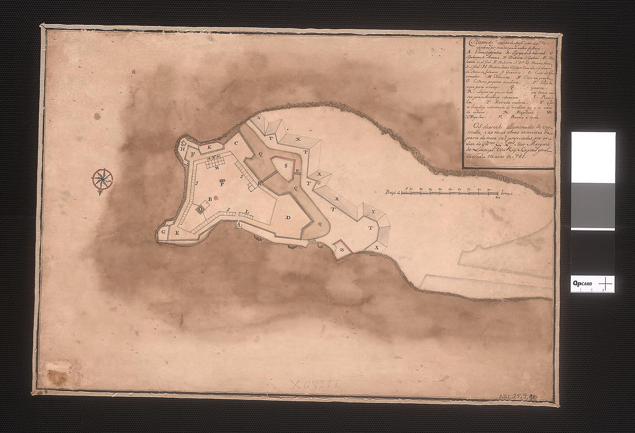
Map of the Fortress of Mozambique With New Works Projected for Better Defense. (Planta Da Fortaleza De Mosse. Moçambique Com As Novas Obras Projectadas Para Melhor Defença) 1741
- Regular price
-
$49.95 - Regular price
-
$34.95 - Sale price
-
$49.95
Buy one map, get any other map in our collection for 50% OFF! Add to cart to see discount.
Couldn't load pickup availability
About This Map
Discover the timeless beauty of our fine art quality printed reproduction of this antique map. Perfect for history enthusiasts, collectors, and interior decorators.
Restored with meticulous attention to detail by our team with over a decade of experience, this stunning reproduction captures the intricate artistry and historical significance of the original map.
Whether you're a collector or seeking a unique decor piece, this archival-quality map reproduction is a timeless addition to any space. Order now to bring history to life!
Old map of Mozambique, Portugal.This manuscript map shows the fortress of San Sebastian on the Island of Mozambique, a small but strategic island off the coast of the African mainland. The fortress was built in the 16th century by the Portuguese, who developed the island into a major trading port. The structure was constructed in an Italianate style out of local materials, and incorporated an intricate system of collecting rainwater, needed to compensate for the island's lack of fresh water. This map was drawn in 1741, as the Portuguese were planning a renovation of the fortress to incorporate new defense structures. The fortress was inscribed as a UNESCO World Heritage site in 1991.
- Title devised, in English, by Library staff.
- Original resource extent: 1 manuscript map : color ; 33 x 47 centimeters.
- Original resource at: National Library of Brazil.
- Content in Portuguese.
- Description based on data extracted from World Digital Library, which may be extracted from partner institutions.
Map Subjects
Colonies
Mozambique
Portugal
1741
- For the best legibility, order your map in the original size or larger. Most maps have intricate detail and small text that is best appreciated when the print size hasn't been reduced.
- Sizes labeled "Fits a Standard Frame" will drop right into any frame that you purchase in that size. The sizes that we offer are commonly available online and at most retail stores.
- Our standard sizes are recommendations based on the aspect ratio of the original map, but still may require some added "white space" in one dimension to fit.
- Non-standard sizes will require custom framing, and we suggest taking your print to the frame shop of your choice after you receive it for the best results.
- Custom sizes are available, simply contact us for a quote.
Below is an approximation of the scale of a few standard sizes, and how they might appear in your space.
