
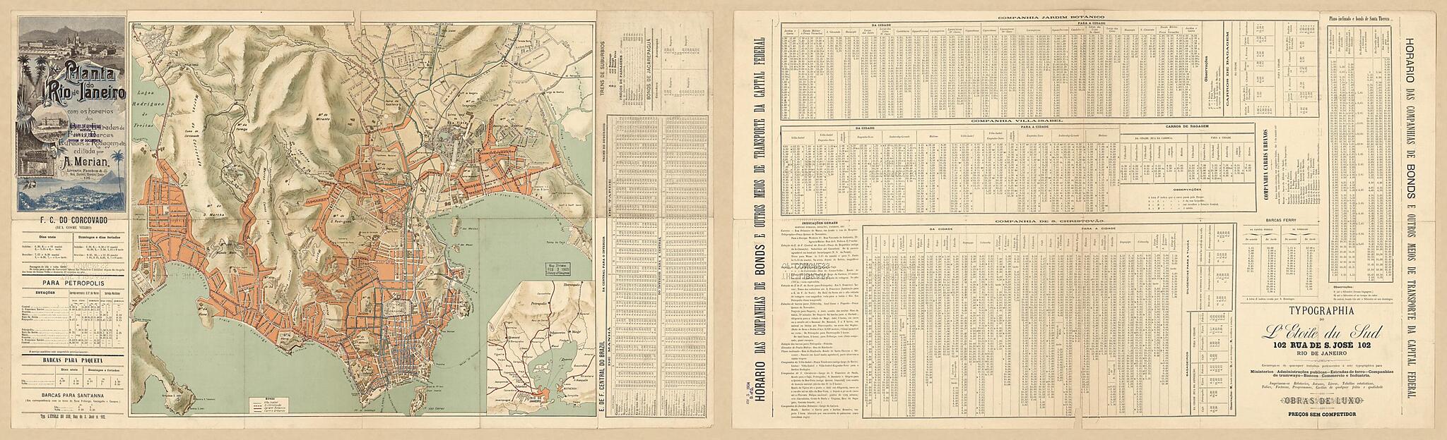
Planta Do Rio De Janeiro Com Os Horarios Dos Bondes, Estradas De Ferro, Barcas, Estradas De Rodagem Etc 1900
- Regular price
-
$110.95 - Regular price
-
$105.95 - Sale price
-
$110.95
Shipping calculated at checkout.
Buy one map, get any other map in our collection for 50% OFF! Add to cart to see discount.
Couldn't load pickup availability
About This Map
Old topographic map of Brazil, Rio De Janeiro, Rio De Janeiro Metropolitan Area, Rio De Janeiro Region.
Created by A. Merian in 1900.
Created by A. Merian in 1900.
- Relief shown by shading.
- This map has some imperfections: fragile, torn along fold lines, holes with minor losses. We'll do our best to restore the image before printing.
- Includes indexes and color illustration.
- Text and various bond tables on verso.
Map Subjects
Brazil
Local Transit
Rio De Janeiro
Rio De Janeiro (Brazil)
Rio De Janeiro Metropolitan Area
Rio De Janeiro Region
Roads
Topographic Maps
A. Merian
1900
Map Sizing Information
- For the best legibility, order your map in the original size or larger. Most maps have intricate detail and small text that is best appreciated when the print size hasn't been reduced.
- Sizes labeled "Fits a Standard Frame" will drop right into any frame that you purchase in that size. The sizes that we offer are commonly available online and at most retail stores.
- Our standard sizes are recommendations based on the aspect ratio of the original map, but still may require some added "white space" in one dimension to fit.
- Non-standard sizes will require custom framing, and we suggest taking your print to the frame shop of your choice after you receive it for the best results.
- Custom sizes are available, simply contact us for a quote.
Below is an approximation of the scale of a few standard sizes, and how they might appear in your space.
