
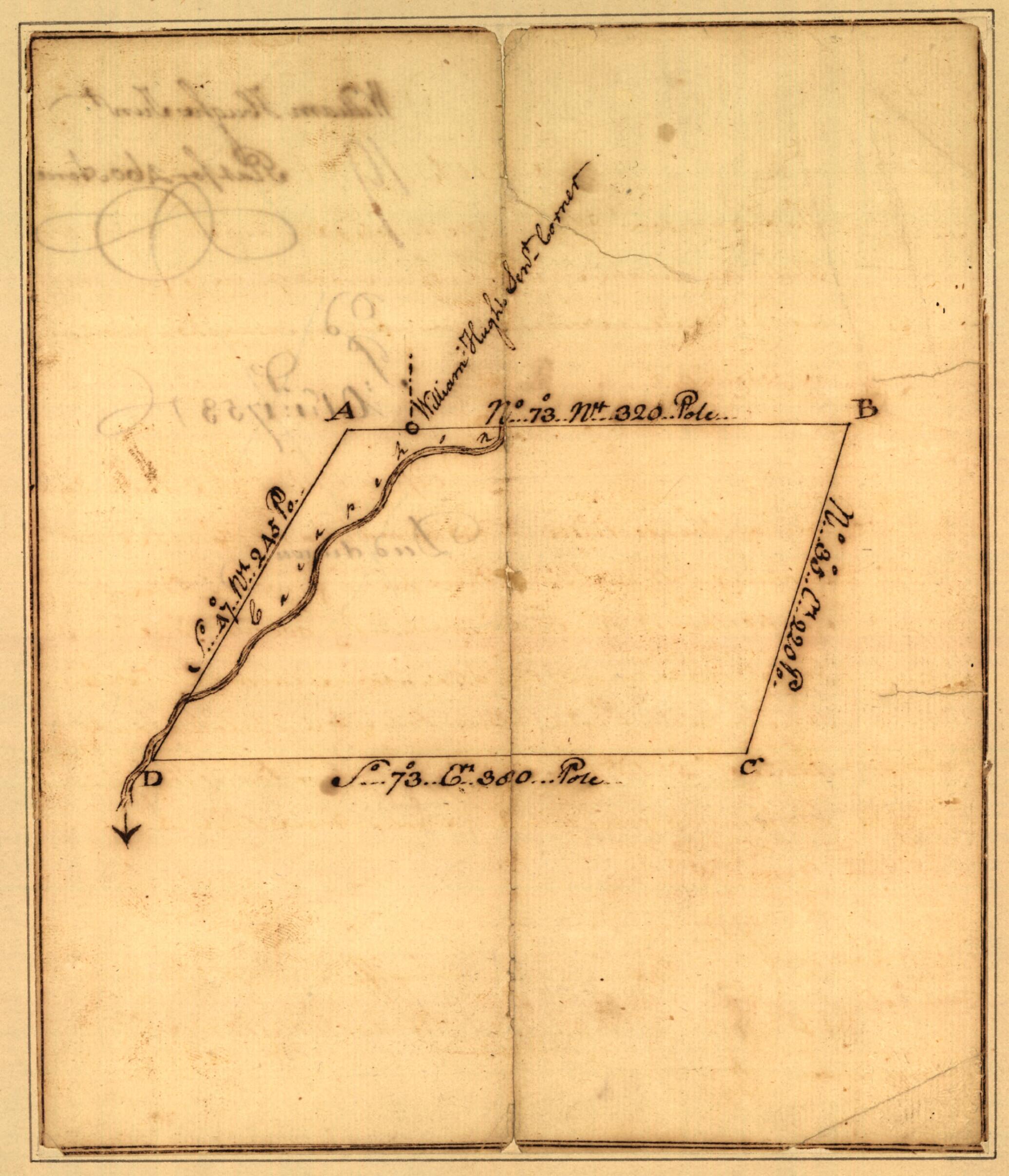
Plat of a Survey for William Hughes, Jr. of 460 Acres In Frederick County, Va. On the Cacapon River 1750
- Regular price
-
$49.95 - Regular price
-
$34.95 - Sale price
-
$49.95
Shipping calculated at checkout.
Buy one map, get any other map in our collection for 50% OFF! Add to cart to see discount.
Couldn't load pickup availability
About This Map
Old map of Hampshire County, Morgan County, United States, West Virginia.
Created by George Washington in 1750.
Created by George Washington in 1750.
- Title from Lawrence Martin's The George Washington Atlas. 1932.
- Survey plot is located either in Hampshire County or Morgan County, W. Va.
- Handwritten on verso: William Hughes Junr., plat for 460 acres, 1753, deed drawn.
- Pen-and-ink.
- Mounted on linen covered cardboard.
- Accompanied by handwritten surveying notes of April 4, 1750, signed by George Washington.
- Martin. George Washington atlas, 14a
- Acquisitions control no. 83-36
Map Sizing Information
- For the best legibility, order your map in the original size or larger. Most maps have intricate detail and small text that is best appreciated when the print size hasn't been reduced.
- Sizes labeled "Fits a Standard Frame" will drop right into any frame that you purchase in that size. The sizes that we offer are commonly available online and at most retail stores.
- Our standard sizes are recommendations based on the aspect ratio of the original map, but still may require some added "white space" in one dimension to fit.
- Non-standard sizes will require custom framing, and we suggest taking your print to the frame shop of your choice after you receive it for the best results.
- Custom sizes are available, simply contact us for a quote.
Below is an approximation of the scale of a few standard sizes, and how they might appear in your space.

