
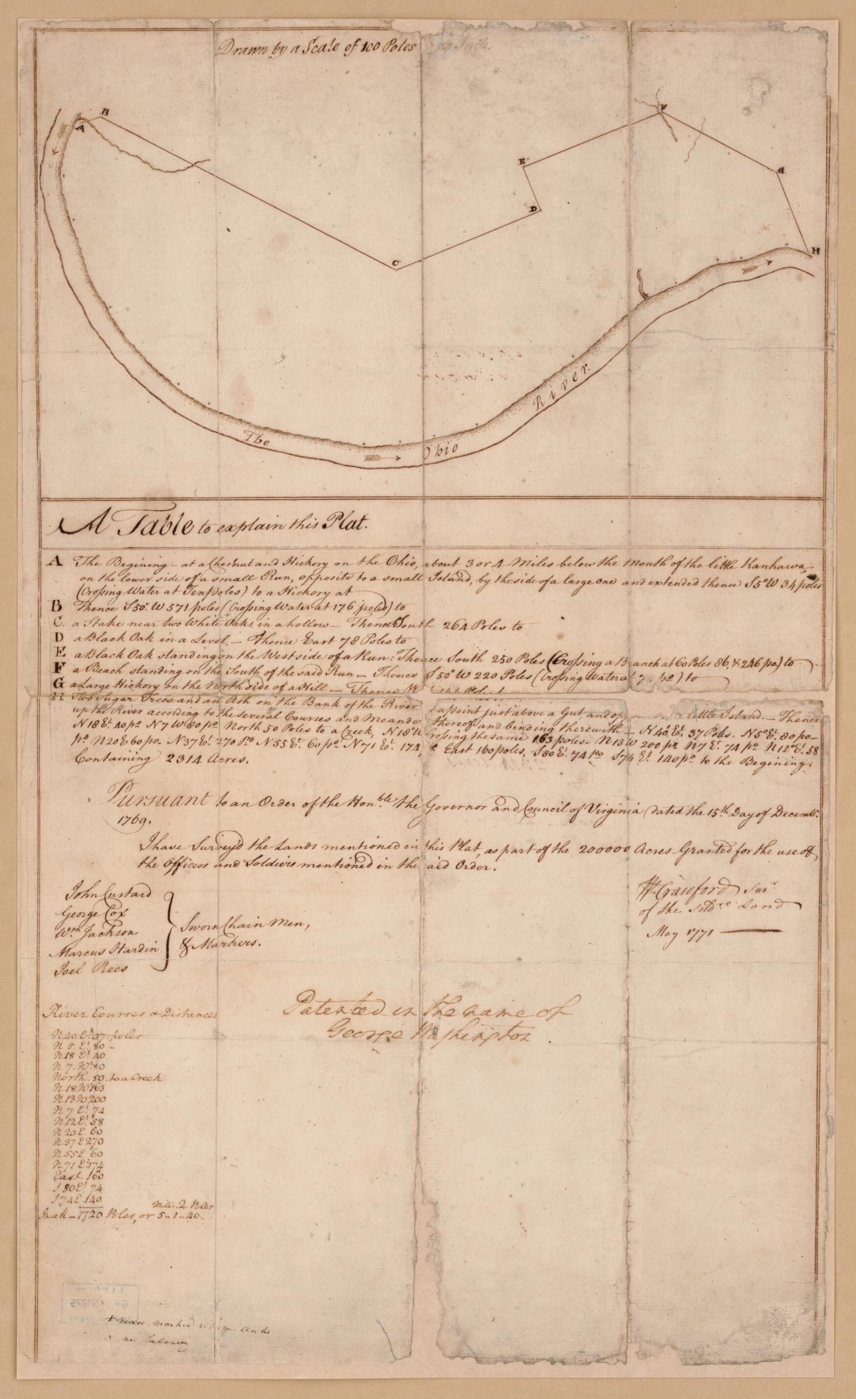
Plat of a Survey of 2,314 Acres of Land, Being the First Large Bottom On the East Side of the Ohio River, 3 Or 4 Miles Below the Mouth, a Portion of Which Is Divided Into 17 Lots 1771
- Regular price
-
$52.95 - Regular price
-
$36.95 - Sale price
-
$52.95
Shipping calculated at checkout.
Buy one map, get any other map in our collection for 50% OFF! Add to cart to see discount.
Couldn't load pickup availability
About This Map
Old map of United States, West Virginia, Wood County.
Created by William Crawford, George Washington in 1771.
Created by William Crawford, George Washington in 1771.
- Scale ca. 1:20,000.
- Title from Lawrence Martin's The George Washington atlas. 1932.
- Cover title: George Washington; survey of land in Ohio, a grant from the Colony of Virginia to Washington for military services ...
- Manuscript, pen-and-ink.
- Oriented with north toward the lower left.
- This map has some imperfections: deteriorated along fold lines. We'll do our best to restore the image before printing.
- Annotated by George Washington: Patented in the name of George Washington.
- Includes table of "River courses & distances" annotated by George Washington and "A table to explain this plat."
- On verso: Survey for 2,314 acres, bottom-Ohio, made-in-1771.
- Accompanied by typewritten letter of Sept. 26, 1921, signed "Warren G. Harding," to David G. Joyce, Chicago.
Map Sizing Information
- For the best legibility, order your map in the original size or larger. Most maps have intricate detail and small text that is best appreciated when the print size hasn't been reduced.
- Sizes labeled "Fits a Standard Frame" will drop right into any frame that you purchase in that size. The sizes that we offer are commonly available online and at most retail stores.
- Our standard sizes are recommendations based on the aspect ratio of the original map, but still may require some added "white space" in one dimension to fit.
- Non-standard sizes will require custom framing, and we suggest taking your print to the frame shop of your choice after you receive it for the best results.
- Custom sizes are available, simply contact us for a quote.
Below is an approximation of the scale of a few standard sizes, and how they might appear in your space.

