
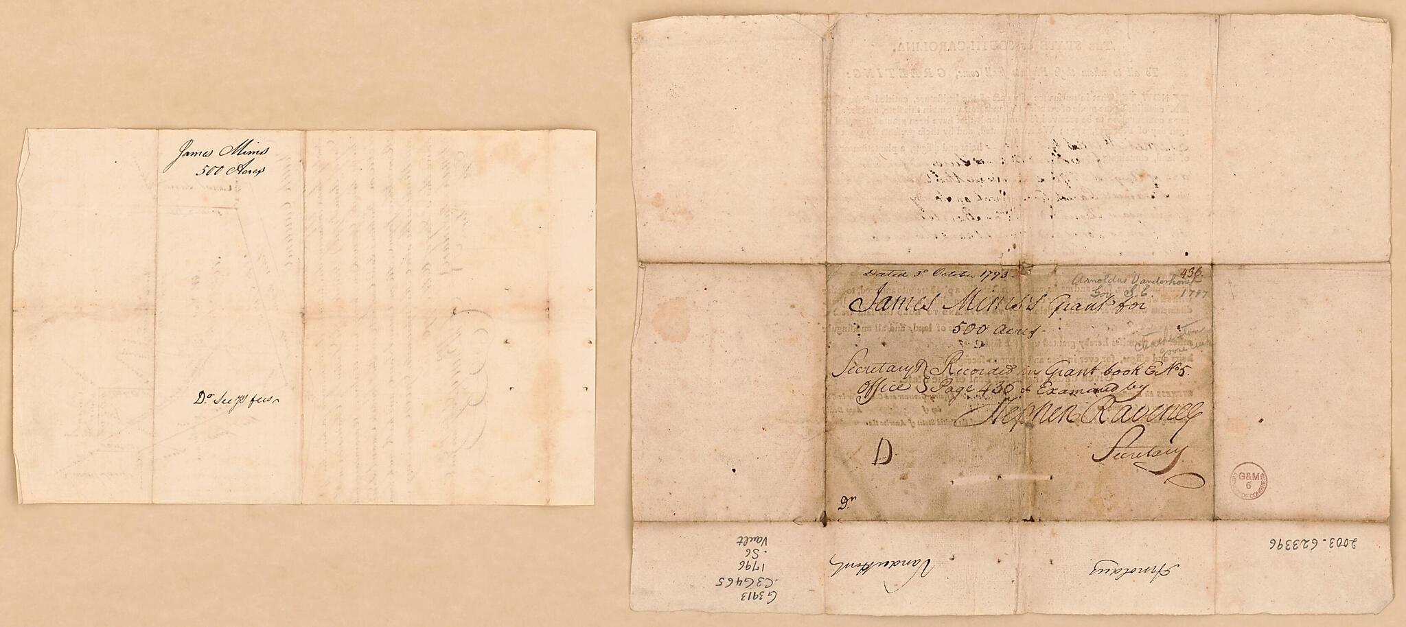
Plat of Land Grant Survey In South Carolina, Accompanied by Deed of Grant 1796
- Regular price
-
$61.95 - Regular price
-
$43.95 - Sale price
-
$61.95
Shipping calculated at checkout.
Buy one map, get any other map in our collection for 50% OFF! Add to cart to see discount.
Couldn't load pickup availability
About This Map
Old map of Charleston District, South Carolina, United States.
Created by South Carolina in 1796.
Created by South Carolina in 1796.
- Pen-and-ink.
- "Five hundred acres surveyed for him [James Mims] the 4th day of August 1796. Situate in the District of Charleston in St. James 's Parish Goose Creek ... given under the Great Seal of the State."
- On verso of deed: Dated 3d October 1793.
- Includes text.
- Copy This map has some imperfections: stained and deteriorated along the folded lines of deed of grant. We'll do our best to restore the image before printing.
- Control no.: 2002-25
Map Subjects
Charleston District
Early Works To 1800
Land Grants
Manuscript Maps
South Carolina
United States
South Carolina
1796
Map Sizing Information
- For the best legibility, order your map in the original size or larger. Most maps have intricate detail and small text that is best appreciated when the print size hasn't been reduced.
- Sizes labeled "Fits a Standard Frame" will drop right into any frame that you purchase in that size. The sizes that we offer are commonly available online and at most retail stores.
- Our standard sizes are recommendations based on the aspect ratio of the original map, but still may require some added "white space" in one dimension to fit.
- Non-standard sizes will require custom framing, and we suggest taking your print to the frame shop of your choice after you receive it for the best results.
- Custom sizes are available, simply contact us for a quote.
Below is an approximation of the scale of a few standard sizes, and how they might appear in your space.
