
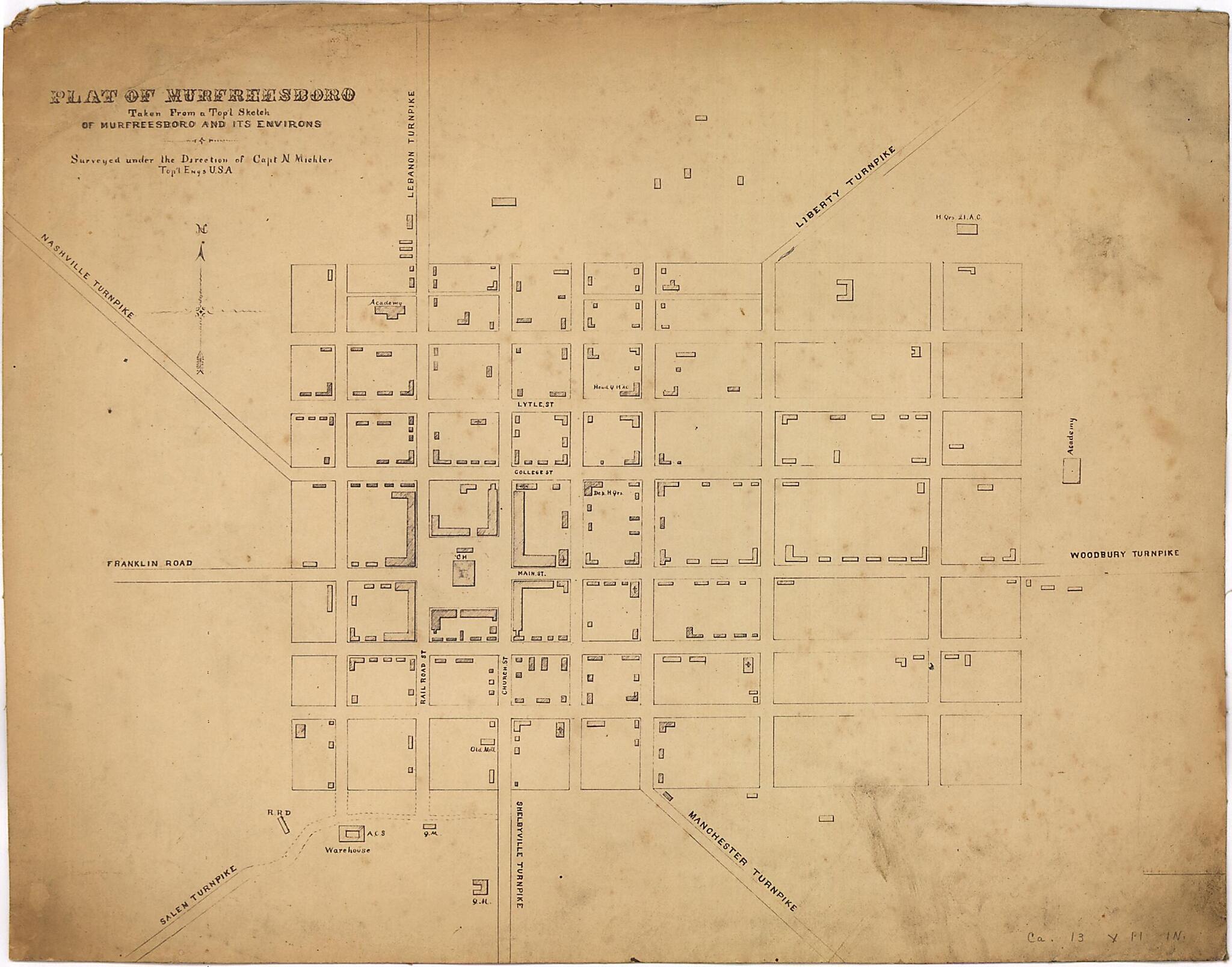
Plat of Murfreesboro. Taken from a Top'l. Sketch of Murfreesboro and Its Environs. Surveyed Under the Direction of Capt. N. Michler, Top'l. Engs., U.S.A 1863
- Regular price
-
$49.95 - Regular price
-
$34.95 - Sale price
-
$49.95
Shipping calculated at checkout.
Buy one map, get any other map in our collection for 50% OFF! Add to cart to see discount.
Couldn't load pickup availability
About This Map
Old map of Murfreesboro, Tennessee, United States.
Created by N. (Nathaniel) Michler in 1863.
Created by N. (Nathaniel) Michler in 1863.
- Scale not given.
- Map indicates streets and buildings. Sites occupied by the 14th and 21st Corps of the Army of the Cumberland, Department Headquarters, and the Quarter Master are identified.
- Photocopy (positive).
- Description derived from published bibliography.
- Civil War salted paper maps. AL-21.
- Civil War Map
Map Subjects
Murfreesboro
Murfreesboro (Tenn.)
Salted Paper Prints
Tennessee
United States
N. (Nathaniel) Michler
1863
Map Sizing Information
- For the best legibility, order your map in the original size or larger. Most maps have intricate detail and small text that is best appreciated when the print size hasn't been reduced.
- Sizes labeled "Fits a Standard Frame" will drop right into any frame that you purchase in that size. The sizes that we offer are commonly available online and at most retail stores.
- Our standard sizes are recommendations based on the aspect ratio of the original map, but still may require some added "white space" in one dimension to fit.
- Non-standard sizes will require custom framing, and we suggest taking your print to the frame shop of your choice after you receive it for the best results.
- Custom sizes are available, simply contact us for a quote.
Below is an approximation of the scale of a few standard sizes, and how they might appear in your space.

