
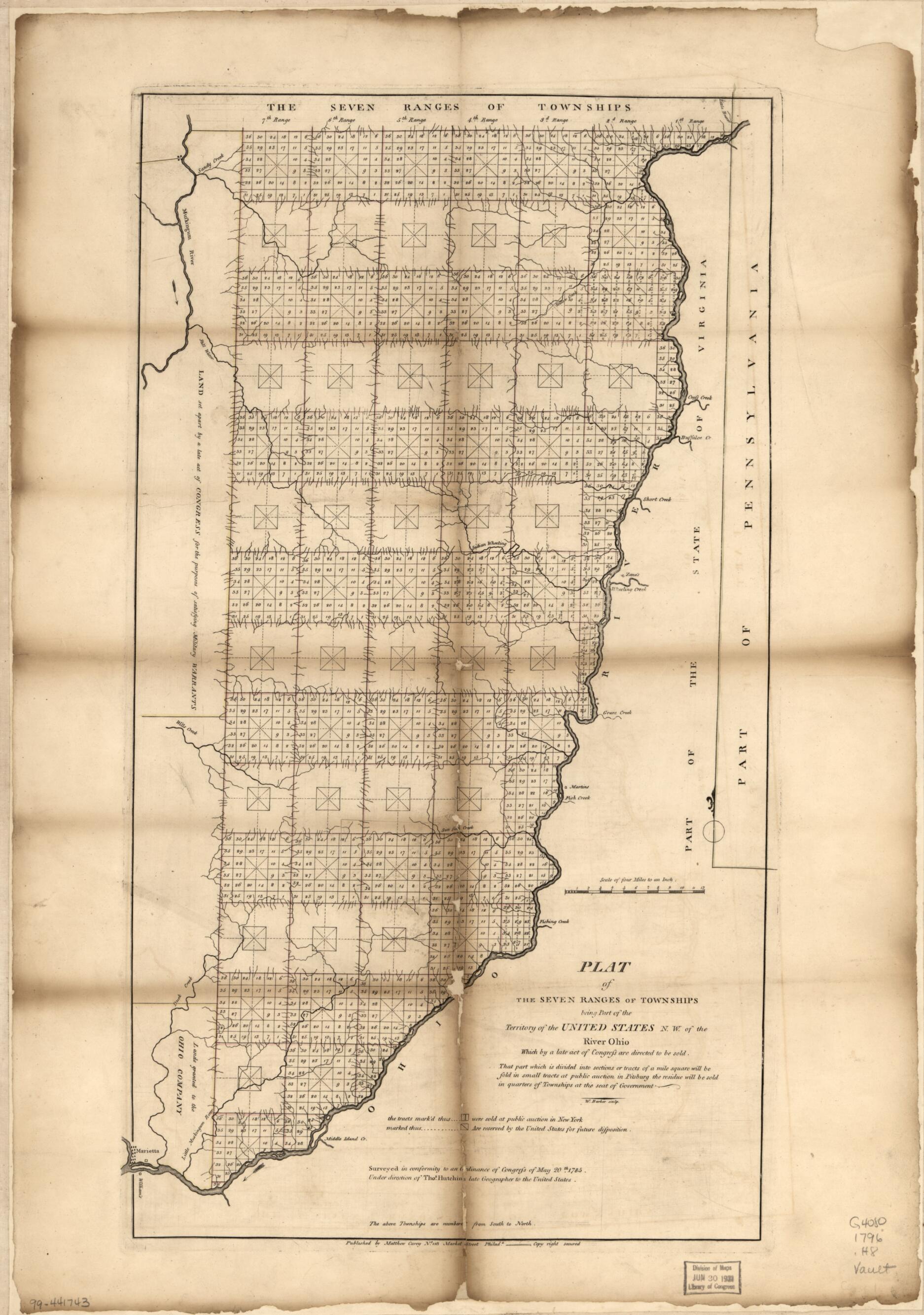
Plat of the Seven Ranges of Townships Being Part of the Territory of the United States, N.W. of the River Ohio 1796
- Regular price
-
$62.95 - Regular price
-
$57.95 - Sale price
-
$62.95
Shipping calculated at checkout.
Buy one map, get any other map in our collection for 50% OFF! Add to cart to see discount.
Couldn't load pickup availability
About This Map
Old early map of Ohio, United States.
Created by W. (William) Barker, Mathew Carey, Thomas Hutchins in 1796.
Created by W. (William) Barker, Mathew Carey, Thomas Hutchins in 1796.
- Covers Columbiana, Carroll, Jefferson, Harrison, Guernsey, Belmont, Noble, Monroe, and Washington Counties.
- Three copies. Copy 1 has black ink annotated on verso: N. 157, title of a plat of the 7 ranges ... deposited by Mathew Carey as proprietor, 30th Septr. 1796. Copy 2 not hand colored. Copy 3 from Carey's General atlas of the world and quarters, 1814; lacks publishing information and sculptor note; "28" in lower right margin.
Map Sizing Information
- For the best legibility, order your map in the original size or larger. Most maps have intricate detail and small text that is best appreciated when the print size hasn't been reduced.
- Sizes labeled "Fits a Standard Frame" will drop right into any frame that you purchase in that size. The sizes that we offer are commonly available online and at most retail stores.
- Our standard sizes are recommendations based on the aspect ratio of the original map, but still may require some added "white space" in one dimension to fit.
- Non-standard sizes will require custom framing, and we suggest taking your print to the frame shop of your choice after you receive it for the best results.
- Custom sizes are available, simply contact us for a quote.
Below is an approximation of the scale of a few standard sizes, and how they might appear in your space.

