
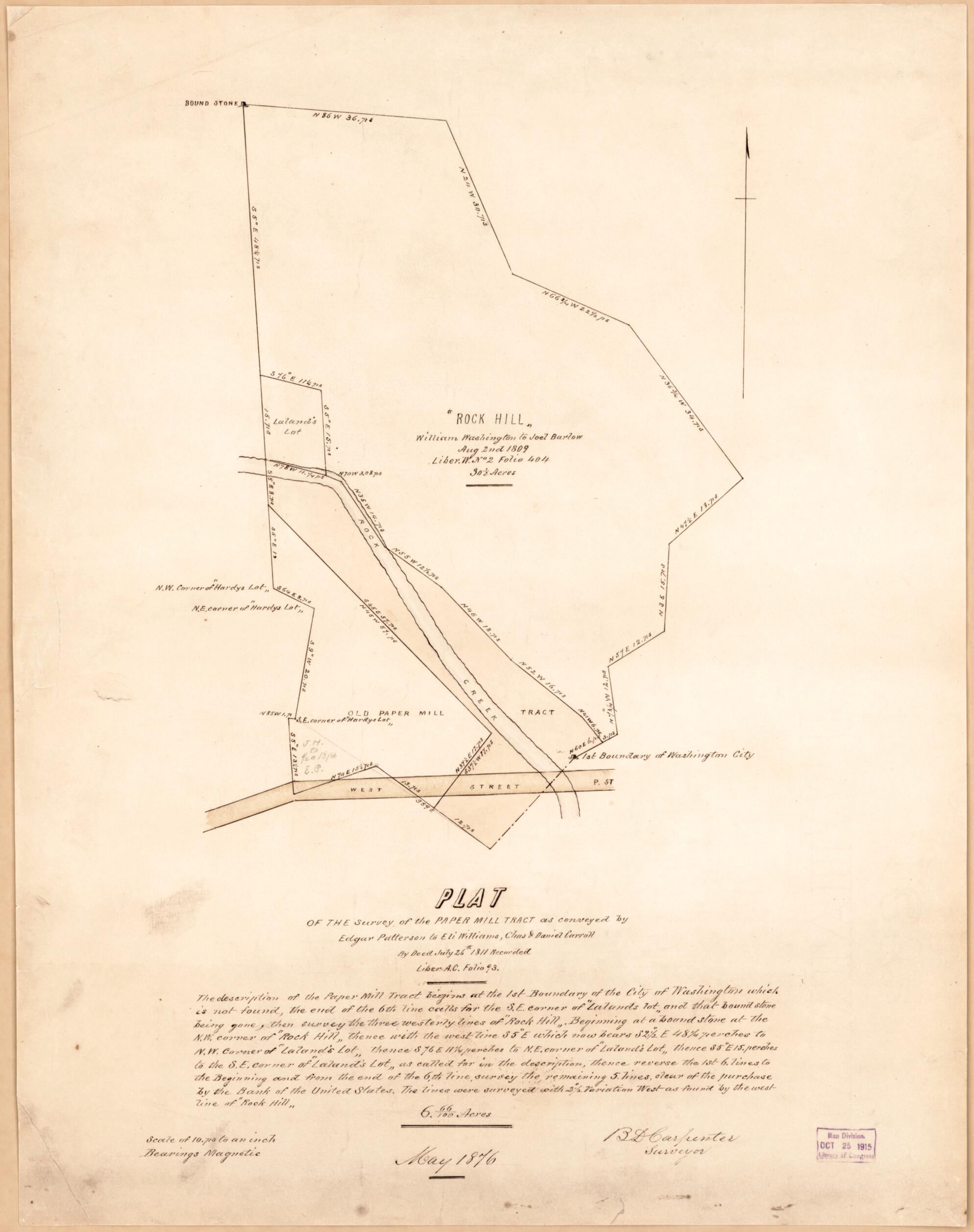
Plat of the Survey of the Paper Mill Tract : As Conveyed by Edgar Patterson to Eli Williams, Chas. & Daniel Carroll, by Deed, July 26th 1811 : Recorded Liber A.C. Folio 93 1876
- Regular price
-
$57.95 - Regular price
-
$40.95 - Sale price
-
$57.95
Shipping calculated at checkout.
Buy one map, get any other map in our collection for 50% OFF! Add to cart to see discount.
Couldn't load pickup availability
About This Map
Old map of District of Columbia, Paper Mill, United States, Washington, Washington D.C..
Created by B. D. (Benjamin D.) Carpenter in 1876.
Created by B. D. (Benjamin D.) Carpenter in 1876.
- Cadastral survey map.
- "May 1876."
- Also covers tract called "Rock Hill."
- Pen-and-ink, lead pencil, and yellow wash.
- Faced with gauze and mounted on cloth backing.
- Includes text.
- Phillips. Washington 680
Map Sizing Information
- For the best legibility, order your map in the original size or larger. Most maps have intricate detail and small text that is best appreciated when the print size hasn't been reduced.
- Sizes labeled "Fits a Standard Frame" will drop right into any frame that you purchase in that size. The sizes that we offer are commonly available online and at most retail stores.
- Our standard sizes are recommendations based on the aspect ratio of the original map, but still may require some added "white space" in one dimension to fit.
- Non-standard sizes will require custom framing, and we suggest taking your print to the frame shop of your choice after you receive it for the best results.
- Custom sizes are available, simply contact us for a quote.
Below is an approximation of the scale of a few standard sizes, and how they might appear in your space.

