
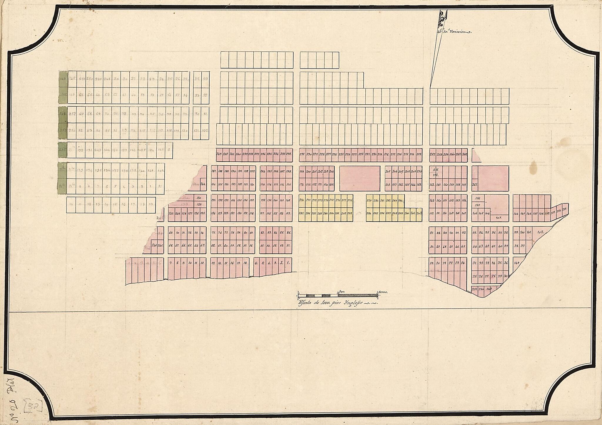
Plat of Unidentified City 1810
- Regular price
-
$49.95 - Regular price
-
$29.95 - Sale price
-
$49.95
Shipping calculated at checkout.
Buy one map, get any other map in our collection for 50% OFF! Add to cart to see discount.
Couldn't load pickup availability
About This Map
Old cadastral map of Florida, Pensacola, United States.
Created by Vicente Sebastián Pintado in 1810.
Created by Vicente Sebastián Pintado in 1810.
- This is probably a plan of Pensacola, Florida.
- Cadastral map. Some lots are numbered.
- Title from John R. Hébert's list of maps.
- Scale statement in Spanish.
- Pen-and-ink, watercolor, and pencil.
- Watermark: Fleur-de-lis in a shield surmounted by a crown.
- From the papers of Vicente Sebastián Pintado.
- Described in: Vicente Sebastián Pintado, Surveyor General of Spanish West Florida, 1805-17 : the man and his maps / by John R. Hébert. Imago mundi, v. 39, pp. 50-72. 1987. p. 65, no. 32.
- In lower left corner: No. 20 plat.
Map Subjects
Cadastral Maps
Florida
Manuscript Maps
Pensacola
Pensacola (Fla.)
Real Property
United States
Vicente Sebastián Pintado
1810
Map Sizing Information
- For the best legibility, order your map in the original size or larger. Most maps have intricate detail and small text that is best appreciated when the print size hasn't been reduced.
- Sizes labeled "Fits a Standard Frame" will drop right into any frame that you purchase in that size. The sizes that we offer are commonly available online and at most retail stores.
- Our standard sizes are recommendations based on the aspect ratio of the original map, but still may require some added "white space" in one dimension to fit.
- Non-standard sizes will require custom framing, and we suggest taking your print to the frame shop of your choice after you receive it for the best results.
- Custom sizes are available, simply contact us for a quote.
Below is an approximation of the scale of a few standard sizes, and how they might appear in your space.

