
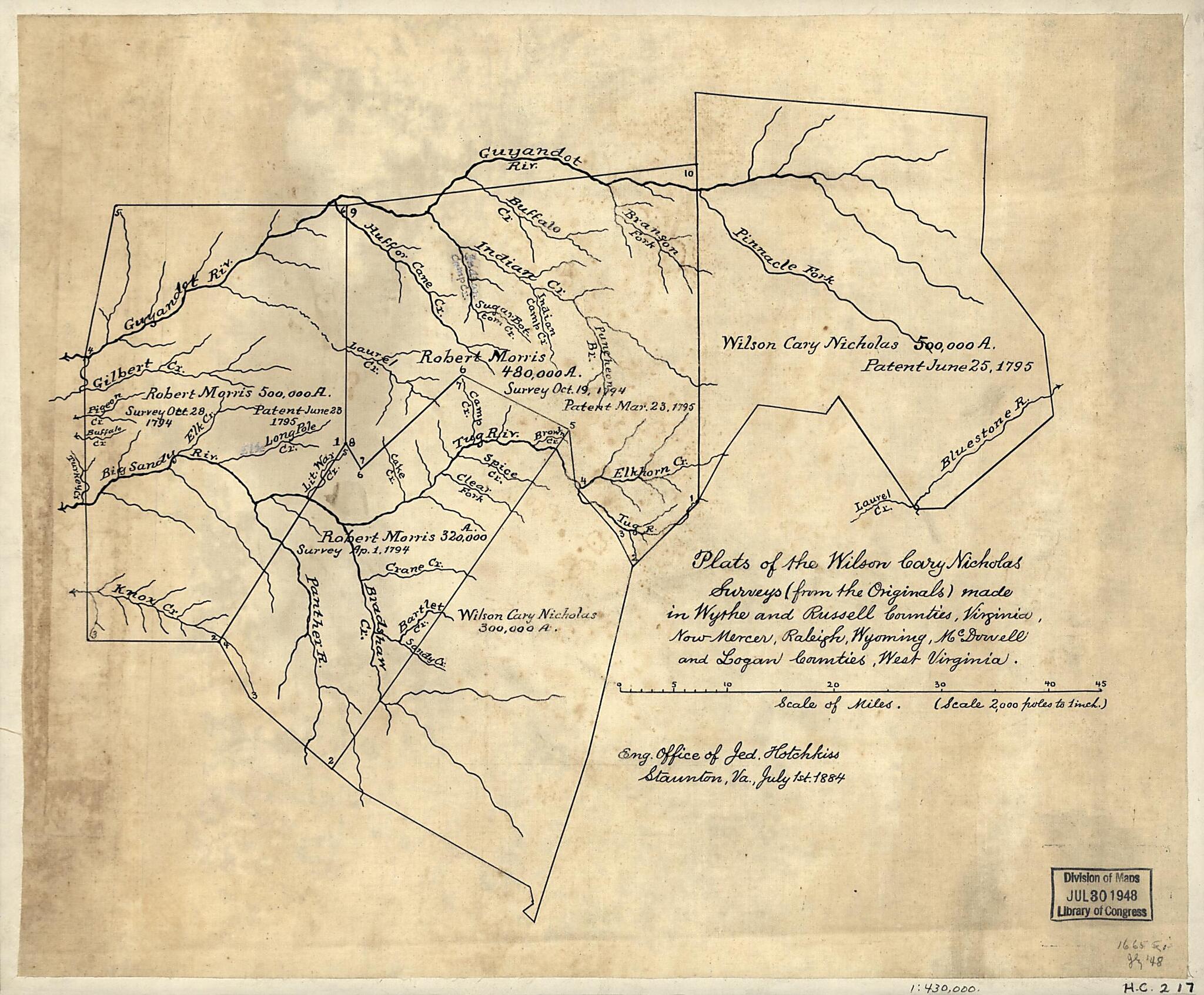
Plats of the Wilson Cary Nicholas Surveys (from the Originals) Made In Wythe and Russell Counties, Virginia, Now Mercer, Raleigh, Wyoming, McDowell, and Logan Counties, West Virginia 1795
- Regular price
-
$49.95 - Regular price
-
$34.95 - Sale price
-
$49.95
Shipping calculated at checkout.
Buy one map, get any other map in our collection for 50% OFF! Add to cart to see discount.
Couldn't load pickup availability
About This Map
Old map of Logan County, McDowell County, Mercer County, Raleigh County, United States, West Virginia, Wyoming County.
Created by Jedediah Hotchkiss in 1795.
Created by Jedediah Hotchkiss in 1795.
- Pen-and-ink on tracing linen, mounted on cloth.
- Civil War Map
Map Subjects
Landowners
Logan County
Logan County (W. Va.)
Maps Manuscript
McDowell County
McDowell County (W. Va.)
Mercer County
Mercer County (W. Va.)
Raleigh County
Raleigh County (W. Va.)
Real Property
United States
West Virginia
Wyoming County
Wyoming County (W. Va.)
Jedediah Hotchkiss
1795
Map Sizing Information
- For the best legibility, order your map in the original size or larger. Most maps have intricate detail and small text that is best appreciated when the print size hasn't been reduced.
- Sizes labeled "Fits a Standard Frame" will drop right into any frame that you purchase in that size. The sizes that we offer are commonly available online and at most retail stores.
- Our standard sizes are recommendations based on the aspect ratio of the original map, but still may require some added "white space" in one dimension to fit.
- Non-standard sizes will require custom framing, and we suggest taking your print to the frame shop of your choice after you receive it for the best results.
- Custom sizes are available, simply contact us for a quote.
Below is an approximation of the scale of a few standard sizes, and how they might appear in your space.

