
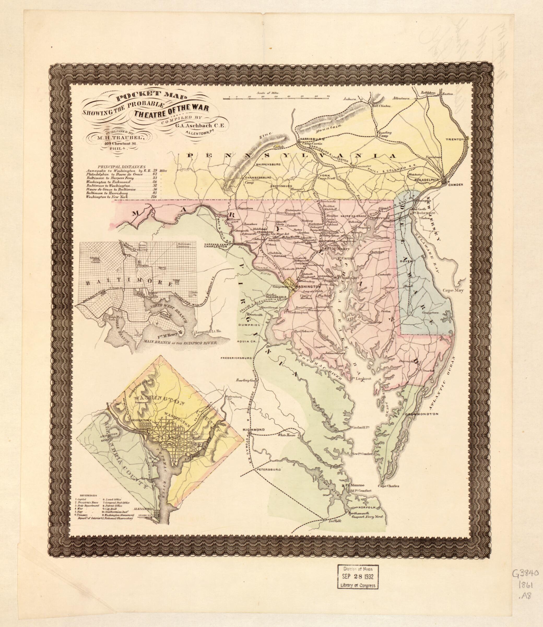
Pocket Map Showing the Probable Theatre of the War 1861
- Regular price
-
$54.95 - Regular price
-
$30.95 - Sale price
-
$54.95
Shipping calculated at checkout.
Buy one map, get any other map in our collection for 50% OFF! Add to cart to see discount.
Couldn't load pickup availability
About This Map
Old map of Maryland, United States.
Created by G. A. Aschbach in 1861.
Created by G. A. Aschbach in 1861.
- Scale ca. 1:1,700,000.
- Civil War Map
- Another issue.
- Map of Maryland, Delaware, and parts of Pennsylvania and Virginia, "camps & forts" underlined in red and "prominent places" underlined in blue are not shown.
- Insets: [Street pattern of the city of Baltimore] 9 x 12 cm.-[Map of the city and county of Washington, and the county of Alexandria] 13 x 13 cm. Contains a list of 12 buildings keyed by number to the map.
- Handwritten note on the verso reads: No. 189, filed 9 May 1861, Aschbach & Traubel Prop.
- Description derived from published bibliography.
Map Sizing Information
- For the best legibility, order your map in the original size or larger. Most maps have intricate detail and small text that is best appreciated when the print size hasn't been reduced.
- Sizes labeled "Fits a Standard Frame" will drop right into any frame that you purchase in that size. The sizes that we offer are commonly available online and at most retail stores.
- Our standard sizes are recommendations based on the aspect ratio of the original map, but still may require some added "white space" in one dimension to fit.
- Non-standard sizes will require custom framing, and we suggest taking your print to the frame shop of your choice after you receive it for the best results.
- Custom sizes are available, simply contact us for a quote.
Below is an approximation of the scale of a few standard sizes, and how they might appear in your space.

