
Port of Louisbourg On Île Royale. (Port De Louisbourg Dans L'Isle Royale) 1764
- Regular price
-
$54.95 - Regular price
-
$38.95 - Sale price
-
$54.95
Shipping calculated at checkout.
Buy one map, get any other map in our collection for 50% OFF! Add to cart to see discount.
Couldn't load pickup availability
About This Map
Old map of Canada, Louisbourg, Nova Scotia.
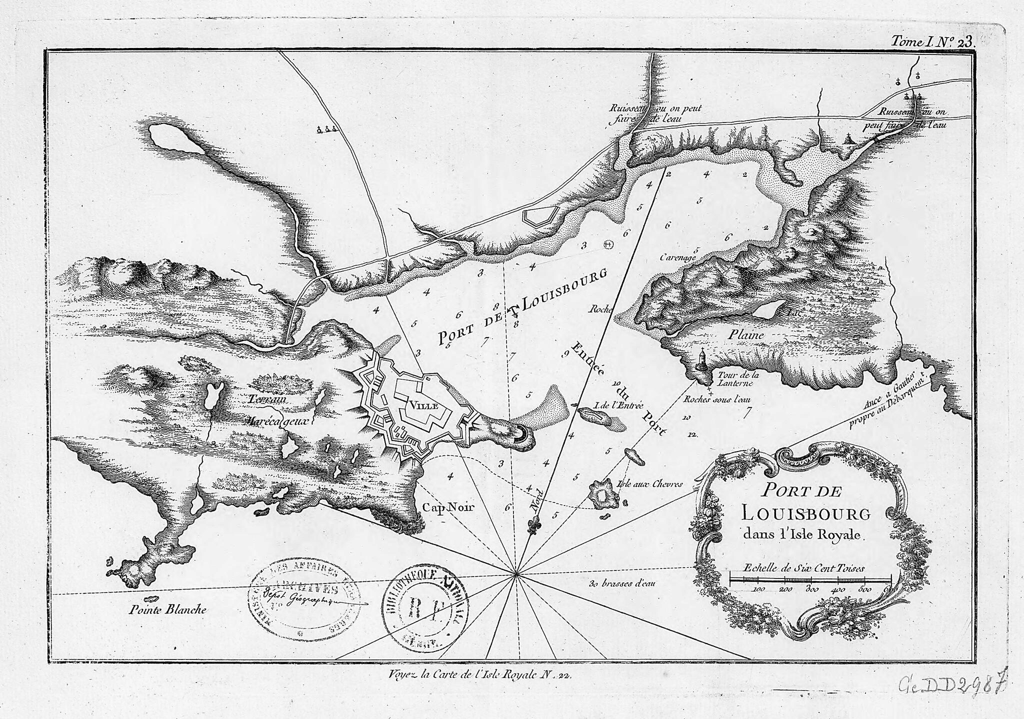
day Cape Breton Island, Nova Scotia), it commanded the entrance to the Gulf of Saint Lawrence and ultimately access to the Saint Lawrence River. In 1745, during King George's War (1744--48), as the North American part of the War of the Austrian Succession (1740--48) is known, the British captured the fortress. It was returned to France in 1748 under the terms of the Treaty of Aix-la-Chapelle and remained in French hands until 1758 when, during the Seven Years War (known in North America as the French and Indian War), it was again captured by the British. The fall of the fortress led to the French loss of Quebec and ultimately of all of Canada. In both 1745 and 1758, colonial militia from New England attached to the British Army played a vital role in the sieges of Louisbourg. Louisbourg Square in Boston is named after the battle of 1745. This map depicting the harbor, fort, and town of Louisbourg, along with the surrounding countryside is by Jacques-Nicolas Bellin (1703-72), a prolific cartographer attached to the French Marine Office. Bellin's maps and atlases reflect the careful mapping of bays, seas, and harbors that characterized 18th-century French naval cartography. The map is from the collection of the geographer Jean-Baptiste Bourguignon d'Anville (1697--1782). It was given to King Louis XVI in 1782 and deposited in the National Library of France in 1924. Scale on the map is shown in toises, an old French unit of measurement; one toise equals about 1.95 meters.
Created by Nicolas in 1764.
- Title devised, in English, by Library staff.
- Original resource extent: 1 map ; 32 x 48.5 centimeters.
- Original resource at: National Library of France.
- Content in French.
- Description based on data extracted from World Digital Library, which may be extracted from partner institutions.
Map Subjects
Canada
Forts And Fortifications
France In America
Louisbourg
Nova Scotia
Ports
Nicolas
1764
Map Sizing Information
- For the best legibility, order your map in the original size or larger. Most maps have intricate detail and small text that is best appreciated when the print size hasn't been reduced.
- Sizes labeled "Fits a Standard Frame" will drop right into any frame that you purchase in that size. The sizes that we offer are commonly available online and at most retail stores.
- Our standard sizes are recommendations based on the aspect ratio of the original map, but still may require some added "white space" in one dimension to fit.
- Non-standard sizes will require custom framing, and we suggest taking your print to the frame shop of your choice after you receive it for the best results.
- Custom sizes are available, simply contact us for a quote.
Below is an approximation of the scale of a few standard sizes, and how they might appear in your space.

