
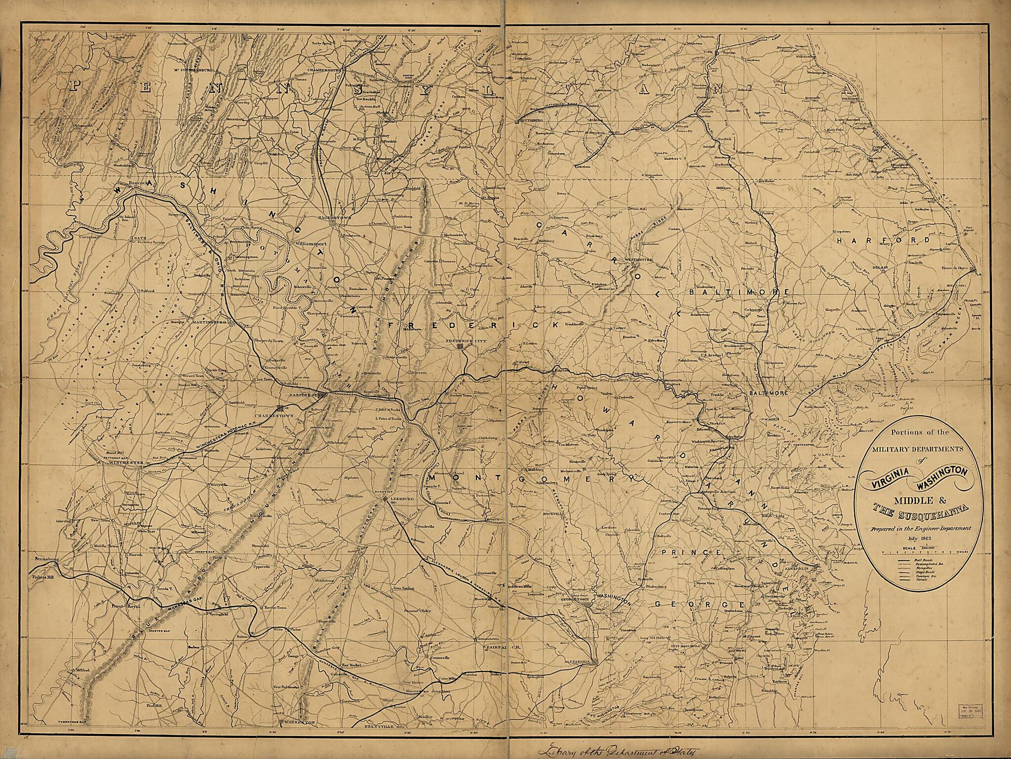
Portions of the Military Departments of Virginia, Washington, Middle & the Susquehanna 1863
- Regular price
-
$135.95 - Regular price
-
$130.95 - Sale price
-
$135.95
Shipping calculated at checkout.
Buy one map, get any other map in our collection for 50% OFF! Add to cart to see discount.
Couldn't load pickup availability
About This Map
Old map of Middle Atlantic States, United States.
Created by United States. Army. Corps of Engineers in 1863.
Created by United States. Army. Corps of Engineers in 1863.
- Scale 1:200,000.
- Civil War Map
- Another edition.
- Roughly drawn base map covering southern Pennsylvania, Maryland, Northern Virginia, and Washington D. C., and indicating populated places, common roads and turnpikes, contemplated and existing railroads, canals, and relief by hachures.
- Completely redrawn edition of the preceeding map. Dennis Callahan's name has been dropped from this edition.
- Description derived from published bibliography.
Map Subjects
Middle Atlantic States
United States
United States. Army. Corps Of Engineers
1863
Map Sizing Information
- For the best legibility, order your map in the original size or larger. Most maps have intricate detail and small text that is best appreciated when the print size hasn't been reduced.
- Sizes labeled "Fits a Standard Frame" will drop right into any frame that you purchase in that size. The sizes that we offer are commonly available online and at most retail stores.
- Our standard sizes are recommendations based on the aspect ratio of the original map, but still may require some added "white space" in one dimension to fit.
- Non-standard sizes will require custom framing, and we suggest taking your print to the frame shop of your choice after you receive it for the best results.
- Custom sizes are available, simply contact us for a quote.
Below is an approximation of the scale of a few standard sizes, and how they might appear in your space.

