
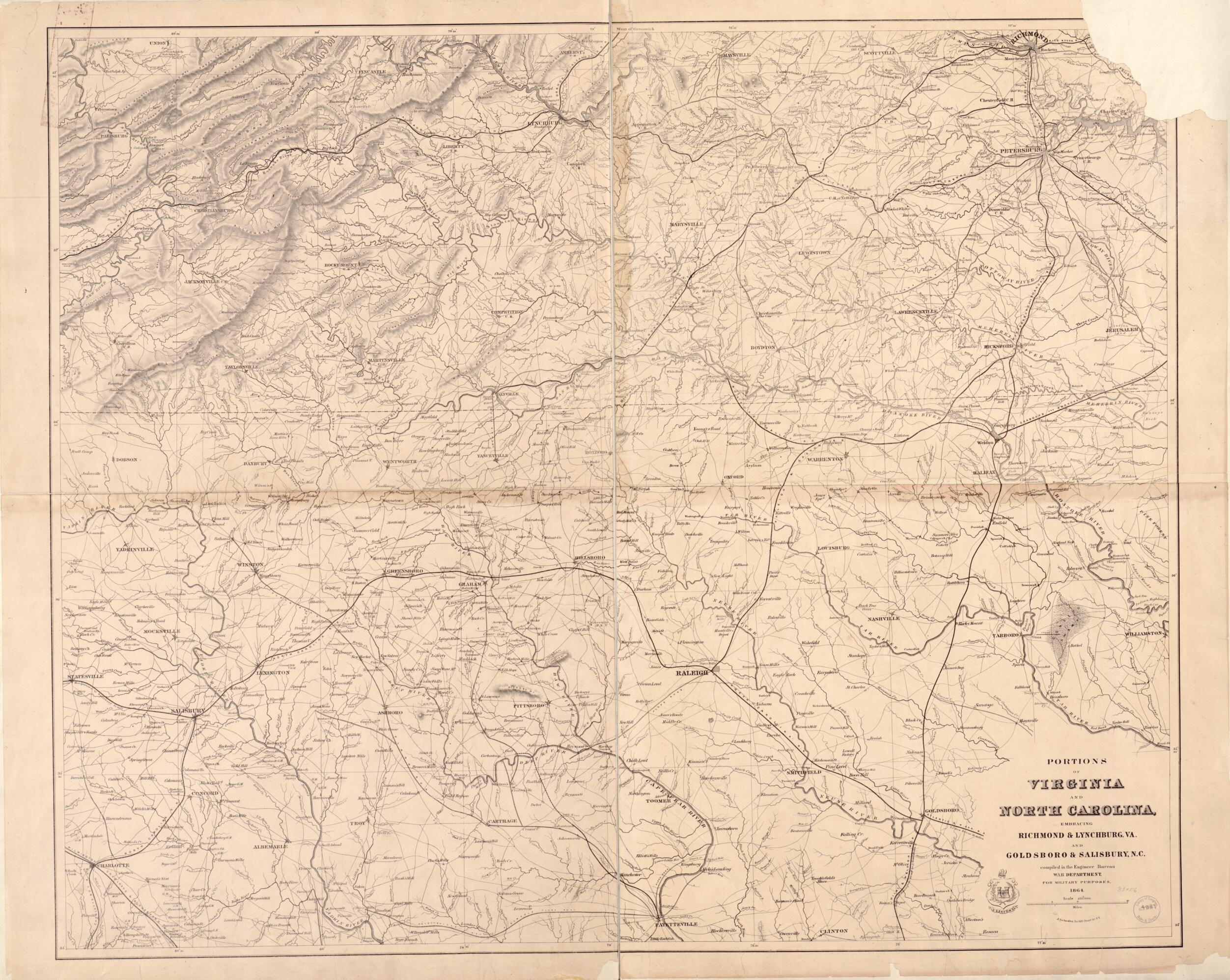
Portions of Virginia and North Carolina, Embracing Richmond & Lynchburg, Va. and Goldsboro & Salisbury, N.C 1864
- Regular price
-
$159.95 - Regular price
-
$154.95 - Sale price
-
$159.95
Shipping calculated at checkout.
Buy one map, get any other map in our collection for 50% OFF! Add to cart to see discount.
Couldn't load pickup availability
About This Map
Old map of North Carolina, United States, Virginia.
Created by United States. War Department. Engineer Bureau in 1864.
Created by United States. War Department. Engineer Bureau in 1864.
- Relief shown by hachures.
- General map extending from Richmond, Virginia, south to Fayetteville, North Carolina.
- Lacks upper right corner.
- Civil War Map
- Description derived from published bibliography.
- Differs from G3880 1864 .U549 CW 501.2 in that the title is missing the oval border and an engineers graphic is to the left of the title information.
Map Sizing Information
- For the best legibility, order your map in the original size or larger. Most maps have intricate detail and small text that is best appreciated when the print size hasn't been reduced.
- Sizes labeled "Fits a Standard Frame" will drop right into any frame that you purchase in that size. The sizes that we offer are commonly available online and at most retail stores.
- Our standard sizes are recommendations based on the aspect ratio of the original map, but still may require some added "white space" in one dimension to fit.
- Non-standard sizes will require custom framing, and we suggest taking your print to the frame shop of your choice after you receive it for the best results.
- Custom sizes are available, simply contact us for a quote.
Below is an approximation of the scale of a few standard sizes, and how they might appear in your space.

