
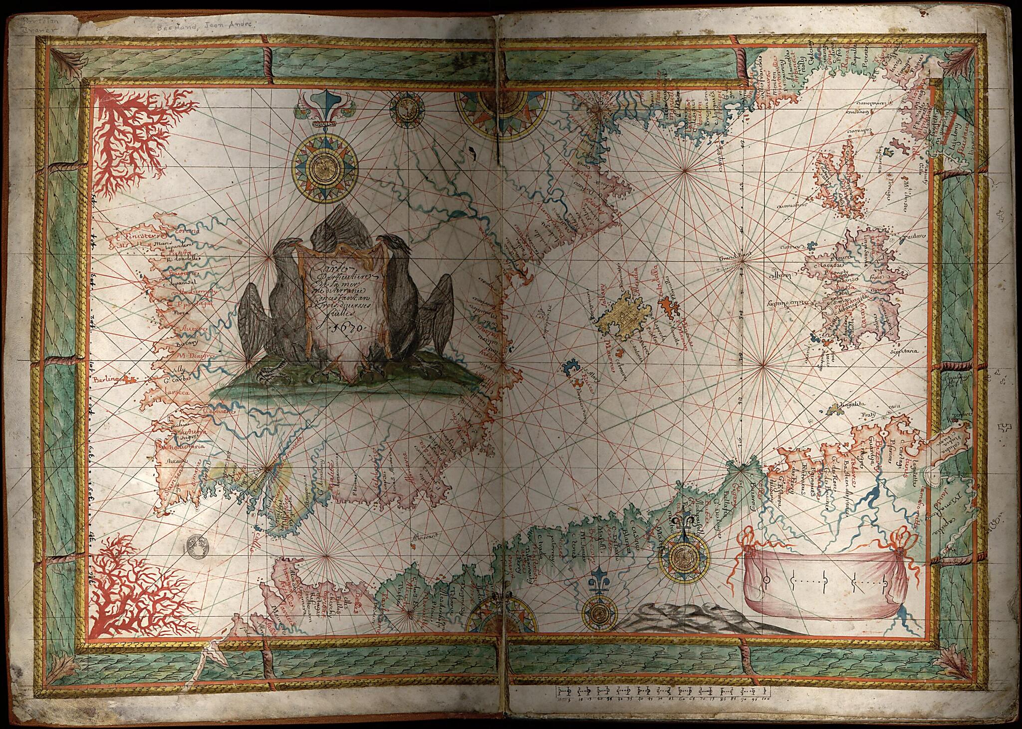
Portolan Atlas of the Mediterranean Sea and Western Europe 1670
- Regular price
-
$62.95 - Regular price
-
$57.95 - Sale price
-
$62.95
Shipping calculated at checkout.
Buy one map, get any other map in our collection for 50% OFF! Add to cart to see discount.
Couldn't load pickup availability
About This Map
Old atlase / manuscript map / portolan chart / early map of Mediterranean Region.
Created by Jean André Brémond in 1670.
Created by Jean André Brémond in 1670.
- Title supplied by cataloger.
- Pen-and-ink, watercolor, and gilding on vellum. Half of charts 1 and 5 are attached respectively to the inside of the front and back boards. The other halves of these charts and charts 2 to 4 are mounted on four paper boards.
- Bound in contemporary tooled and gilded brown leather, with modern repairs at spine and edges.
Map Subjects
Atlases
Early Maps
Early Works To 1800
Manuscript Maps
Mediterranean Region
Portolan Charts
Jean André Brémond
1670
Map Sizing Information
- For the best legibility, order your map in the original size or larger. Most maps have intricate detail and small text that is best appreciated when the print size hasn't been reduced.
- Sizes labeled "Fits a Standard Frame" will drop right into any frame that you purchase in that size. The sizes that we offer are commonly available online and at most retail stores.
- Our standard sizes are recommendations based on the aspect ratio of the original map, but still may require some added "white space" in one dimension to fit.
- Non-standard sizes will require custom framing, and we suggest taking your print to the frame shop of your choice after you receive it for the best results.
- Custom sizes are available, simply contact us for a quote.
Below is an approximation of the scale of a few standard sizes, and how they might appear in your space.

