
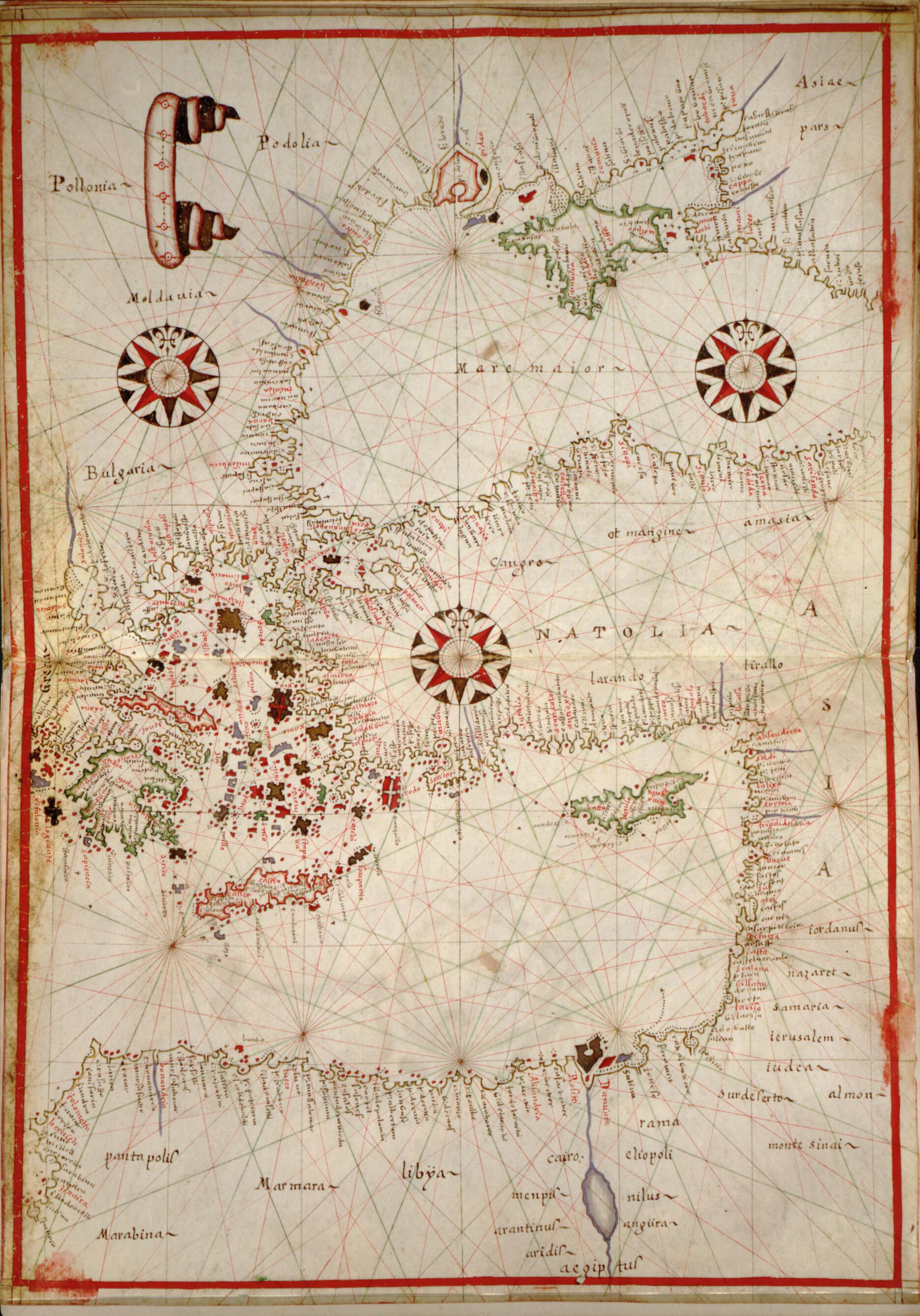
Portolan Atlas of the Mediterranean Sea, Western Europe, and the Northwest Coast of Africa 1590
- Regular price
-
$49.95 - Regular price
-
$34.95 - Sale price
-
$49.95
Shipping calculated at checkout.
Buy one map, get any other map in our collection for 50% OFF! Add to cart to see discount.
Couldn't load pickup availability
About This Map
Old manuscript map / portolan chart / early map / world atlase of Earth, Mediterranean Region.
Created by Joan Oliva in 1590.
Created by Joan Oliva in 1590.
- Title supplied by cataloger.
- Attributed to Joan Oliva by John Wolter in A portolan atlas of the Mediterranean Sea and western European waters, with a world map, 1987.
- Pen-and-ink and watercolor on vellum. World map painted on paper affixed to vellum.
- Six blank paper pages precede and follow the 10 vellum pages of maps. Circular watermarks on pp. [3] and [19].
- Bound in contemporary tooled and gilded vellum covers.
- Accompanied by 4 pieces of a Latin manuscript on vellum removed from the spine during conservation.
Map Sizing Information
- For the best legibility, order your map in the original size or larger. Most maps have intricate detail and small text that is best appreciated when the print size hasn't been reduced.
- Sizes labeled "Fits a Standard Frame" will drop right into any frame that you purchase in that size. The sizes that we offer are commonly available online and at most retail stores.
- Our standard sizes are recommendations based on the aspect ratio of the original map, but still may require some added "white space" in one dimension to fit.
- Non-standard sizes will require custom framing, and we suggest taking your print to the frame shop of your choice after you receive it for the best results.
- Custom sizes are available, simply contact us for a quote.
Below is an approximation of the scale of a few standard sizes, and how they might appear in your space.

