
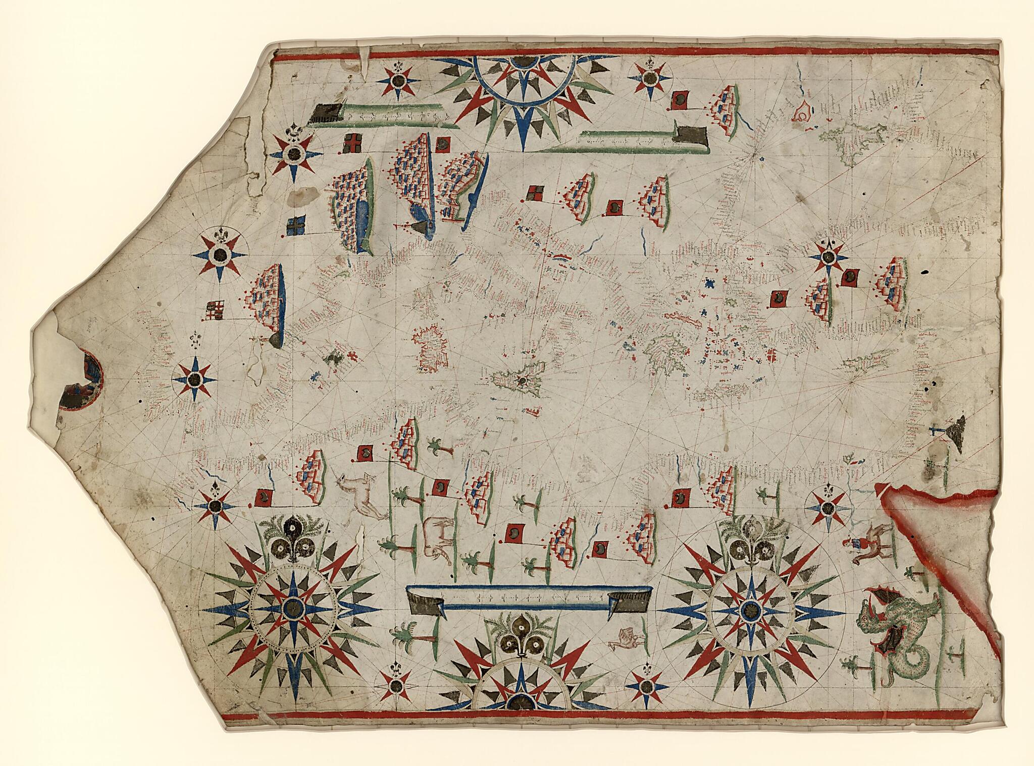
Portolan Chart of the Mediterranean and Black Seas With the West Coast of Spain and Portugal 1580
- Regular price
-
$142.95 - Regular price
-
$137.95 - Sale price
-
$142.95
Shipping calculated at checkout.
Buy one map, get any other map in our collection for 50% OFF! Add to cart to see discount.
Couldn't load pickup availability
About This Map
Old manuscript map / portolan chart / early map of Mediterranean Sea.
Created by Placido Oliva in 1580.
Created by Placido Oliva in 1580.
- Portolan chart with seaport names given for all coastlines.
- Title provided by cataloguer.
- Fragmentary signature on upper right portion leading into neck reads "Io Placid...".
- Oriented with north to the right (indicated by fleurs-de-lys).
- Contains 10 small and 4 large compass roses centered on Sicily.
- Pen-and-ink and goauche, with traces of gilding.
- Includes 2 scale bars in unidentified units, fragment of an illustration on the neck, and many illustrations throughout.
Map Subjects
Early Maps
Early Works To 1800
Manuscript Maps
Mediterranean Sea
Portolan Charts
Seaports
Manuscript Maps
Portolan Charts
Early Maps
Placido Oliva
1580
Map Sizing Information
- For the best legibility, order your map in the original size or larger. Most maps have intricate detail and small text that is best appreciated when the print size hasn't been reduced.
- Sizes labeled "Fits a Standard Frame" will drop right into any frame that you purchase in that size. The sizes that we offer are commonly available online and at most retail stores.
- Our standard sizes are recommendations based on the aspect ratio of the original map, but still may require some added "white space" in one dimension to fit.
- Non-standard sizes will require custom framing, and we suggest taking your print to the frame shop of your choice after you receive it for the best results.
- Custom sizes are available, simply contact us for a quote.
Below is an approximation of the scale of a few standard sizes, and how they might appear in your space.

