
Portolan Chart of the Mediterranean and Connecting Seas 1550
- Regular price
-
$57.95 - Regular price
-
$40.95 - Sale price
-
$57.95
Shipping calculated at checkout.
Buy one map, get any other map in our collection for 50% OFF! Add to cart to see discount.
Couldn't load pickup availability
About This Map
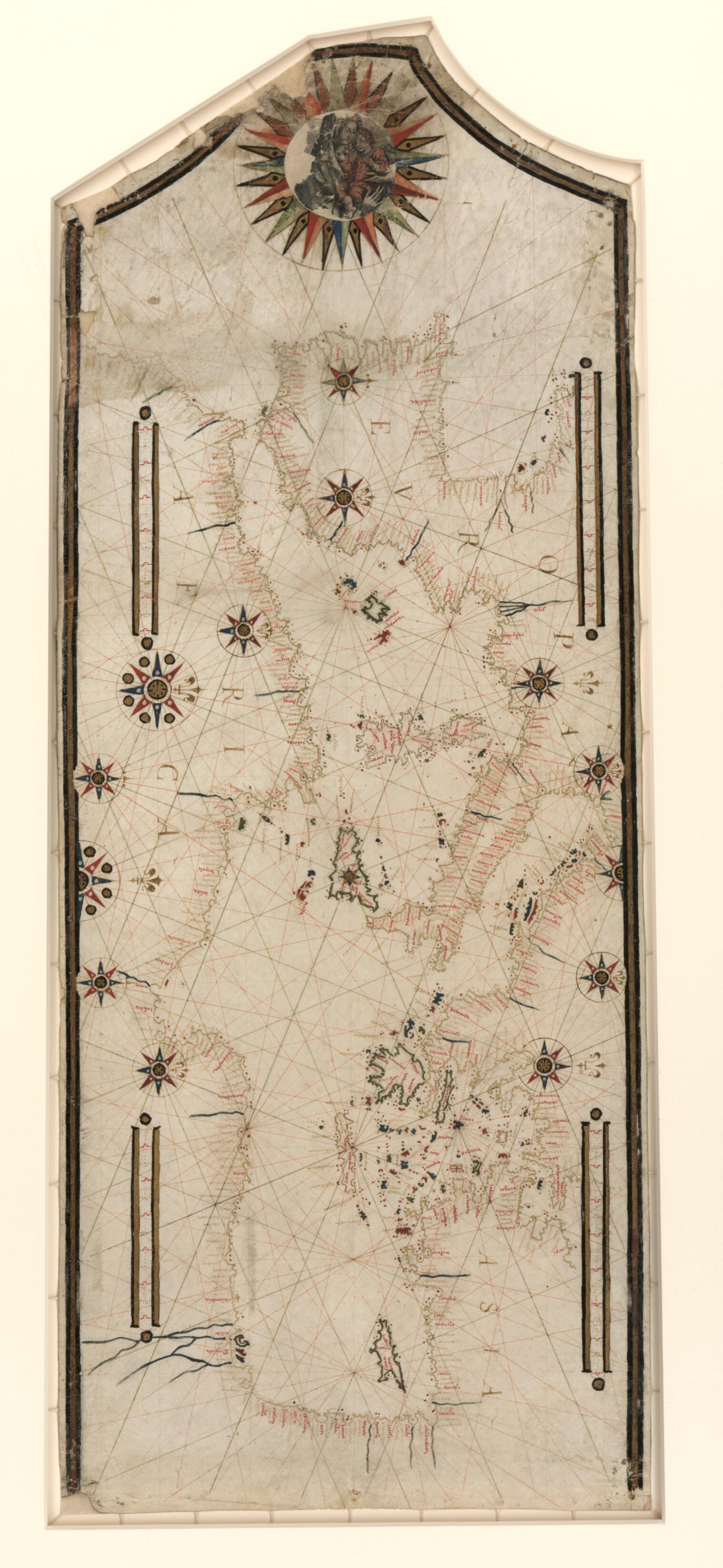
Old manuscript map / portolan chart / early map of Mediterranean Sea.
- Portolan chart with seaport names given for all coastlines. Does not cover Black Sea.
- Title devised by cataloguer.
- Oriented with north to the right (indicated by fleurs-de-lys).
- Contains 11 compass roses in a circle centered on Sicily, 2 additional roses in Iberia, and rhumb lines connecting all roses and some central points without roses.
- Manuscript: pen-and-ink (brown) and dark watercolors.
- Includes 4 scale bars (unidentified) and a large compass rose at top (in neck of sheet) containing a drawing of the Madonna and Child.
Map Sizing Information
- For the best legibility, order your map in the original size or larger. Most maps have intricate detail and small text that is best appreciated when the print size hasn't been reduced.
- Sizes labeled "Fits a Standard Frame" will drop right into any frame that you purchase in that size. The sizes that we offer are commonly available online and at most retail stores.
- Our standard sizes are recommendations based on the aspect ratio of the original map, but still may require some added "white space" in one dimension to fit.
- Non-standard sizes will require custom framing, and we suggest taking your print to the frame shop of your choice after you receive it for the best results.
- Custom sizes are available, simply contact us for a quote.
Below is an approximation of the scale of a few standard sizes, and how they might appear in your space.

