
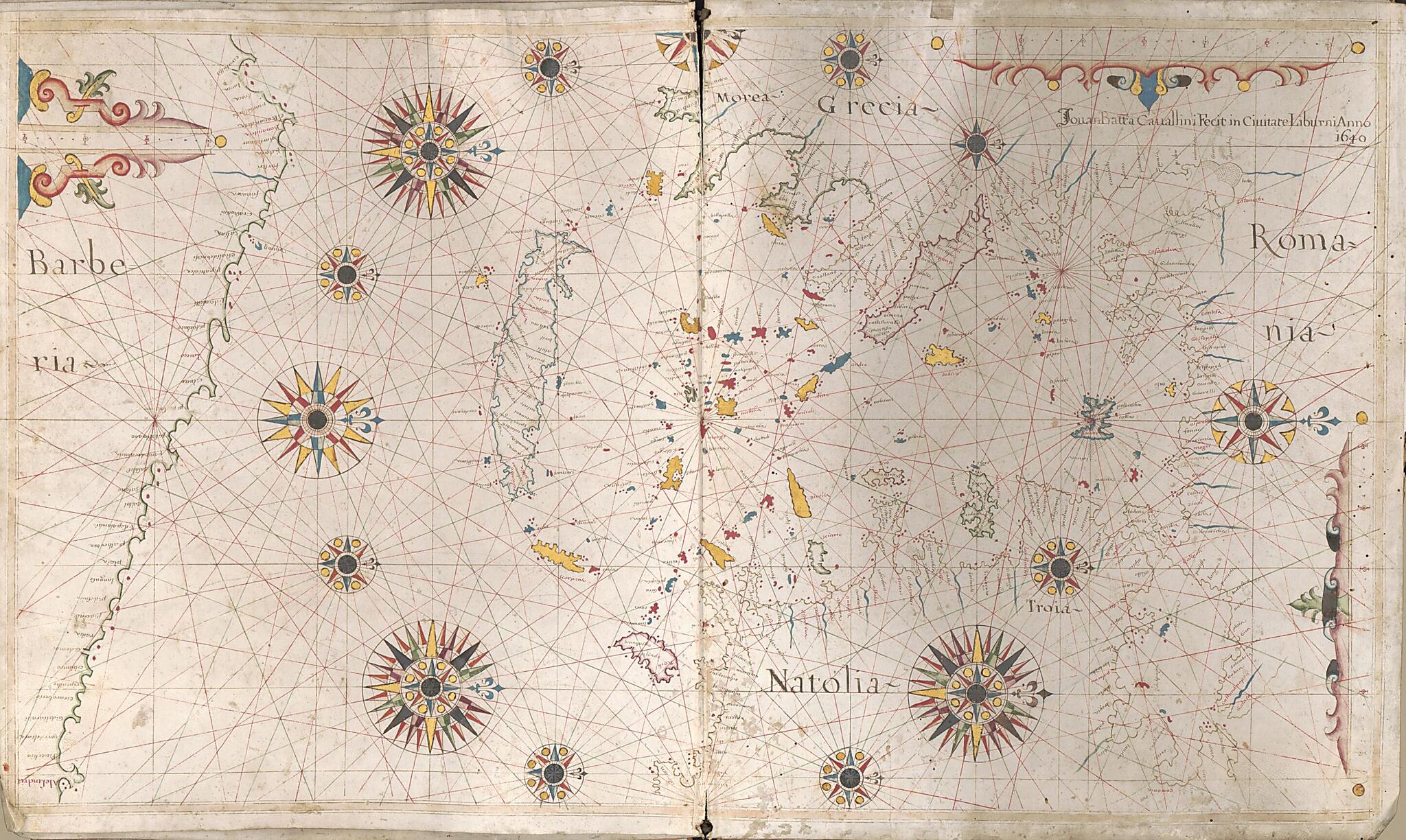
Portolan Chart of the Mediterranean Sea and Western Part of the Black Sea ; Portolan Chart of the Aegean Sea and Part of the Mediterranean Sea Including Crete (Portolan Chart of the Aegean Sea and Part of the Mediterranean Sea Including Crete, Mediter...
- Regular price
-
$61.95 - Regular price
-
$56.95 - Sale price
-
$61.95
Shipping calculated at checkout.
Buy one map, get any other map in our collection for 50% OFF! Add to cart to see discount.
Couldn't load pickup availability
About This Map
Old portolan chart / manuscript map / early map of Aegean Sea Region, Black Sea Region, Mediterranean Region.
Created by Giovanni Battista Cavallini in 1640.
Created by Giovanni Battista Cavallini in 1640.
- Shows names of harbors along the coastlines of the Mediterranean Sea, Black Sea, and adjoining waters.
- Relief shown pictorially on the Mediterranean Sea chart.
- Statement of attribution from the Aegean Sea chart.
- Titles devised by cataloguer.
- Aegean Sea chart oriented with north to the right.
- The 2 charts are half-joined at the cover spine.
- Includes color drawings of cities, flags, illustration of Christ on the cross, and numerous compass roses.
- Two circular insets in the Mediterranean chart: America [north and south] -- Europa, Asia, Africa.
Map Subjects
Aegean Sea Region
Black Sea Region
Early Maps
Early Works To 1800
Manuscript Maps
Mediterranean Region
Portolan Charts
Giovanni Battista Cavallini
1640
Map Sizing Information
- For the best legibility, order your map in the original size or larger. Most maps have intricate detail and small text that is best appreciated when the print size hasn't been reduced.
- Sizes labeled "Fits a Standard Frame" will drop right into any frame that you purchase in that size. The sizes that we offer are commonly available online and at most retail stores.
- Our standard sizes are recommendations based on the aspect ratio of the original map, but still may require some added "white space" in one dimension to fit.
- Non-standard sizes will require custom framing, and we suggest taking your print to the frame shop of your choice after you receive it for the best results.
- Custom sizes are available, simply contact us for a quote.
Below is an approximation of the scale of a few standard sizes, and how they might appear in your space.
