
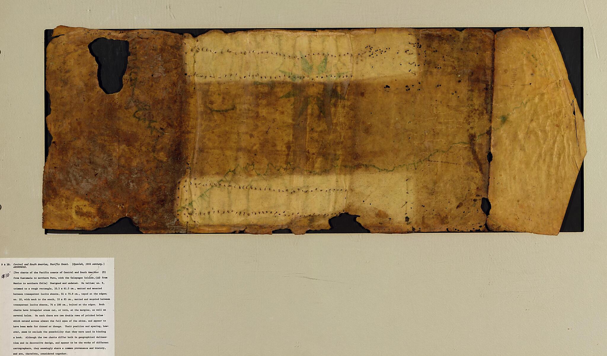
Portolan Chart of the Pacific Coast from Mexico to Northern Chile 1500
- Regular price
-
$90.95 - Regular price
-
$85.95 - Sale price
-
$90.95
Shipping calculated at checkout.
Buy one map, get any other map in our collection for 50% OFF! Add to cart to see discount.
Couldn't load pickup availability
About This Map
Old manuscript map / portolan chart / early map of Central America, Mexico, Pacific Coast, South America.
- Seems to be in Spanish.
- Title supplied by cataloger.
- Pen-and-ink; black, brown, green, and red.
- Trimmed to a rough rectangle.
- Matted and mounted between sheets of transparent lucite.
- Includes col. ill.
- This map has some imperfections: some tears on edge and several holes. We'll do our best to restore the image before printing.
Map Subjects
Central America
Coasts
Early Maps
Early Works To 1800
Manuscript Maps
Mexico
Pacific Coast (Central America)
Pacific Coast (Mexico)
Pacific Coast (South America)
Portolan Charts
South America
Pacific Coast
1500
Map Sizing Information
- For the best legibility, order your map in the original size or larger. Most maps have intricate detail and small text that is best appreciated when the print size hasn't been reduced.
- Sizes labeled "Fits a Standard Frame" will drop right into any frame that you purchase in that size. The sizes that we offer are commonly available online and at most retail stores.
- Our standard sizes are recommendations based on the aspect ratio of the original map, but still may require some added "white space" in one dimension to fit.
- Non-standard sizes will require custom framing, and we suggest taking your print to the frame shop of your choice after you receive it for the best results.
- Custom sizes are available, simply contact us for a quote.
Below is an approximation of the scale of a few standard sizes, and how they might appear in your space.
