
Portolan Chart (Old World) 1505
- Regular price
-
$201.95 - Regular price
-
$196.95 - Sale price
-
$201.95
Shipping calculated at checkout.
Buy one map, get any other map in our collection for 50% OFF! Add to cart to see discount.
Couldn't load pickup availability
About This Map
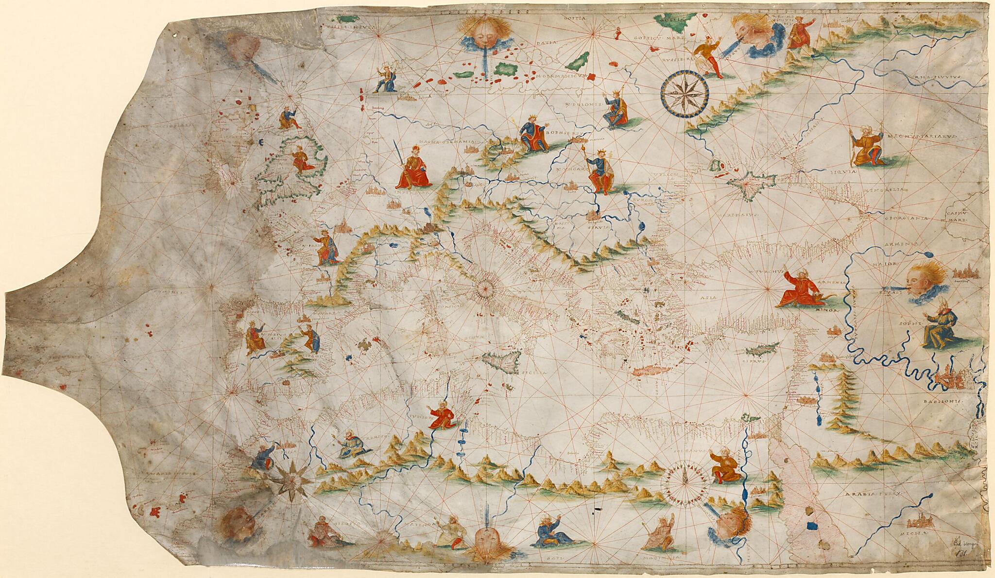
century geographers. The map was transferred to the Bavarian State Library from the Cistercian monastery of Aldersbach. It is extraordinary for the precise and detailed knowledge of the mountain chain from Spain to the Urals that it reflects, and for its portrayal of the regions of Africa and Asia, whose exotic masters are depicted along with their surnames. The texts accompanying the chart begin with capital letters and underline the importance of the pilgrimage cities of Jerusalem and Mecca.
- Title devised, in English, by Library staff.
- "BSB Shelfmark: Cod.icon. 131"--Note extracted from World Digital Library.
- Original resource extent: 1 sheet, parchment : illustrations ; 61 x 85-105 centimeters.
- Original resource at: Bavarian State Library.
- Content in Latin.
- Description based on data extracted from World Digital Library, which may be extracted from partner institutions.
Map Subjects
Portolan Charts
1505
Map Sizing Information
- For the best legibility, order your map in the original size or larger. Most maps have intricate detail and small text that is best appreciated when the print size hasn't been reduced.
- Sizes labeled "Fits a Standard Frame" will drop right into any frame that you purchase in that size. The sizes that we offer are commonly available online and at most retail stores.
- Our standard sizes are recommendations based on the aspect ratio of the original map, but still may require some added "white space" in one dimension to fit.
- Non-standard sizes will require custom framing, and we suggest taking your print to the frame shop of your choice after you receive it for the best results.
- Custom sizes are available, simply contact us for a quote.
Below is an approximation of the scale of a few standard sizes, and how they might appear in your space.
