
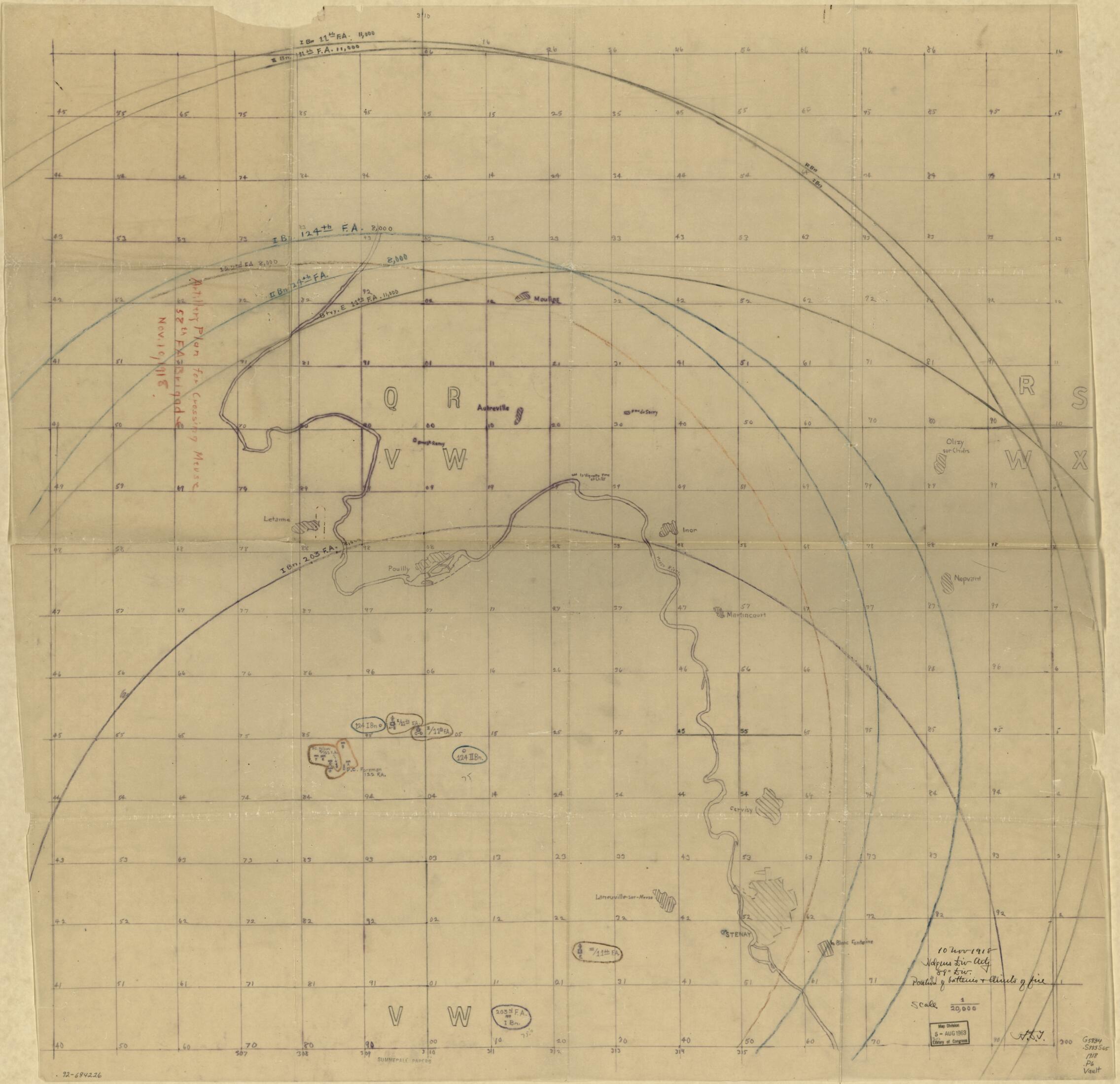
Position of Batteries & Units of Fire : Stenay 1918
- Regular price
-
$123.95 - Regular price
-
$118.95 - Sale price
-
$123.95
Shipping calculated at checkout.
Buy one map, get any other map in our collection for 50% OFF! Add to cart to see discount.
Couldn't load pickup availability
About This Map
Old map of France, Stenay.
Created by Charles Pelot Summerall in 1918.
Created by Charles Pelot Summerall in 1918.
- Shows northwestern vicinity of Stenay.
- "10 Nov. 1918."
- At head of title: Hdqrs. Div. Arty., 89" Div.
- Accompanied by typescript text: Plan of attack for supporting attack of 177th Infantry Brigade. [1] leaf ; 34 cm. -- Text annotated in pencil. [2] leaves ; 33 cm. -- Ms. map at 1:20,000 in pencil: Foreman 11/10/18 grouping. 1 map : ms., tracing : 21 x 33 cm.
- Black ink, pencil, and color pencils on mimeographed grid sheet.
- ARP
Map Sizing Information
- For the best legibility, order your map in the original size or larger. Most maps have intricate detail and small text that is best appreciated when the print size hasn't been reduced.
- Sizes labeled "Fits a Standard Frame" will drop right into any frame that you purchase in that size. The sizes that we offer are commonly available online and at most retail stores.
- Our standard sizes are recommendations based on the aspect ratio of the original map, but still may require some added "white space" in one dimension to fit.
- Non-standard sizes will require custom framing, and we suggest taking your print to the frame shop of your choice after you receive it for the best results.
- Custom sizes are available, simply contact us for a quote.
Below is an approximation of the scale of a few standard sizes, and how they might appear in your space.

