
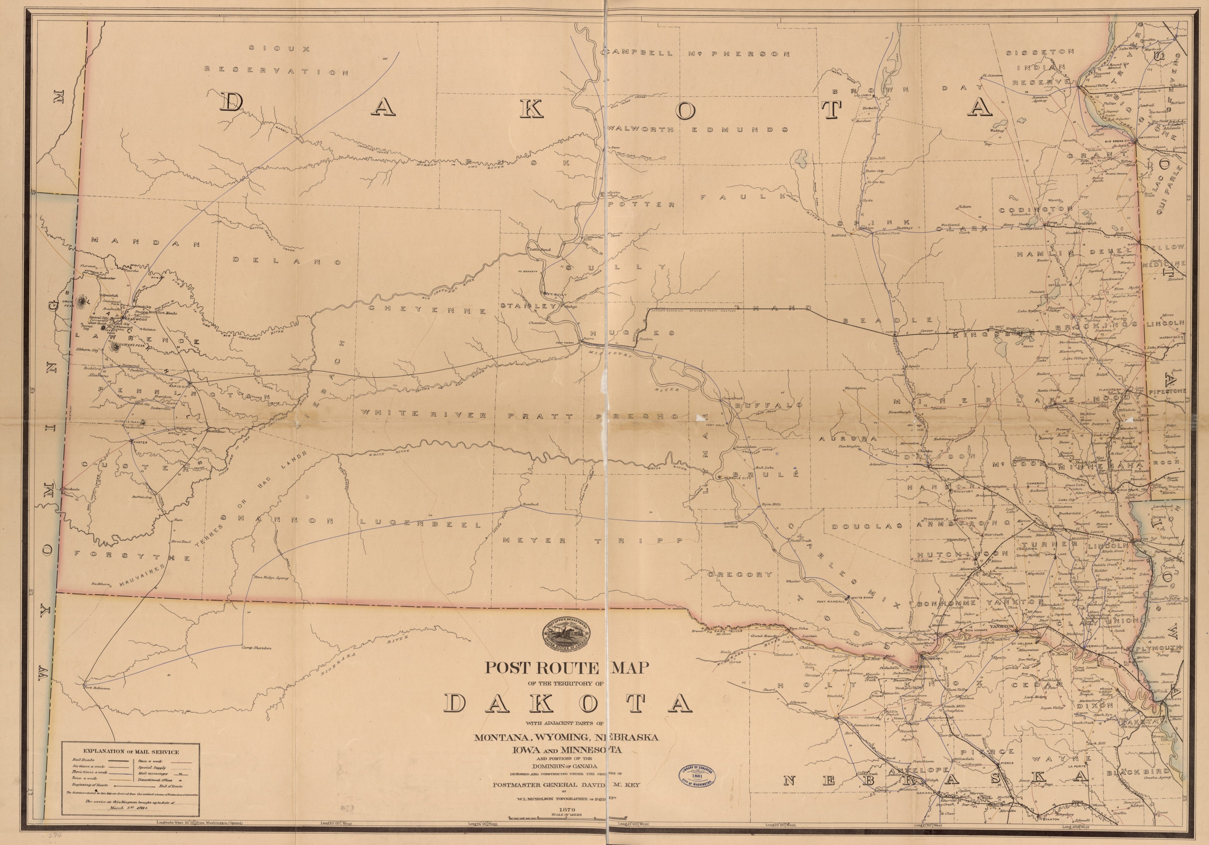
Post Route Map of the Territory of Dakota With Adjacent Parts of Montana, Wyoming, Nebraska, Iowa and Minnesota, and Portions of the Dominion of Canada in 1881
- Regular price
-
$202.95 - Regular price
-
$197.95 - Sale price
-
$202.95
Shipping calculated at checkout.
Buy one map, get any other map in our collection for 50% OFF! Add to cart to see discount.
Couldn't load pickup availability
About This Map
Old map of Dakota Territory, Montana, North Dakota, South Dakota, United States, West North Central States, Wyoming.
Created by W. L. Nicholson, United States. Post Office Department in 1881.
Created by W. L. Nicholson, United States. Post Office Department in 1881.
- Dated 1879.
- "The service on this diagram brought up to date of March 1st, 1881."
- Originally printed 2 maps 73 x 51 cm. on sheets 76 x 54 cm., sheets joined vertically to form 1 map.
- Prime meridian: Washington, D.C.
- Includes explanation of mail service.
Map Sizing Information
- For the best legibility, order your map in the original size or larger. Most maps have intricate detail and small text that is best appreciated when the print size hasn't been reduced.
- Sizes labeled "Fits a Standard Frame" will drop right into any frame that you purchase in that size. The sizes that we offer are commonly available online and at most retail stores.
- Our standard sizes are recommendations based on the aspect ratio of the original map, but still may require some added "white space" in one dimension to fit.
- Non-standard sizes will require custom framing, and we suggest taking your print to the frame shop of your choice after you receive it for the best results.
- Custom sizes are available, simply contact us for a quote.
Below is an approximation of the scale of a few standard sizes, and how they might appear in your space.
