
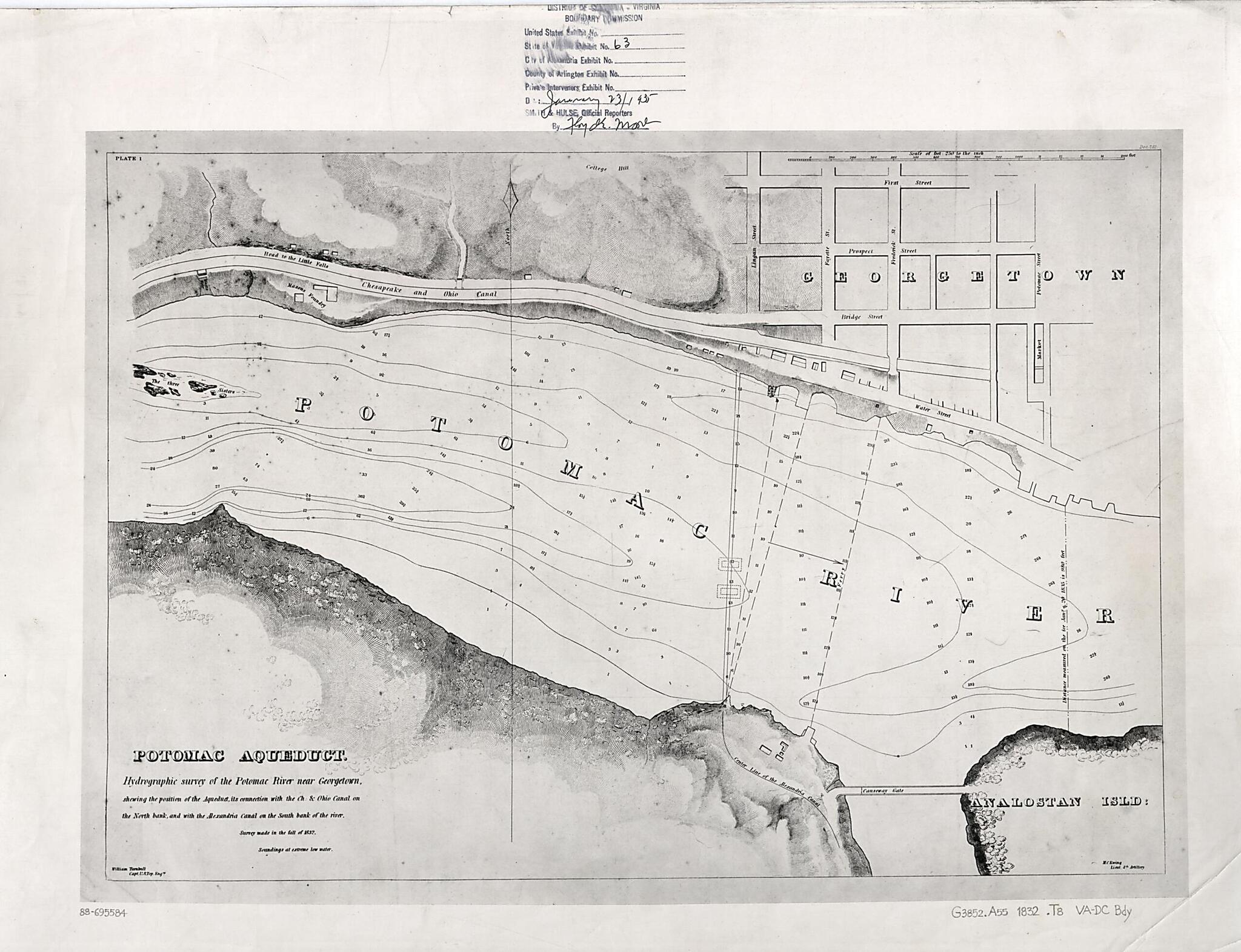
Potomac Aqueduct, Hydrographic Survey of the Potomac River Near Georgetown : Shewing the Position of the Aqueduct, Its Connection With the Ch. & Ohio Canal On the North Bank, and With the Alexandria Canal On the South Bank of the River 1832
- Regular price
-
$80.95 - Regular price
-
$75.95 - Sale price
-
$80.95
Shipping calculated at checkout.
Buy one map, get any other map in our collection for 50% OFF! Add to cart to see discount.
Couldn't load pickup availability
About This Map
Old bathymetric map of Aqueduct Bridge, Aqueduct Bridge (Virginia), Aqueduct Bridge (Washington, D.C.), District of Columbia, Georgetown, Potomac River Estuary, United States, Virginia, Washington D.C..
Created by Maskell C. Ewing, Wm. (William) Turnbull, District of Columbia Boundary Commission in 1832.
Created by Maskell C. Ewing, Wm. (William) Turnbull, District of Columbia Boundary Commission in 1832.
- "Survey made in the fall of 1832."
- Relief shown by hachures. Depths shown by contours and soundings.
- From the papers of the Virginia-District of Columbia Boundary Commission.
- Rubber-stamped and annotated in ink on recto and verso: District of Columbia-Virginia Boundary Commission ... State of Virginia Exhibit No. 63 ... Date: January 23/1935, Smith & Hulse, Official Reporters.
- In upper left corner: Plate 1.
- In right upper margin: Doc. 261.
Map Subjects
Aqueduct Bridge (Virginia)
Aqueduct Bridge (Washington D.C.)
Aqueduct Bridge (Washington D.C. And Va.)
Bathymetric Maps
District Of Columbia
Georgetown
Georgetown (Washington D.C.)
Planning
Potomac River Estuary
United States
Aqueduct Bridge
Virginia
Washington D.C.
Maskell C. Ewing
Wm. (William) Turnbull
District Of Columbia Boundary Commission
1832
Map Sizing Information
- For the best legibility, order your map in the original size or larger. Most maps have intricate detail and small text that is best appreciated when the print size hasn't been reduced.
- Sizes labeled "Fits a Standard Frame" will drop right into any frame that you purchase in that size. The sizes that we offer are commonly available online and at most retail stores.
- Our standard sizes are recommendations based on the aspect ratio of the original map, but still may require some added "white space" in one dimension to fit.
- Non-standard sizes will require custom framing, and we suggest taking your print to the frame shop of your choice after you receive it for the best results.
- Custom sizes are available, simply contact us for a quote.
Below is an approximation of the scale of a few standard sizes, and how they might appear in your space.

