
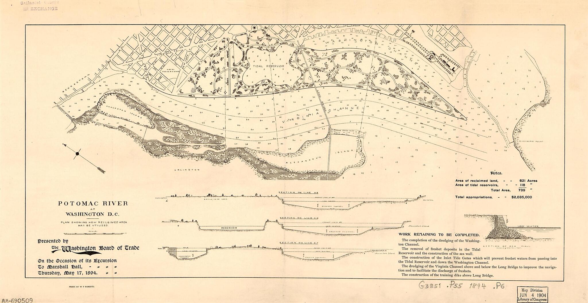
Potomac River at Washington D.C., Plan Showing How Reclaimed Area May Be Utilized 1894
- Regular price
-
$49.95 - Regular price
-
$29.95 - Sale price
-
$49.95
Shipping calculated at checkout.
Buy one map, get any other map in our collection for 50% OFF! Add to cart to see discount.
Couldn't load pickup availability
About This Map
Old map of Arlington, District of Columbia, East Potomac Park, Potomac River Estuary, United States, Virginia, Washington, Washington D.C., West Potomac Park.
Created by Washington Board of Trade in 1894.
Created by Washington Board of Trade in 1894.
- Shows dredged and reclaimed areas with proposed roads and plantings for the Potomac parks.
- Depths shown by soundings.
- Oriented with north toward the upper left.
- Includes text, 3 cross-sections, statistical table, and ill.
Map Subjects
Arlington
District Of Columbia
East Potomac Park
East Potomac Park (Washington D.C.)
Harbors
Potomac River Estuary
Reclamation Of Land
United States
Virginia
Washington
Washington (D.C.)
Waterfronts
West Potomac Park
West Potomac Park (Washington D.C.)
Washington D.C.
Washington Board Of Trade
1894
Map Sizing Information
- For the best legibility, order your map in the original size or larger. Most maps have intricate detail and small text that is best appreciated when the print size hasn't been reduced.
- Sizes labeled "Fits a Standard Frame" will drop right into any frame that you purchase in that size. The sizes that we offer are commonly available online and at most retail stores.
- Our standard sizes are recommendations based on the aspect ratio of the original map, but still may require some added "white space" in one dimension to fit.
- Non-standard sizes will require custom framing, and we suggest taking your print to the frame shop of your choice after you receive it for the best results.
- Custom sizes are available, simply contact us for a quote.
Below is an approximation of the scale of a few standard sizes, and how they might appear in your space.
