
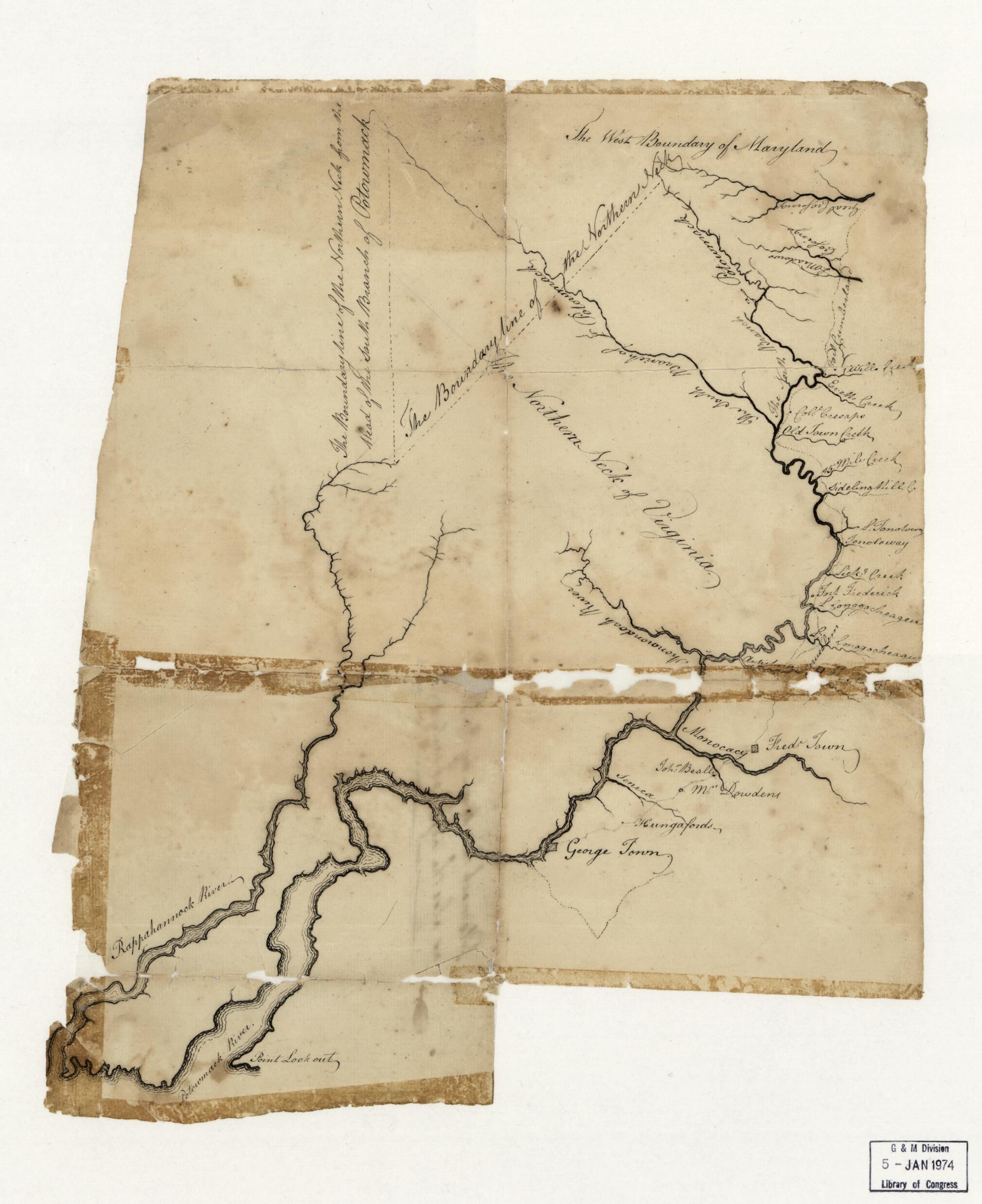
Potomack 1770
- Regular price
-
$49.95 - Regular price
-
$34.95 - Sale price
-
$49.95
Shipping calculated at checkout.
Buy one map, get any other map in our collection for 50% OFF! Add to cart to see discount.
Couldn't load pickup availability
About This Map
Old early map / manuscript map of Early Works to 1800, Maps, Maryland, Northern Neck, Potomac River, Potomac River Estuary, Rappahannock River, United States, Virginia.
Created by Robert Booth in 1770.
Created by Robert Booth in 1770.
- Covers the Potomac River (estuary and river), its tributaries, and the Rappahannock River.
- Also covers "The Northern Neck of Virginia".
- Title from annotation on verso.
- Gift; Robert Lee Brown, Woodville, Va.; October 1973.
- Manuscript: pen-and-ink.
- Condition This map has some imperfections: torn at fold lines, missing small internal sections at fold lines and at sheet edges, formerly taped. We'll do our best to restore the image before printing.
Map Sizing Information
- For the best legibility, order your map in the original size or larger. Most maps have intricate detail and small text that is best appreciated when the print size hasn't been reduced.
- Sizes labeled "Fits a Standard Frame" will drop right into any frame that you purchase in that size. The sizes that we offer are commonly available online and at most retail stores.
- Our standard sizes are recommendations based on the aspect ratio of the original map, but still may require some added "white space" in one dimension to fit.
- Non-standard sizes will require custom framing, and we suggest taking your print to the frame shop of your choice after you receive it for the best results.
- Custom sizes are available, simply contact us for a quote.
Below is an approximation of the scale of a few standard sizes, and how they might appear in your space.

