
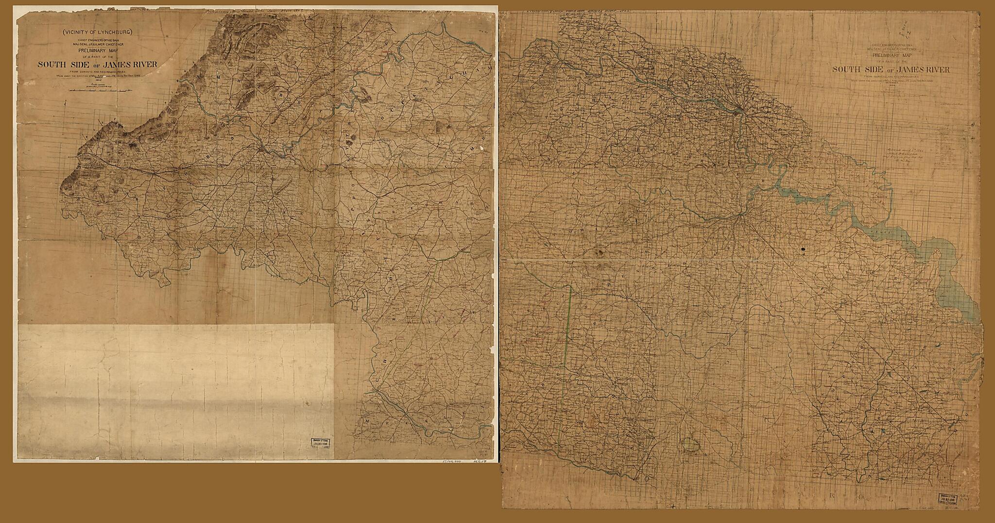
Preliminary Map of a Part of the South Side of James River : from Surveys and Reconnaissances 1864
- Regular price
-
$277.95 - Regular price
-
$272.95 - Sale price
-
$277.95
Shipping calculated at checkout.
Buy one map, get any other map in our collection for 50% OFF! Add to cart to see discount.
Couldn't load pickup availability
About This Map
Old map of United States, Virginia.
Created by Albert H. (Albert Henry) Campbell, Confederate States of America. Army. Department of Northern Virginia. Chief Engineer's Office, Jeremy Francis Gilmer, J. Houston Patton in 1864.
Created by Albert H. (Albert Henry) Campbell, Confederate States of America. Army. Department of Northern Virginia. Chief Engineer's Office, Jeremy Francis Gilmer, J. Houston Patton in 1864.
- Shows names of some residents.
- Relief shown by hachures.
- At head of title: Chief Engineer's Office D.N.V. Maj Genl. J.F. Gilmer Chief Engr.
- Civil War salted paper maps. AL 91.
- Civil War Map
Map Subjects
Landowners
Salted Paper Prints
United States
Virginia
Albert H. (Albert Henry) Campbell
Confederate States Of America. Army. Department Of Northern Virginia. Chief Engineer's Office
Jeremy Francis Gilmer
J. Houston Patton
1864
Map Sizing Information
- For the best legibility, order your map in the original size or larger. Most maps have intricate detail and small text that is best appreciated when the print size hasn't been reduced.
- Sizes labeled "Fits a Standard Frame" will drop right into any frame that you purchase in that size. The sizes that we offer are commonly available online and at most retail stores.
- Our standard sizes are recommendations based on the aspect ratio of the original map, but still may require some added "white space" in one dimension to fit.
- Non-standard sizes will require custom framing, and we suggest taking your print to the frame shop of your choice after you receive it for the best results.
- Custom sizes are available, simply contact us for a quote.
Below is an approximation of the scale of a few standard sizes, and how they might appear in your space.
