
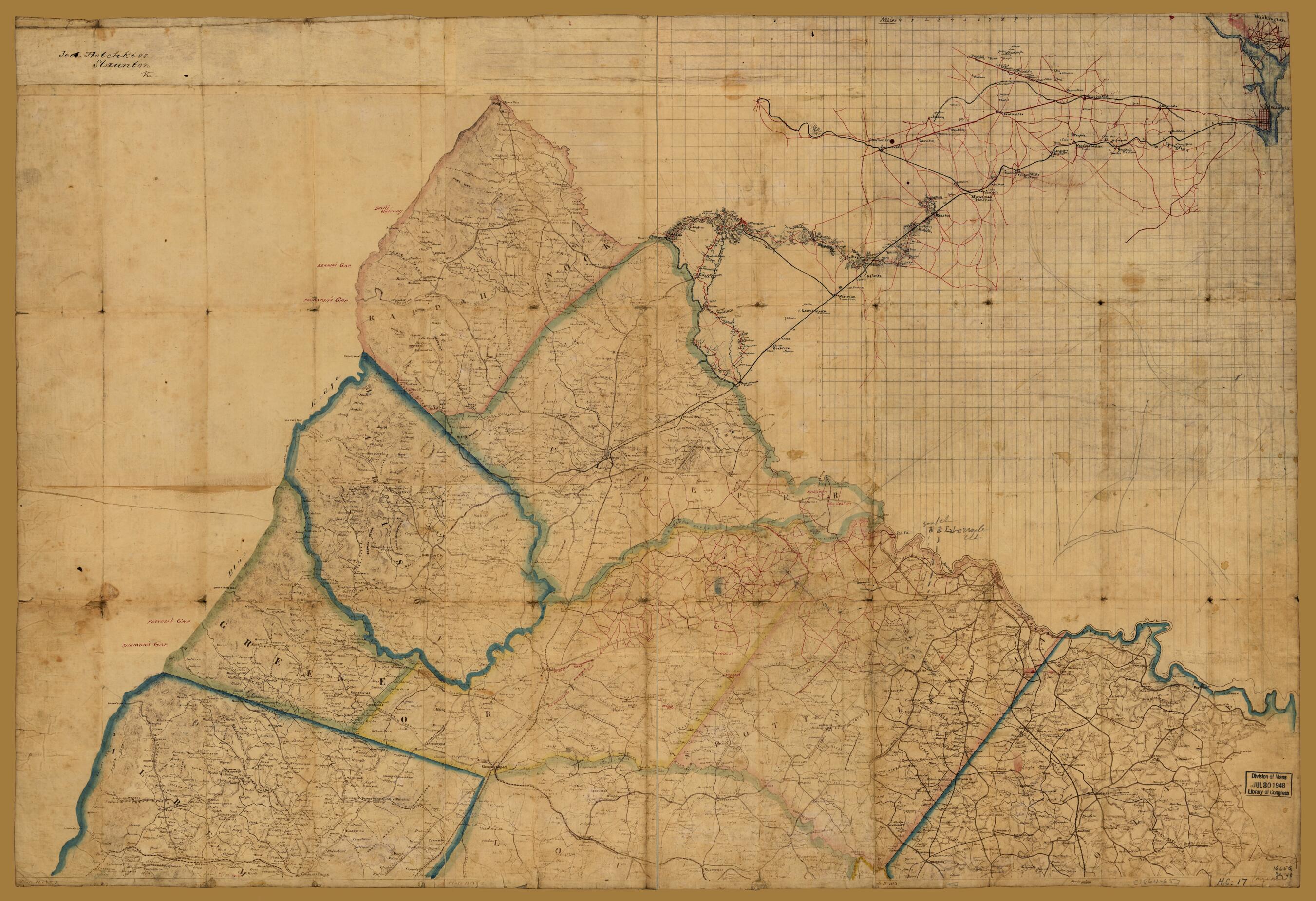
Preliminary Map of Northeastern Virginia, South of the Rappahannock, East of the Blue Ridge, and North of 38⁰ N. Lat. 1864
- Regular price
-
$111.95 - Regular price
-
$106.95 - Sale price
-
$111.95
Shipping calculated at checkout.
Buy one map, get any other map in our collection for 50% OFF! Add to cart to see discount.
Couldn't load pickup availability
About This Map
Old map of United States, Virginia.
- Shows names of some residents.
- Relief shown by hachures.
- Date and title from Stephenson's Civil War maps, 1989.
- Sun print on a number of sheets pieced together and sectioned in two, with extensive ink and pencil annotations including a colored ink extension of the map drawn over a pencil grid showing roads connecting a portion of the map with Washington, D.C. and Alexandria, Virginia.
- Civil War salted paper maps.
- Civil War Map
- In pencil on upper left verso: N.E. Va. Rappahannock & James.
- Red bordered label on verso: 384.
- In lower margin: Plate B No. 1, Plate B No. 2, [Pl]ate B No. 3.
Map Sizing Information
- For the best legibility, order your map in the original size or larger. Most maps have intricate detail and small text that is best appreciated when the print size hasn't been reduced.
- Sizes labeled "Fits a Standard Frame" will drop right into any frame that you purchase in that size. The sizes that we offer are commonly available online and at most retail stores.
- Our standard sizes are recommendations based on the aspect ratio of the original map, but still may require some added "white space" in one dimension to fit.
- Non-standard sizes will require custom framing, and we suggest taking your print to the frame shop of your choice after you receive it for the best results.
- Custom sizes are available, simply contact us for a quote.
Below is an approximation of the scale of a few standard sizes, and how they might appear in your space.
