
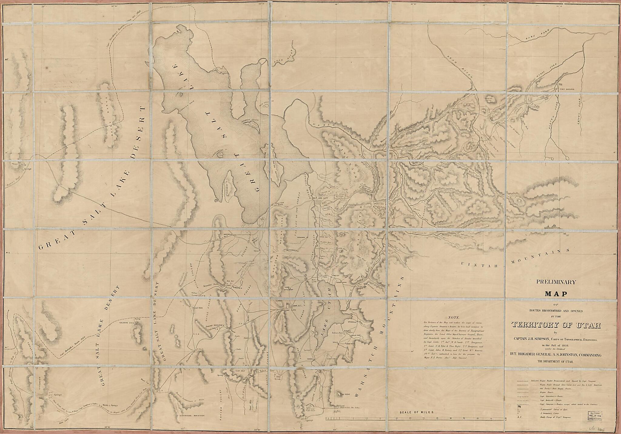
Preliminary Map of Routes Reconnoitered and Opened In the Territory of Utah in 1858
- Regular price
-
$143.95 - Regular price
-
$138.95 - Sale price
-
$143.95
Shipping calculated at checkout.
Buy one map, get any other map in our collection for 50% OFF! Add to cart to see discount.
Couldn't load pickup availability
About This Map
Old map of Roads, Southwest, New, Trails, United States, Utah.
Created by Millard Fillmore, J. H. (James Hervey) Simpson in 1858.
Created by Millard Fillmore, J. H. (James Hervey) Simpson in 1858.
- Relief shown by hachures. Depths shown by contours.
- Shows camps, forts, early trails through Great Salt Lake region, wagon roads, springs and mountains.
- From: Report of the Secretary of War, communicating, in compliance with a resolution of the Senate, Captain Simpson's report and map of wagon road routes in Utah Territory (35th Cong. 2nd Session Senate Ex. Doc. no.10).
- Includes "Note."
Map Subjects
Discovery And Exploration
Roads
Southwest New
Trails
United States
Utah
Millard Fillmore
J. H. (James Hervey) Simpson
1858
Map Sizing Information
- For the best legibility, order your map in the original size or larger. Most maps have intricate detail and small text that is best appreciated when the print size hasn't been reduced.
- Sizes labeled "Fits a Standard Frame" will drop right into any frame that you purchase in that size. The sizes that we offer are commonly available online and at most retail stores.
- Our standard sizes are recommendations based on the aspect ratio of the original map, but still may require some added "white space" in one dimension to fit.
- Non-standard sizes will require custom framing, and we suggest taking your print to the frame shop of your choice after you receive it for the best results.
- Custom sizes are available, simply contact us for a quote.
Below is an approximation of the scale of a few standard sizes, and how they might appear in your space.
