
Preliminary Map of the Routes Followed by the Members of the Afghan Boundary Commission 1885
- Regular price
-
$49.95 - Regular price
-
$34.95 - Sale price
-
$49.95
Shipping calculated at checkout.
Buy one map, get any other map in our collection for 50% OFF! Add to cart to see discount.
Couldn't load pickup availability
About This Map
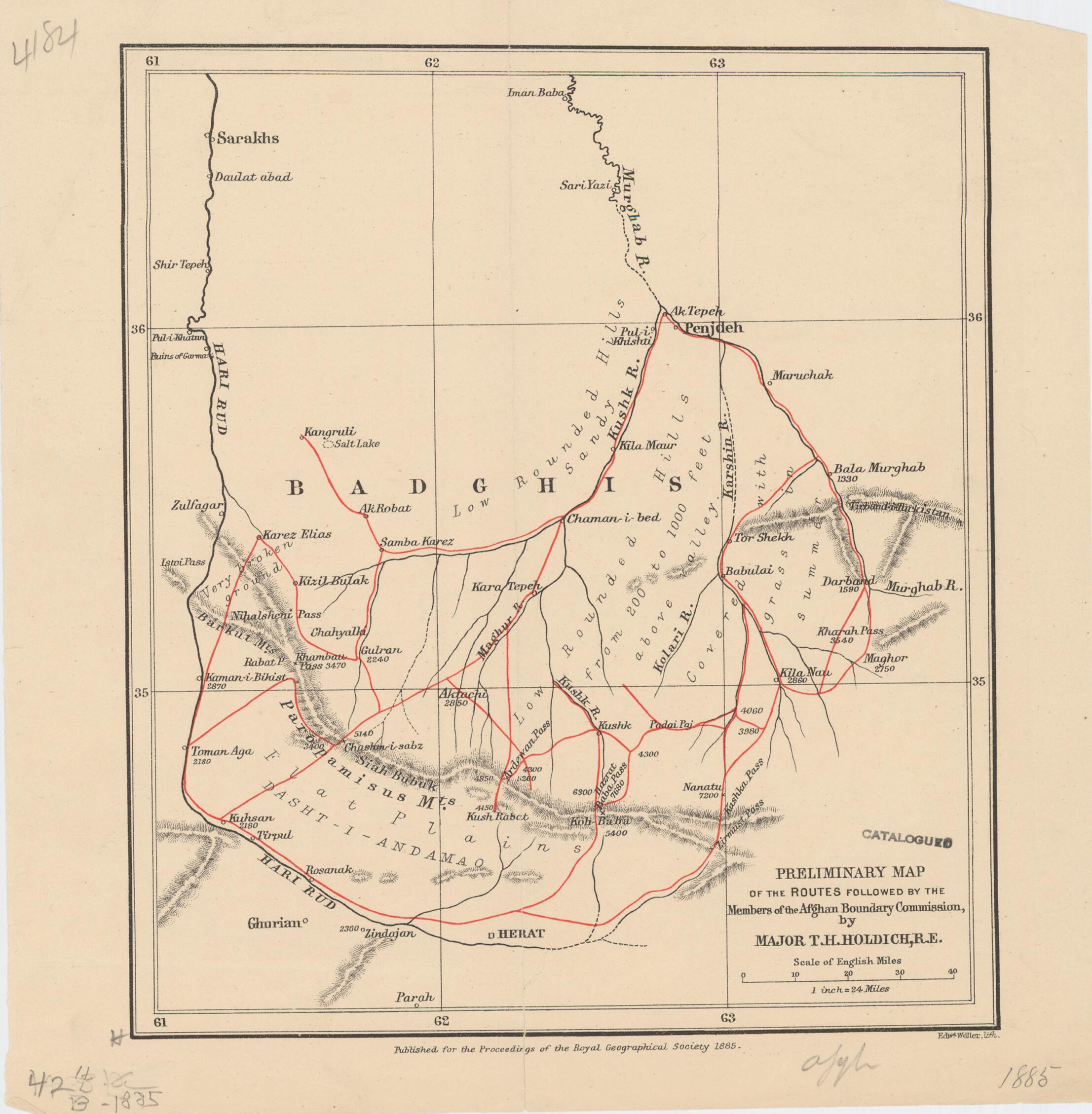
Old map of Afghanistan, Bādghīs.
day Badghis Province) in the northwestern part of the country, on the border with present-day Turkmenistan, which at that time was part of the Russian Empire. The map shows rivers and populated places. Relief is shown by hachures; the height of mountains is given in feet. The scale is one inch to 24 miles (2.54 centimeters to 38.62 kilometers). The map was drawn by Major T.H. Holdich, an officer with the Royal Engineers of the British Army in India, and was prepared for a paper on the Afghan Boundary Commission that was read to the Royal Geographical Society in London in March 1885. The map was produced by lithographer Edward Weller (1819-84), a London-based cartographer and engraver who was the unofficial geographer of the Royal Geographical Society.
Created by Thomas Hungerford Holdich, Royal Geographical Society (Great Britain), Edward Weller in 1885.
- Title devised, in English, by Library staff.
- Original resource extent: 1 map : color ; 20 x 17 centimeters.
- Original resource at: University of Wisconsin-Milwaukee Libraries.
- Content in English.
- Description based on data extracted from World Digital Library, which may be extracted from partner institutions.
Map Sizing Information
- For the best legibility, order your map in the original size or larger. Most maps have intricate detail and small text that is best appreciated when the print size hasn't been reduced.
- Sizes labeled "Fits a Standard Frame" will drop right into any frame that you purchase in that size. The sizes that we offer are commonly available online and at most retail stores.
- Our standard sizes are recommendations based on the aspect ratio of the original map, but still may require some added "white space" in one dimension to fit.
- Non-standard sizes will require custom framing, and we suggest taking your print to the frame shop of your choice after you receive it for the best results.
- Custom sizes are available, simply contact us for a quote.
Below is an approximation of the scale of a few standard sizes, and how they might appear in your space.

