
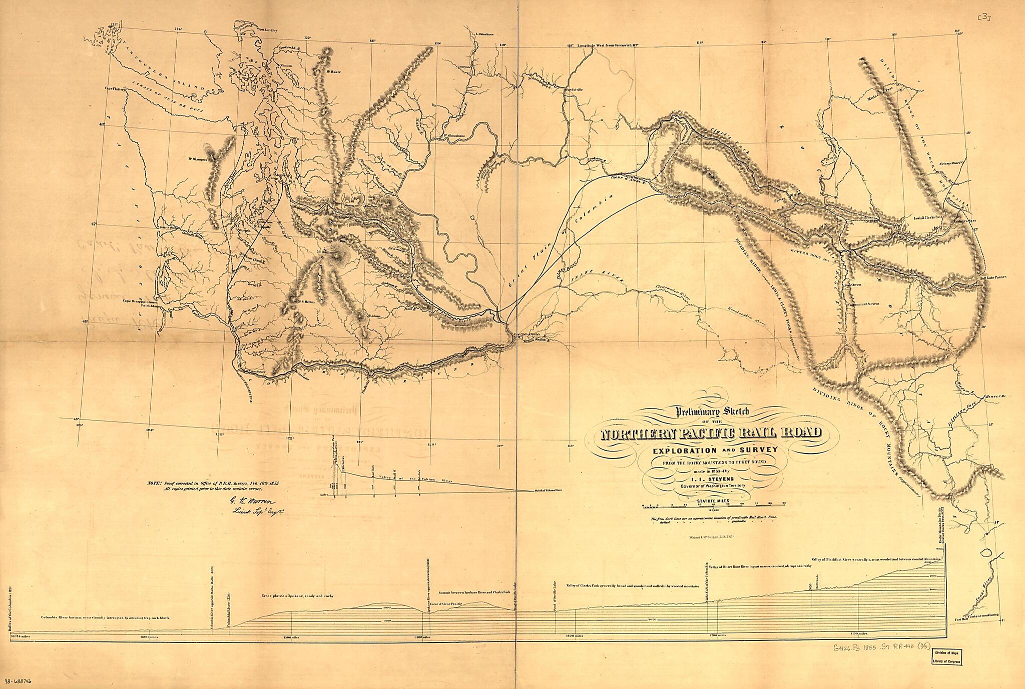
Preliminary Sketch of the Northern Pacific Rail Road Exploration and Survey, by I. I. Stevens, Governor of Washington Territory 1855
- Regular price
-
$99.95 - Regular price
-
$94.95 - Sale price
-
$99.95
Shipping calculated at checkout.
Buy one map, get any other map in our collection for 50% OFF! Add to cart to see discount.
Couldn't load pickup availability
About This Map
Old map of Northwestern States, United States.
Each sheet includes profile of ground covered.
Created by Northern Pacific Railroad Company, Isaac Ingalls Stevens in 1855.
Each sheet includes profile of ground covered.
Created by Northern Pacific Railroad Company, Isaac Ingalls Stevens in 1855.
- Scale not given.
- "Proof corrected in Office of P.R.R. Surveys, Feb 10th 1855. All copies printed prior to this date contain errors. G. K. Warren. Lieut. Topl. Engrs."
- Description derived from published bibliography.
- Sheet [1] From St Paul to Riviere des Lacs.--Sheet [2] From Riviere des Lacs to the Rocky Mountains.--Sheet [3] From the Rocky Mountains to Puget Sound.
Map Subjects
Northern Pacific Railroad Company
Northwestern States
Railroads
United States
Isaac Ingalls Stevens
1855
Map Sizing Information
- For the best legibility, order your map in the original size or larger. Most maps have intricate detail and small text that is best appreciated when the print size hasn't been reduced.
- Sizes labeled "Fits a Standard Frame" will drop right into any frame that you purchase in that size. The sizes that we offer are commonly available online and at most retail stores.
- Our standard sizes are recommendations based on the aspect ratio of the original map, but still may require some added "white space" in one dimension to fit.
- Non-standard sizes will require custom framing, and we suggest taking your print to the frame shop of your choice after you receive it for the best results.
- Custom sizes are available, simply contact us for a quote.
Below is an approximation of the scale of a few standard sizes, and how they might appear in your space.
