
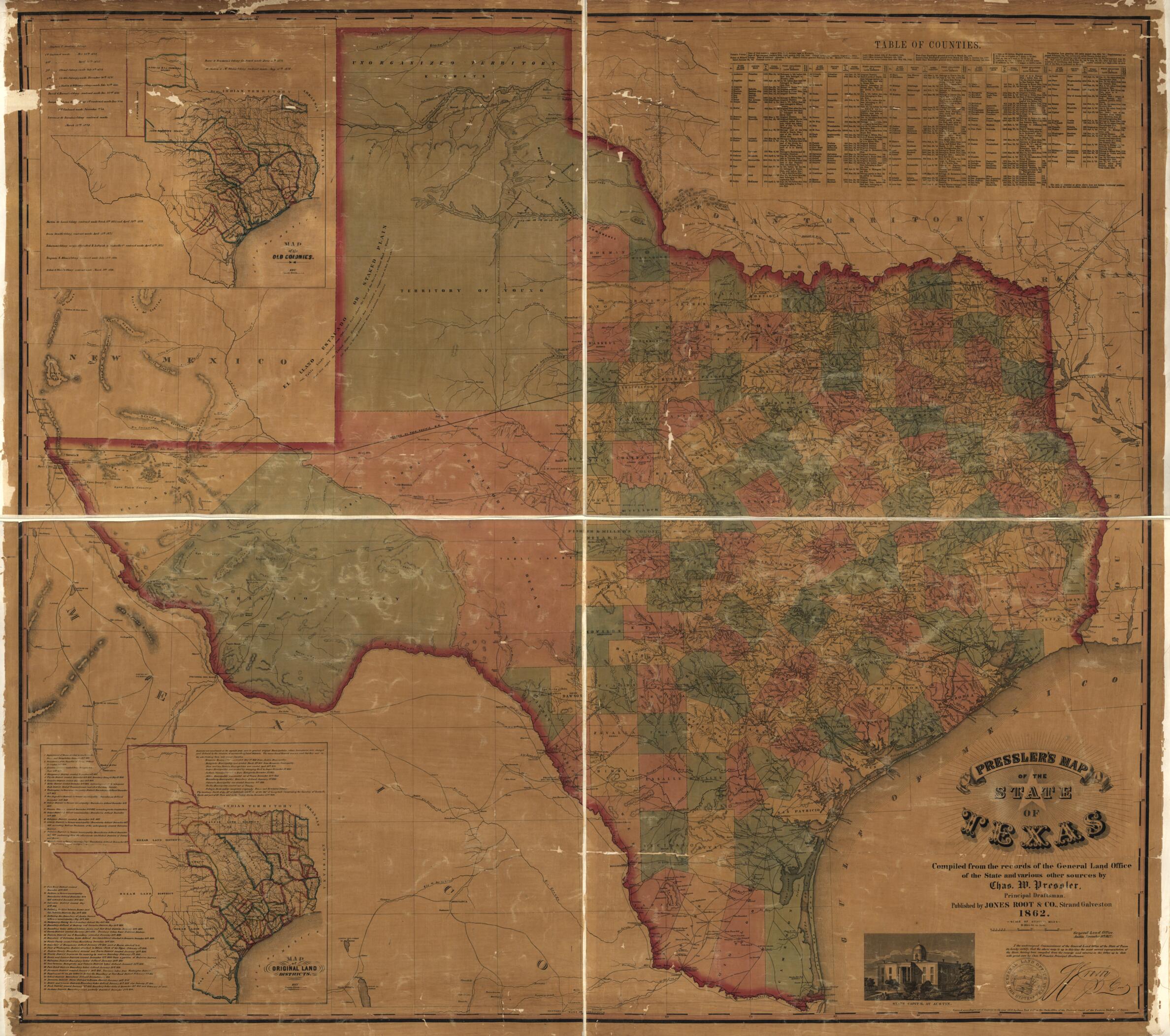
Pressler's Map of the State of Texas in 1857
- Regular price
-
$218.95 - Regular price
-
$213.95 - Sale price
-
$218.95
Shipping calculated at checkout.
Buy one map, get any other map in our collection for 50% OFF! Add to cart to see discount.
Couldn't load pickup availability
About This Map
Old map of Texas, United States.
Created by Root & Co Jones, Chas. W. Pressler in 1857.
Created by Root & Co Jones, Chas. W. Pressler in 1857.
- "General Land Office, Austin, November 18th 1857."
- Relief shown by hachures.
- Shows longitude West from Greenwich and Washington.
- "Entered according to an act of Congress, in the year 1858, by Jones, Root & Co. in the Clerks Office of the District Court of the Eastern District Office of Texas."
- Includes table of contents, notes, and ill.
- Insets: Map of the old colony -- Map of original land districts.
- Mounted on linen.
- Copy This map has some imperfections: torn in margins with holes and water stains throughout. We'll do our best to restore the image before printing.
Map Sizing Information
- For the best legibility, order your map in the original size or larger. Most maps have intricate detail and small text that is best appreciated when the print size hasn't been reduced.
- Sizes labeled "Fits a Standard Frame" will drop right into any frame that you purchase in that size. The sizes that we offer are commonly available online and at most retail stores.
- Our standard sizes are recommendations based on the aspect ratio of the original map, but still may require some added "white space" in one dimension to fit.
- Non-standard sizes will require custom framing, and we suggest taking your print to the frame shop of your choice after you receive it for the best results.
- Custom sizes are available, simply contact us for a quote.
Below is an approximation of the scale of a few standard sizes, and how they might appear in your space.

