
Taking Possession of Louisiana and the Mississippi River, In the Name of Louis XIVth, by Cavelier De La Salle From Rouen On April 9, 1682. (Prise De Possession De La Louisiane Et Du Fleuve Mississipi, Au Nom De Louis XIV, Par Cavelier De La Salle de R...
- Regular price
-
$49.95 - Regular price
-
$34.95 - Sale price
-
$49.95
Buy one map, get any other map in our collection for 50% OFF! Add to cart to see discount.
Couldn't load pickup availability
About This Map
Discover the timeless beauty of our fine art quality printed reproduction of this antique map. Perfect for history enthusiasts, collectors, and interior decorators.
Restored with meticulous attention to detail by our team with over a decade of experience, this stunning reproduction captures the intricate artistry and historical significance of the original map.
Whether you're a collector or seeking a unique decor piece, this archival-quality map reproduction is a timeless addition to any space. Order now to bring history to life!
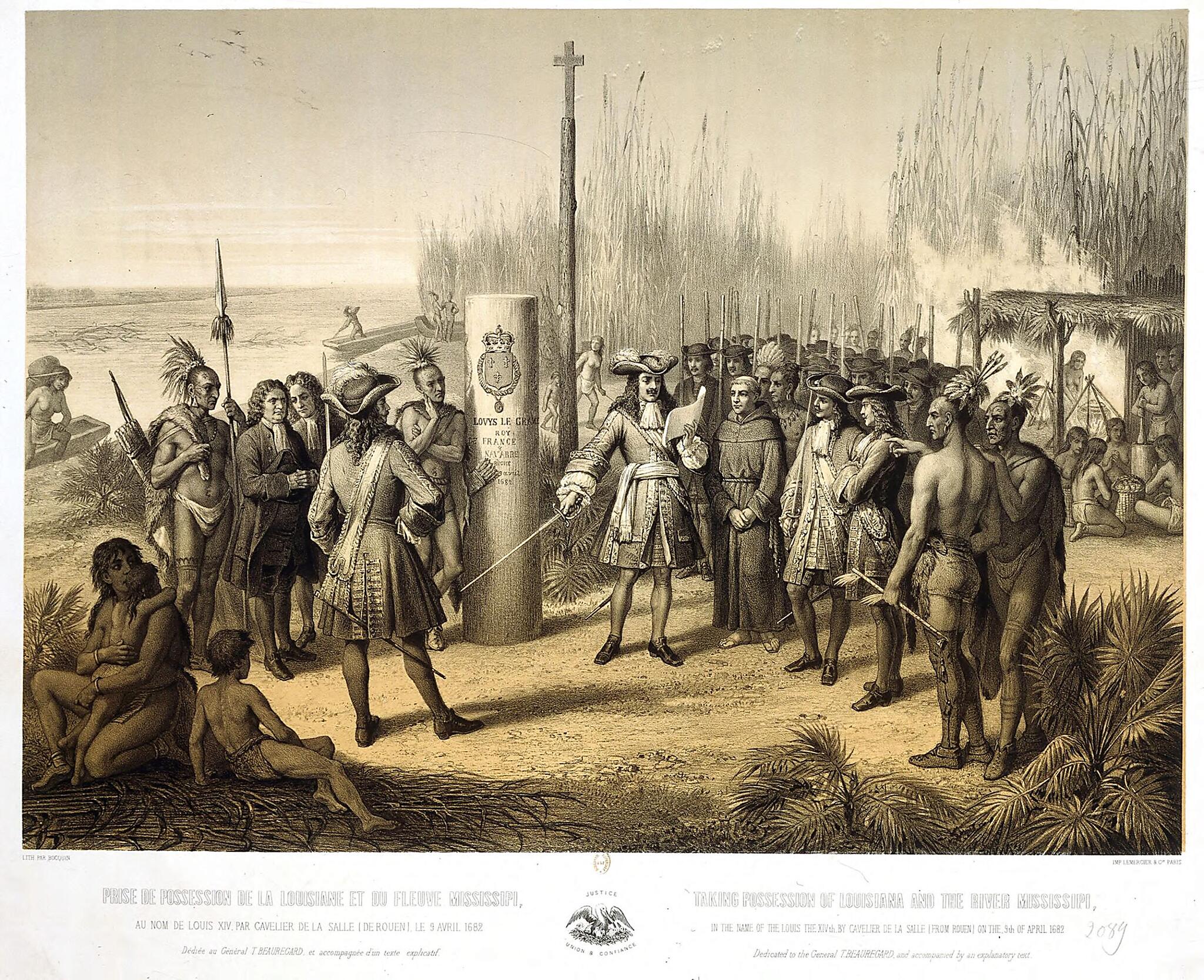
Old map of Louisiana, Mississippi, United States of America.Adolphe Bocquin illustrates the claiming of Louisiana for France by René Robert Cavelier de La Salle, an event that helped to make La Salle one of the heroes of France's first colonial empire. La Salle was born in Rouen in 1643. Educated at a Jesuit college, he originally intended to enter the priesthood, but in 1666 he left France for Canada, seeking to make his fortune. He obtained a grant of land and worked for a time as a farmer and landlord. With the support of Governor Frontenac, he made a name for himself in the fur trade, founding Fort Niagara in 1676. Between 1679 and 1682, assisted by Henri de Tonti, a Neapolitan adventurer, he traversed the entire Great Lakes region. In early 1682 La Salle and Tonti began their descent of the Mississippi. They reached the Gulf of Mexico on April 9, where La Salle claimed the whole of the Mississippi Basin for France and named the territory in honor of King Louis XIV. The fictionalized illustration shows La Salle, sword in hand, reading a proclamation while a group of people that includes French soldiers, a few civilian notables, a priest, and Indian warriors and chiefs looks on. The river and an Indian dwelling are seen in the background.
Created by Active 19th Century Adolphe in 1870.
- Title devised, in English, by Library staff.
- Original resource extent: 1 lithograph ; 59.3 x 75.5 centimeters.
- Original resource at: National Library of France.
- Content in French.
- Description based on data extracted from World Digital Library, which may be extracted from partner institutions.
Map Subjects
04-02
Colonies
Colonization
France
France In America
Indians Of North America
Indigenous Peoples
Jesuits
La Salle Robert Cavelier Sieur De
Louisiana
Missionaries
Mississippi
Mississippi River
New France
Soliders
United States Of America
Active 19th Century Adolphe
1870
- For the best legibility, order your map in the original size or larger. Most maps have intricate detail and small text that is best appreciated when the print size hasn't been reduced.
- Sizes labeled "Fits a Standard Frame" will drop right into any frame that you purchase in that size. The sizes that we offer are commonly available online and at most retail stores.
- Our standard sizes are recommendations based on the aspect ratio of the original map, but still may require some added "white space" in one dimension to fit.
- Non-standard sizes will require custom framing, and we suggest taking your print to the frame shop of your choice after you receive it for the best results.
- Custom sizes are available, simply contact us for a quote.
Below is an approximation of the scale of a few standard sizes, and how they might appear in your space.

