
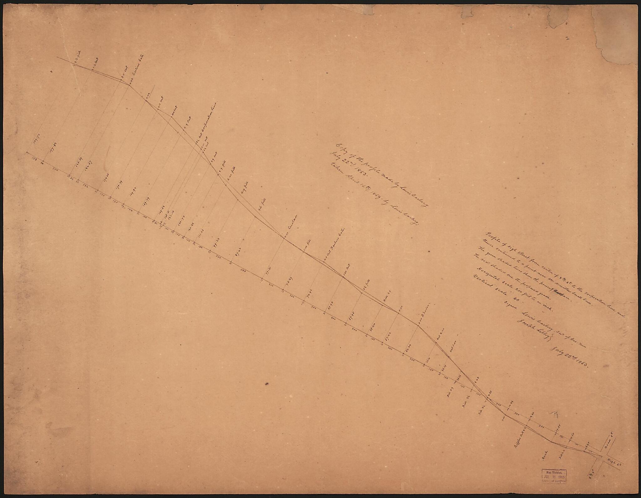
Profile of High Street from Centre of 8th St. to the Corporation Line and Thence Continued to a Point Near Wm. Homitters Small House 1853
- Regular price
-
$55.95 - Regular price
-
$50.95 - Sale price
-
$55.95
Shipping calculated at checkout.
Buy one map, get any other map in our collection for 50% OFF! Add to cart to see discount.
Couldn't load pickup availability
About This Map
Old map of District of Columbia, United States, Washington, Washington D.C., Wisconsin Avenue.
Created by Lewis Carbery, Joseph Libbey in 1853.
Created by Lewis Carbery, Joseph Libbey in 1853.
- Covers Wisconsin Avenue north of R Street N.W., Georgetown, Washington D.C.
- "Copy of the profile made by Lewis Carbery, July 22nd 1853."
- "Signed Lewis Carbery, su'r of Geo. Town, Joseph Libbey, July 22nd 1853."
- Pen-and-ink.
- Soiled, missing edge sections, faced with gauze, and mounted on cloth backing.
- Includes notes.
- Phillips. Washington 503
Map Subjects
Charts Diagrams Etc
District Of Columbia
Manuscript Maps
Maps Manuscript
Streets
United States
Washington
Washington (D.C.)
Wisconsin Avenue
Wisconsin Avenue (Washington D.C.)
Washington D.C.
Lewis Carbery
Joseph Libbey
1853
Map Sizing Information
- For the best legibility, order your map in the original size or larger. Most maps have intricate detail and small text that is best appreciated when the print size hasn't been reduced.
- Sizes labeled "Fits a Standard Frame" will drop right into any frame that you purchase in that size. The sizes that we offer are commonly available online and at most retail stores.
- Our standard sizes are recommendations based on the aspect ratio of the original map, but still may require some added "white space" in one dimension to fit.
- Non-standard sizes will require custom framing, and we suggest taking your print to the frame shop of your choice after you receive it for the best results.
- Custom sizes are available, simply contact us for a quote.
Below is an approximation of the scale of a few standard sizes, and how they might appear in your space.

