
Property Survey of Tracts and Land Grants In Part of Maryland Near Tiber Creek, Now Central Washington D.C. 1760
- Regular price
-
$57.95 - Regular price
-
$40.95 - Sale price
-
$57.95
Shipping calculated at checkout.
Buy one map, get any other map in our collection for 50% OFF! Add to cart to see discount.
Couldn't load pickup availability
About This Map
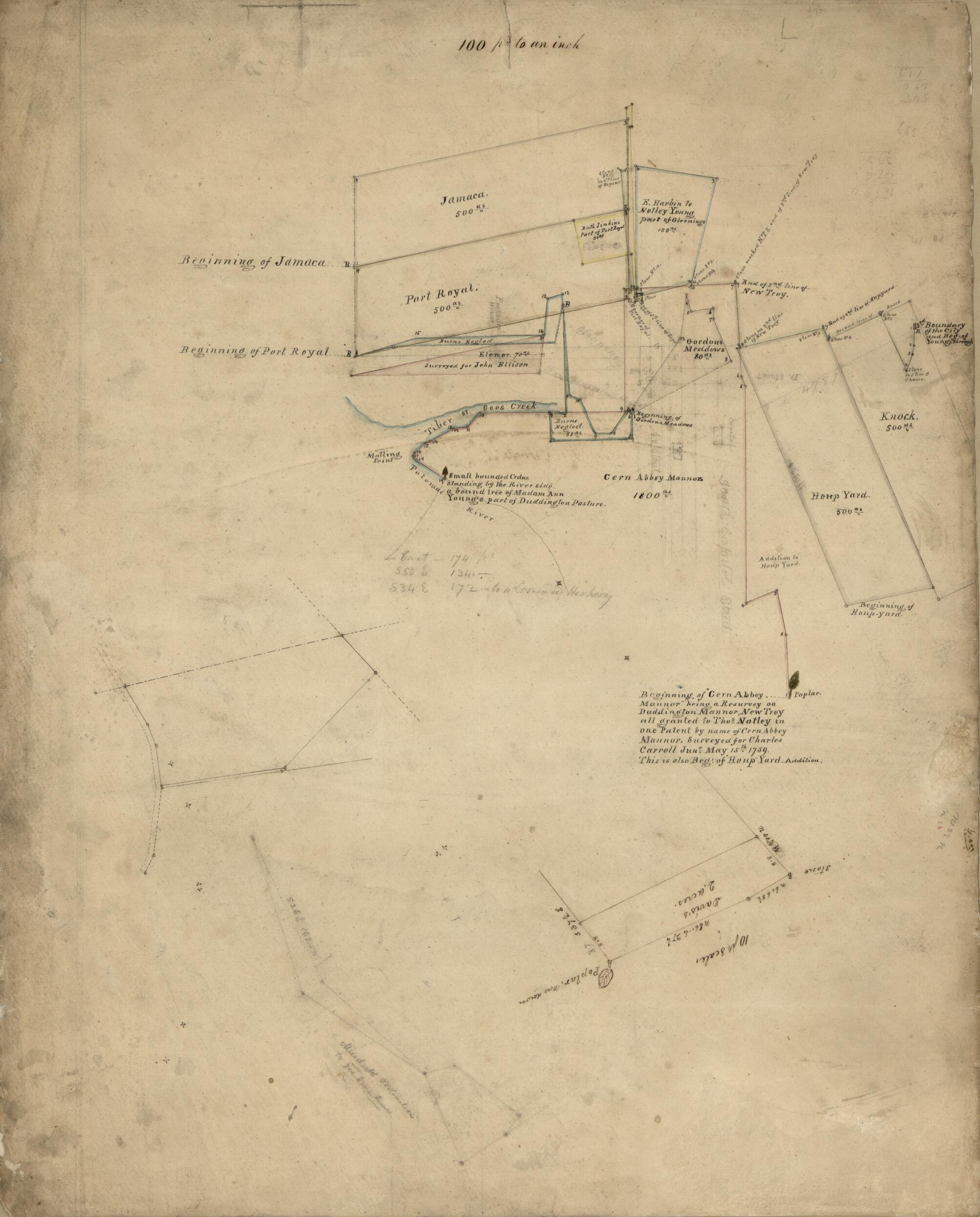
Old map of District of Columbia, United States, Washington, Washington D.C..
- Cadastral map covering tracts named Jamaca, Port Royal, Burns Neglect, Elenor, Gleenings, Gordons Meddows, Knock, Houp Yard, and Cern Abbey Mannor.
- "Beginning of 'Cern Abbey Mannor' being a resurvey on Duddington Mannor, New Troy, all granted to Tho's Notley in one patent by name of Cern Abbey Mannor, surveyed for Charles Carroll Jun'r May 15th 1759."
- Pen-and-ink, pencil, and watercolor.
- Includes 3 insets.
- On cloth backing in ink: Map & plat of Cern Abby Mannor, Houp Yard, &c., Carrol of Duddington, no. [116?] page 4 index WR.
Map Sizing Information
- For the best legibility, order your map in the original size or larger. Most maps have intricate detail and small text that is best appreciated when the print size hasn't been reduced.
- Sizes labeled "Fits a Standard Frame" will drop right into any frame that you purchase in that size. The sizes that we offer are commonly available online and at most retail stores.
- Our standard sizes are recommendations based on the aspect ratio of the original map, but still may require some added "white space" in one dimension to fit.
- Non-standard sizes will require custom framing, and we suggest taking your print to the frame shop of your choice after you receive it for the best results.
- Custom sizes are available, simply contact us for a quote.
Below is an approximation of the scale of a few standard sizes, and how they might appear in your space.

