
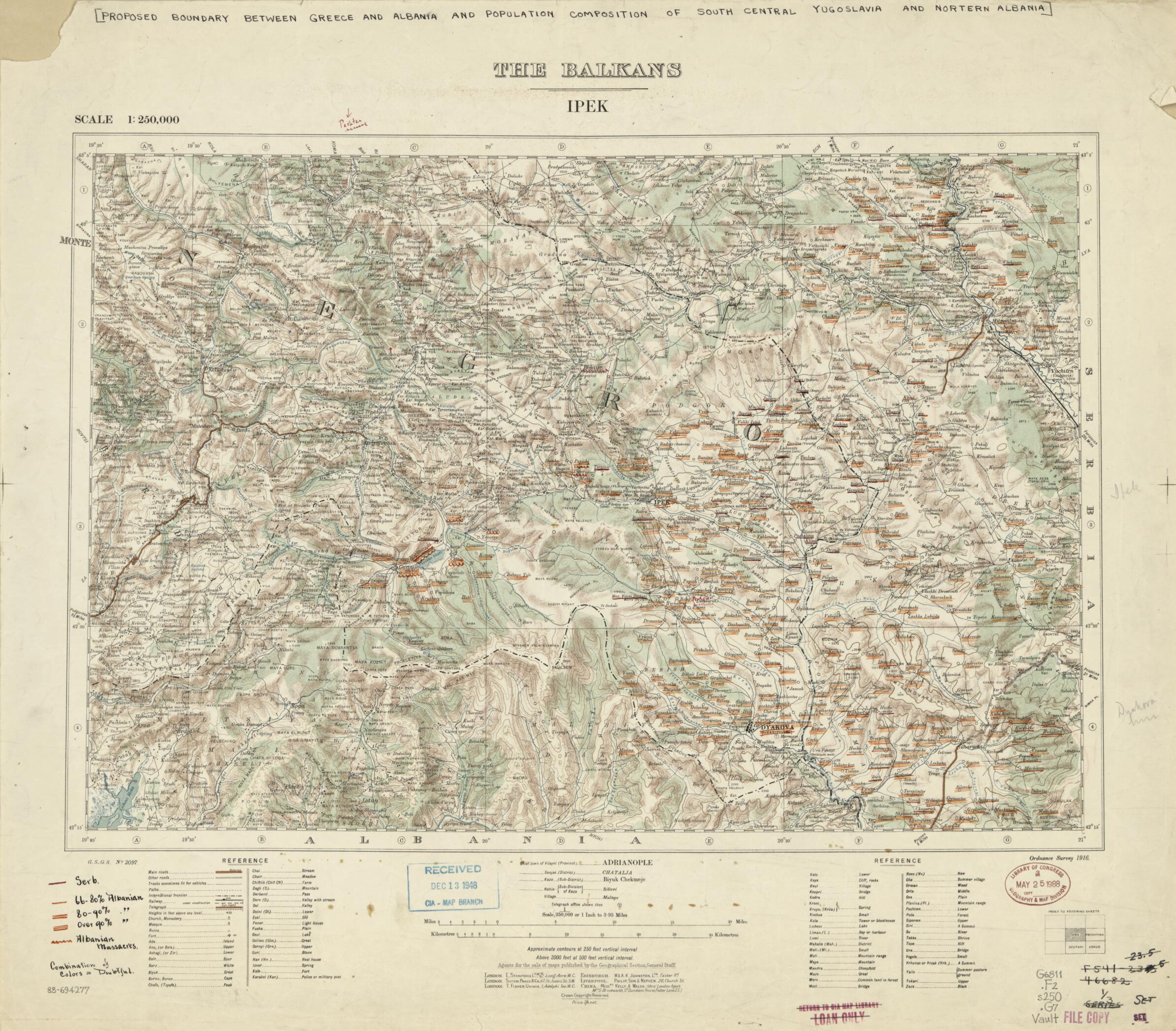
Proposed Boundary Between Greece and Albania and Population Composition of South Central Yugoslavia and Northern Albania 1915
- Regular price
-
$66.95 - Regular price
-
$61.95 - Sale price
-
$66.95
Shipping calculated at checkout.
Buy one map, get any other map in our collection for 50% OFF! Add to cart to see discount.
Couldn't load pickup availability
About This Map
Old map of Albania, Greece, Yugoslavia.
Created by Great Britain. Ordnance Survey, Great Britain. War Office. General Staff. Geographical Section in 1915.
Created by Great Britain. Ordnance Survey, Great Britain. War Office. General Staff. Geographical Section in 1915.
- Relief shown by contours, shading, and spot heights. Depths shown by contours on some maps.
- Title hand-lettered in black ink in upper margin.
- Base map title printed in upper margin: The Balkans : scale 1:250,000.
- Annotated in col. inks and pencil to show proposed boundaries, Serbian settlements, Albanian settlements, and Albanian massacres.
- Includes notes, glossary, and "Index to adjoining sheets."
- Variously torn, fold-lined, missing edge sections, taped on verso, and rubber-stamped.
Map Sizing Information
- For the best legibility, order your map in the original size or larger. Most maps have intricate detail and small text that is best appreciated when the print size hasn't been reduced.
- Sizes labeled "Fits a Standard Frame" will drop right into any frame that you purchase in that size. The sizes that we offer are commonly available online and at most retail stores.
- Our standard sizes are recommendations based on the aspect ratio of the original map, but still may require some added "white space" in one dimension to fit.
- Non-standard sizes will require custom framing, and we suggest taking your print to the frame shop of your choice after you receive it for the best results.
- Custom sizes are available, simply contact us for a quote.
Below is an approximation of the scale of a few standard sizes, and how they might appear in your space.

