
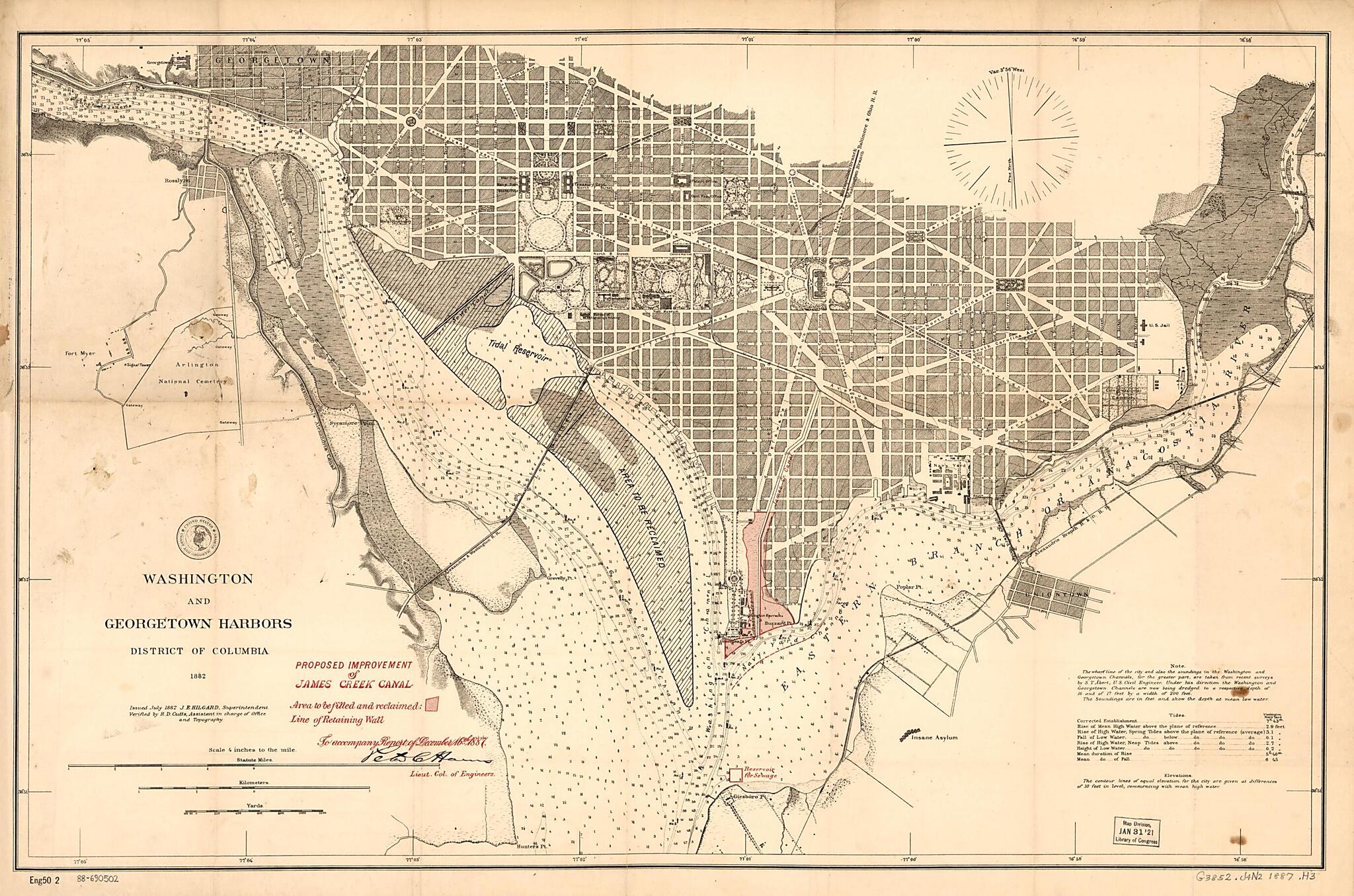
Proposed Improvement of James Creek Canal 1887
- Regular price
-
$65.95 - Regular price
-
$60.95 - Sale price
-
$65.95
Shipping calculated at checkout.
Buy one map, get any other map in our collection for 50% OFF! Add to cart to see discount.
Couldn't load pickup availability
About This Map
Old map of District of Columbia, James Creek Canal, United States, Washington, Washington D.C..
Created by Peter C. (Peter Conover) Hains, J. E. (Julius Erasmus) Hilgard, U.S. Coast and Geodetic Survey in 1887.
Created by Peter C. (Peter Conover) Hains, J. E. (Julius Erasmus) Hilgard, U.S. Coast and Geodetic Survey in 1887.
- Relief shown by contours and hachures. Depths shown by soundings and contours.
- Base map title: Washington and Georgetown harbors, District of Columbia : 1882 / issued July 1882 J.E. Hilgard, superintendent.
- Title and James Creek Canal information shown in red overprint. Author's name handwritten in ink.
- Includes notes, tide table, and USC&GS insigne.
- "Eng50 2."
Map Subjects
District Of Columbia
Harbors
James Creek Canal
James Creek Canal (Washington D.C.)
Reclamation Of Land
United States
Washington
Washington (D.C.)
Waterfronts
Washington D.C.
Peter C. (Peter Conover) Hains
J. E. (Julius Erasmus) Hilgard
U.S. Coast And Geodetic Survey
1887
Map Sizing Information
- For the best legibility, order your map in the original size or larger. Most maps have intricate detail and small text that is best appreciated when the print size hasn't been reduced.
- Sizes labeled "Fits a Standard Frame" will drop right into any frame that you purchase in that size. The sizes that we offer are commonly available online and at most retail stores.
- Our standard sizes are recommendations based on the aspect ratio of the original map, but still may require some added "white space" in one dimension to fit.
- Non-standard sizes will require custom framing, and we suggest taking your print to the frame shop of your choice after you receive it for the best results.
- Custom sizes are available, simply contact us for a quote.
Below is an approximation of the scale of a few standard sizes, and how they might appear in your space.
