
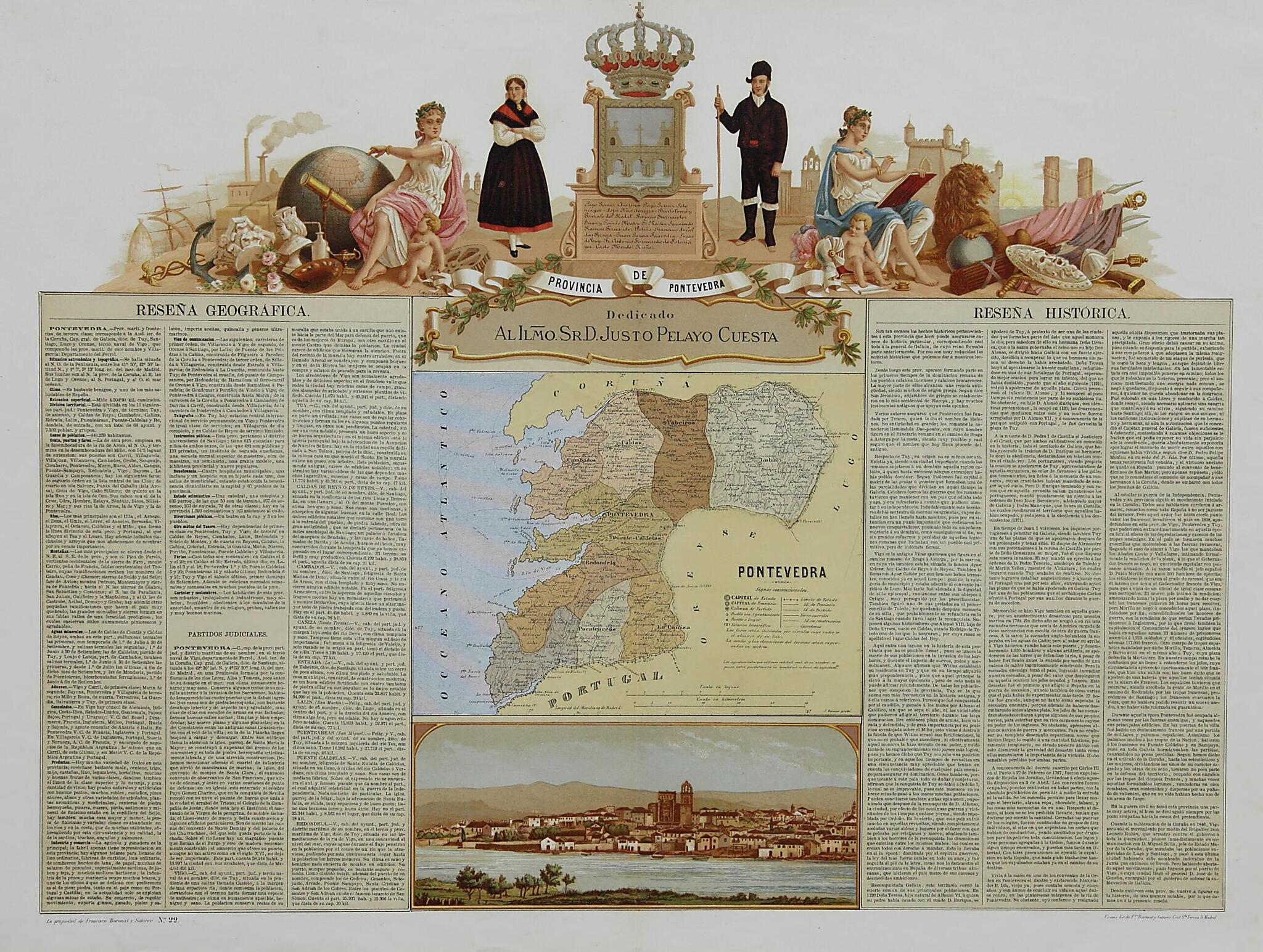
Province of Pontevedra. (Provincia De Pontevedra) 1870
- Regular price
-
$49.95 - Regular price
-
$34.95 - Sale price
-
$49.95
Shipping calculated at checkout.
Buy one map, get any other map in our collection for 50% OFF! Add to cart to see discount.
Couldn't load pickup availability
About This Map
Old map of Galicia, Spain.
and-white negatives, which enabled mass production of images in color before the days of color photography.
Created by Francisco Boronat Y Satorre, José Reinoso in 1870.
and-white negatives, which enabled mass production of images in color before the days of color photography.
Created by Francisco Boronat Y Satorre, José Reinoso in 1870.
- Title devised, in English, by Library staff.
- "Scale approximately 1:556,000|Part of "España Geográfica Histórica Ilustrada" and "Atlas Geográfico Histórico de las provincias de España""--Note extracted from World Digital Library.
- Original resource extent: 1 map : lithograph, color ; 51 x 67 centimeters.
- Original resource at: Library of Galicia.
- Content in Spanish.
- Description based on data extracted from World Digital Library, which may be extracted from partner institutions.
Map Subjects
1870 To 1890
Cityscapes
Clothing And Dress
Galicia
Geography
Spain
Francisco Boronat Y Satorre
José Reinoso
1870
Map Sizing Information
- For the best legibility, order your map in the original size or larger. Most maps have intricate detail and small text that is best appreciated when the print size hasn't been reduced.
- Sizes labeled "Fits a Standard Frame" will drop right into any frame that you purchase in that size. The sizes that we offer are commonly available online and at most retail stores.
- Our standard sizes are recommendations based on the aspect ratio of the original map, but still may require some added "white space" in one dimension to fit.
- Non-standard sizes will require custom framing, and we suggest taking your print to the frame shop of your choice after you receive it for the best results.
- Custom sizes are available, simply contact us for a quote.
Below is an approximation of the scale of a few standard sizes, and how they might appear in your space.

