
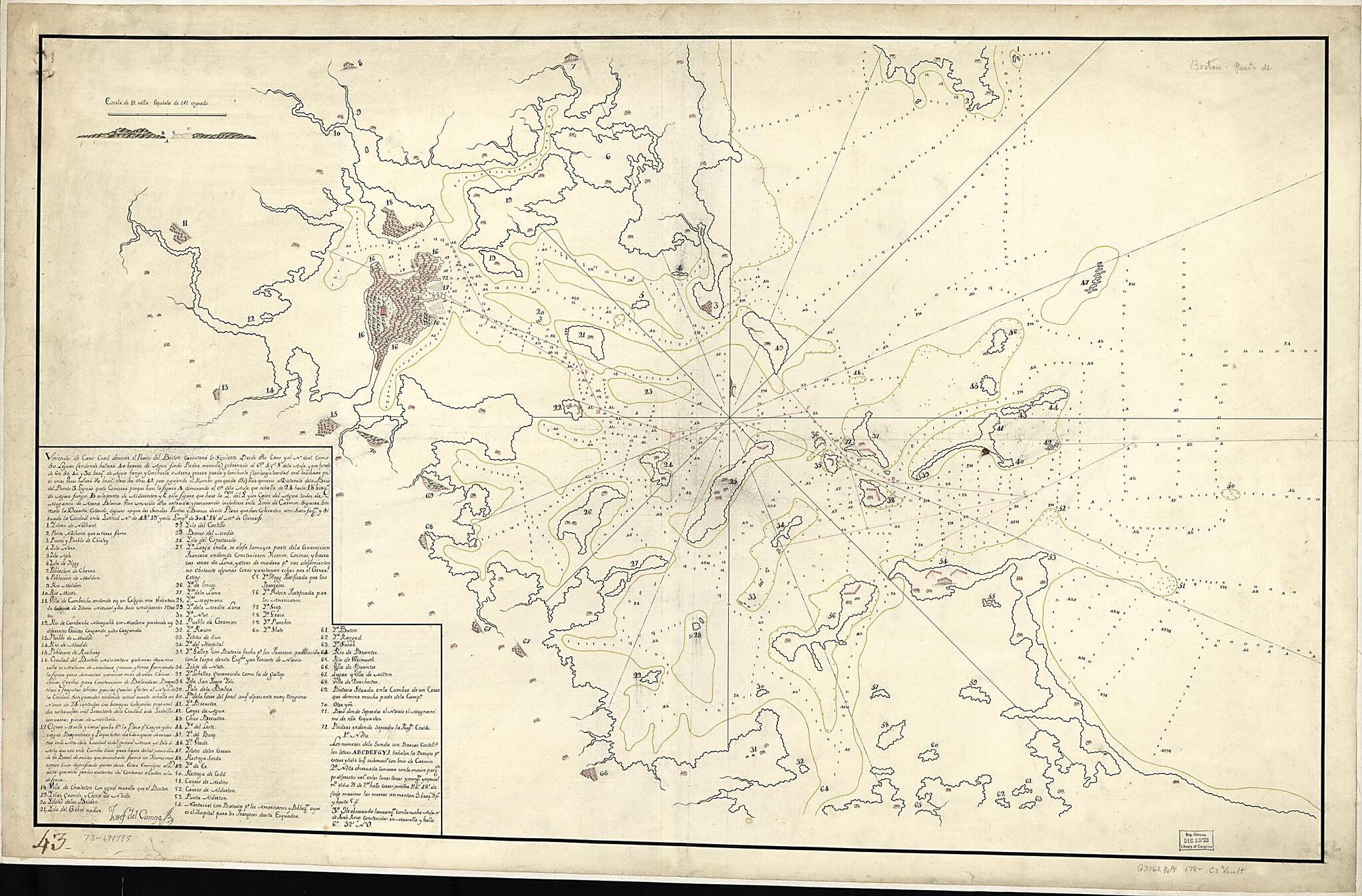
Puerto Del Boston 1780
- Regular price
-
$108.95 - Regular price
-
$103.95 - Sale price
-
$108.95
Shipping calculated at checkout.
Buy one map, get any other map in our collection for 50% OFF! Add to cart to see discount.
Couldn't load pickup availability
About This Map
Old map of Boston Bay, Boston Harbor, Massachusetts, United States.
Created by Josef Del Campo in 1780.
Created by Josef Del Campo in 1780.
- Scale ca. 1:34,000.
- Title on attached label on verso: The city and harbour of Boston.
- Manuscript, pen-and-ink and watercolor.
- Relief shown pictorially. Soundings shown in fathoms.
- Shows settlements and fortifications.
- No. "43" in lower left margin.
- Includes index, sailing directions, and view of entrance to the bay.
Map Subjects
Boston Bay
Boston Bay (Mass.)
Boston Harbor
Boston Harbor (Mass.)
Early Works To 1800
Maps Manuscript
Massachusetts
Nautical Charts
United States
Josef Del Campo
1780
Map Sizing Information
- For the best legibility, order your map in the original size or larger. Most maps have intricate detail and small text that is best appreciated when the print size hasn't been reduced.
- Sizes labeled "Fits a Standard Frame" will drop right into any frame that you purchase in that size. The sizes that we offer are commonly available online and at most retail stores.
- Our standard sizes are recommendations based on the aspect ratio of the original map, but still may require some added "white space" in one dimension to fit.
- Non-standard sizes will require custom framing, and we suggest taking your print to the frame shop of your choice after you receive it for the best results.
- Custom sizes are available, simply contact us for a quote.
Below is an approximation of the scale of a few standard sizes, and how they might appear in your space.
