
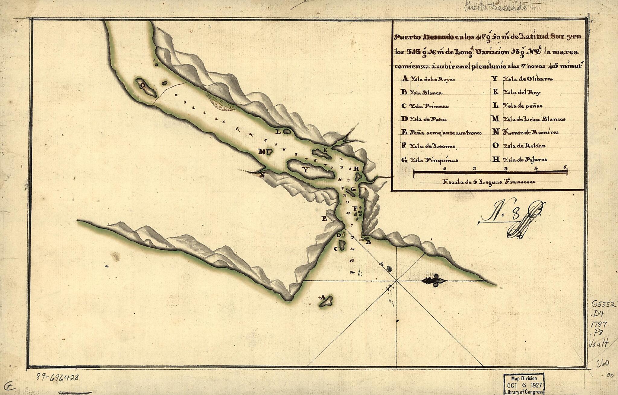
Puerto Deseado En Los 47 Gs. 50 Ms. De Latitud Sur Y En Los 313 Gs. 16 Ms. De Longd., Variación 18 Gs. NE La Marea Comienza à Subiren El Plenilunio Alas 7 Horas 45 Minuts 1787
- Regular price
-
$49.95 - Regular price
-
$29.95 - Sale price
-
$49.95
Shipping calculated at checkout.
Buy one map, get any other map in our collection for 50% OFF! Add to cart to see discount.
Couldn't load pickup availability
About This Map
Old map of Argentina, Deseado River.
- Shows Deseado River at the mouth.
- Dated by comparison with similar map attributed to Miguel García Diez.
- Relief shown pictorially. Depths shown by soundings.
- Oriented with north to the right.
- Watermark: Fleur-de-lis.
- Black and brown inks and watercolor.
- Mounted on cloth backing.
- Maggs number annotated in pencil in lower right corner: 260.
- Annotated in black ink: No. 8 [indecipherable].
- Indexed to islands and river.
Map Subjects
Argentina
Deseado River
Deseado River (Argentina)
Early Works To 1800
Maps Manuscript
1787
Map Sizing Information
- For the best legibility, order your map in the original size or larger. Most maps have intricate detail and small text that is best appreciated when the print size hasn't been reduced.
- Sizes labeled "Fits a Standard Frame" will drop right into any frame that you purchase in that size. The sizes that we offer are commonly available online and at most retail stores.
- Our standard sizes are recommendations based on the aspect ratio of the original map, but still may require some added "white space" in one dimension to fit.
- Non-standard sizes will require custom framing, and we suggest taking your print to the frame shop of your choice after you receive it for the best results.
- Custom sizes are available, simply contact us for a quote.
Below is an approximation of the scale of a few standard sizes, and how they might appear in your space.
