
Quartier: Du Port Paix Et Des Triois Riveres, 1767
- Regular price
-
$60.95 - Regular price
-
$55.95 - Sale price
-
$60.95
Shipping calculated at checkout.
Buy one map, get any other map in our collection for 50% OFF! Add to cart to see discount.
Couldn't load pickup availability
About This Map
Old early map / manuscript map / cadastral map of Haiti.
Created by Antoine Jean Jacques Duportal, Antoine Franðcois Sorrel, Antoine Felix Wuibert in 1767.
Created by Antoine Jean Jacques Duportal, Antoine Franðcois Sorrel, Antoine Felix Wuibert in 1767.
- Relief shown by hachures.
- Covers north central coast of Saint Domingue (modern day Haiti) from west of Port-de-Paix and the Trois Rivieres to east of Cap-haitien (not included) showing delineation of property lines with names of landowners.
- Oriented with north to the bottom.
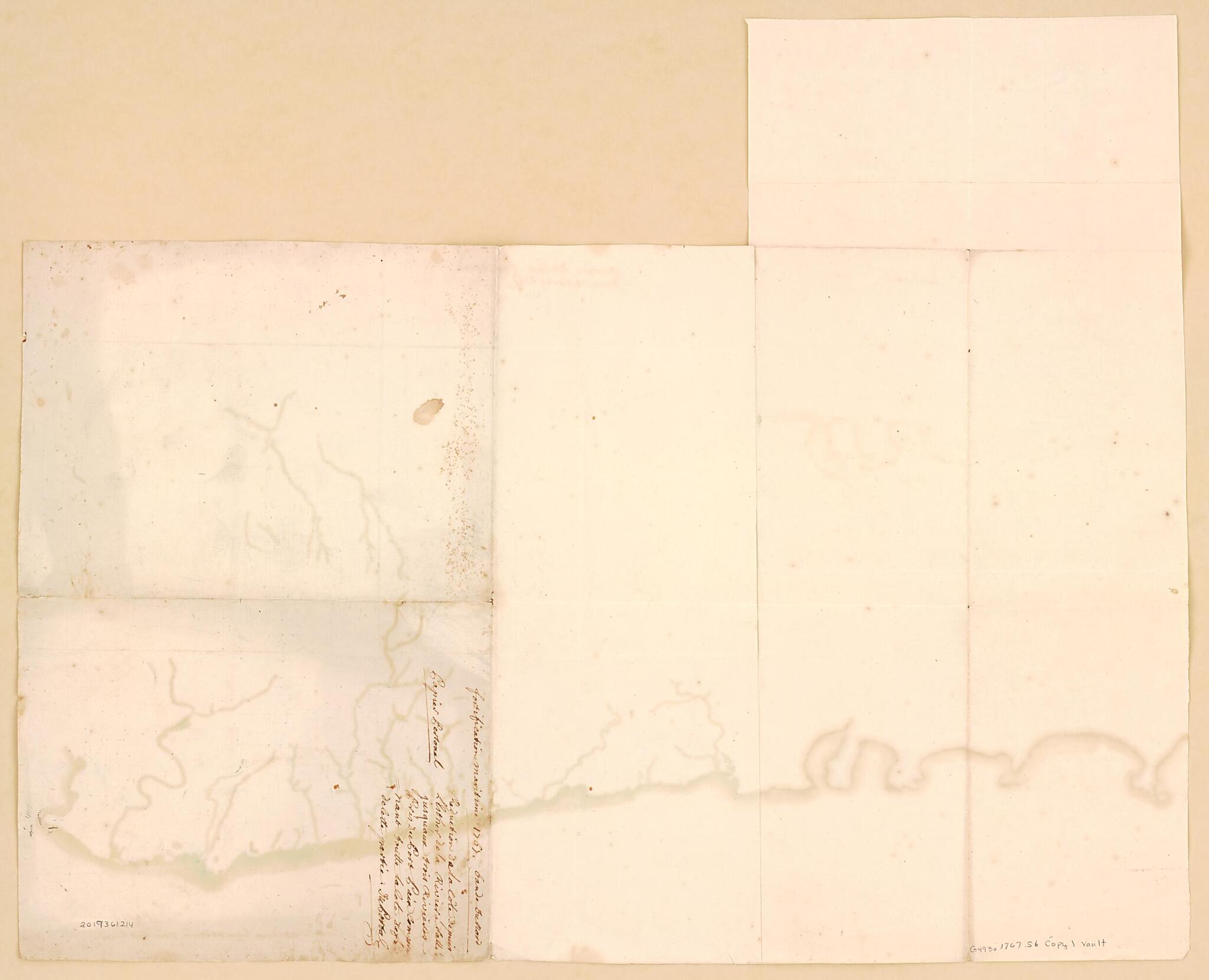
- Pen-and-ink (red and black) and watercolor wash outline on 3 sheets of laid paper pasted together with two watermarks. Sheet cut into the shape of an irregular rectangle
- Title from handwritten (ink) in upper margin.
- Signed at bottom in lower right margin: Du Portal.
- Brown ink inscription on verso: Fortification maritime 1767. Gande DuPort. Copier personal. Reduction ... (rest of handwritten inscription illegible).
- Watermarks: a fleur-de-lis [and] J HONIG & zone.
- This map has some imperfections: light staining, foxed, vertically fold-lined at center, cracked, and annotated in brown ink. We'll do our best to restore the image before printing.
Map Subjects
18th Century
Cadastral Maps
Early Maps
Early Works To 1800
Haiti
Historical Geography
History
Landowners
Manuscript Maps
Real Property
Early Maps
Manuscript Maps
Cadastral Maps
Antoine Jean Jacques Duportal
Antoine Franðcois Sorrel
Antoine Felix Wuibert
1767
Map Sizing Information
- For the best legibility, order your map in the original size or larger. Most maps have intricate detail and small text that is best appreciated when the print size hasn't been reduced.
- Sizes labeled "Fits a Standard Frame" will drop right into any frame that you purchase in that size. The sizes that we offer are commonly available online and at most retail stores.
- Our standard sizes are recommendations based on the aspect ratio of the original map, but still may require some added "white space" in one dimension to fit.
- Non-standard sizes will require custom framing, and we suggest taking your print to the frame shop of your choice after you receive it for the best results.
- Custom sizes are available, simply contact us for a quote.
Below is an approximation of the scale of a few standard sizes, and how they might appear in your space.

