


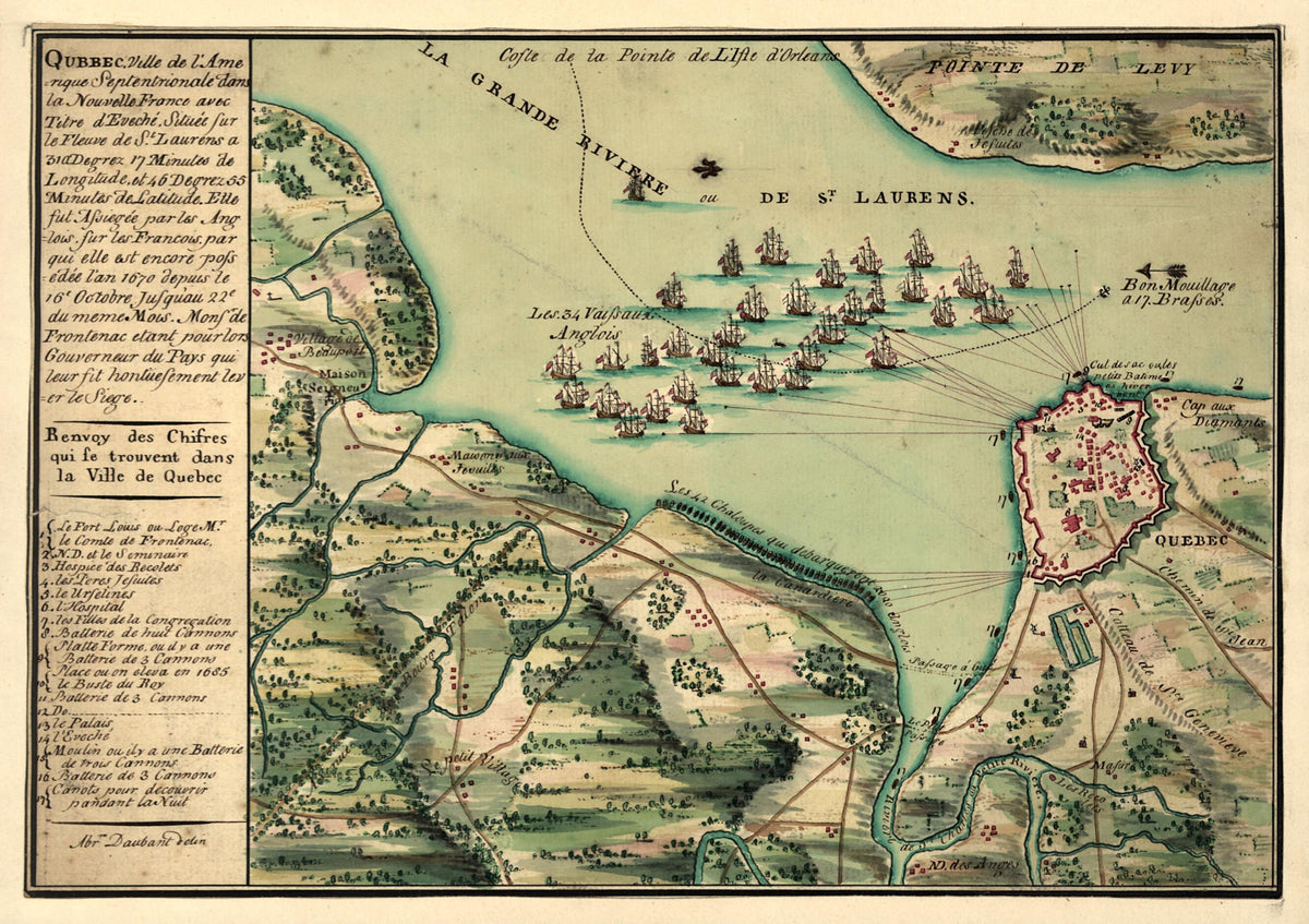
Qubbec, Ville De L'Amerique Septentrionale Dans La Nouvelle France Avec Titre D'Eveché Située Sur Le Fleuve De St. Laurens a 310 Degrez 17 Minutes De Longitude Et 46 Degrez 55 Minutes De Latitude : Elle Fut Assiegée Par Les Anglois Sur Les Francois...
- Regular price
-
$54.95 - Regular price
-
$38.95 - Sale price
-
$54.95
Shipping calculated at checkout.
Couldn't load pickup availability
Archival Quality Reproduction
We print on archival quality paper similar to heavy cardstock (used in greeting cards or invitations). The refined matte finish creates a premium look and feel that elevates presentation quality. Our paper delivers results suitable for display in your home, office or gallery.
Meticulously Restored
All maps undergo a careful digital restoration before printing. We strive for the highest quality presentation while maintaining the original integrity of the map.
About This Map
Old map of Canada, Québec.
Created by Abraham D Aubant in 1755.
Created by Abraham D Aubant in 1755.
- Shows siege of Quebec City in 1670.
- Oriented with north to the left.
- Pen-and-ink and watercolor.
- Includes index and col. ill.
Map Sizing Information
- For the best legibility, order your map in the original size or larger. Most maps have intricate detail and small text that is best appreciated when the print size hasn't been reduced.
- Sizes labeled "Fits a Standard Frame" will drop right into any frame that you purchase in that size. The sizes that we offer are commonly available online and at most retail stores.
- Our standard sizes are recommendations based on the aspect ratio of the original map, but still may require some added "white space" in one dimension to fit.
- Non-standard sizes will require custom framing, and we suggest taking your print to the frame shop of your choice after you receive it for the best results.
- Custom sizes are available, simply contact us for a quote.
Below is an approximation of the scale of a few standard sizes, and how they might appear in your space.
