
Railroad Map of British Honduras 1920
- Regular price
-
$126.95 - Regular price
-
$121.95 - Sale price
-
$126.95
Shipping calculated at checkout.
Buy one map, get any other map in our collection for 50% OFF! Add to cart to see discount.
Couldn't load pickup availability
About This Map
Old map of Belize.
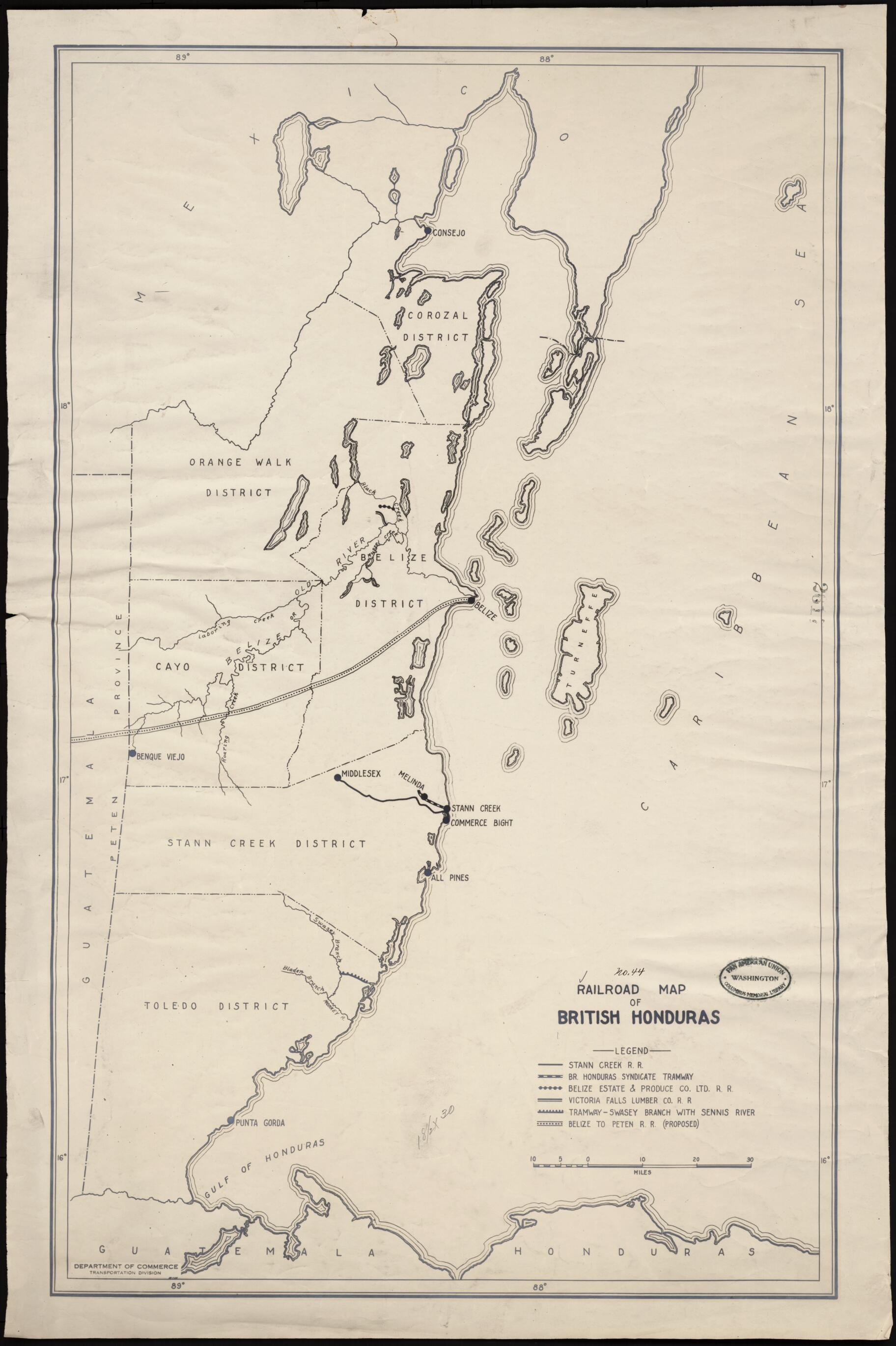
day Belize). Under the Treaty of Versailles of 1783, the Spanish Empire granted Britain the right to harvest timber in the region between the Hondo and Belize Rivers. In 1862 the crown colony of British Honduras was established. Apart from British Guiana, it was the only British possession on the mainland of Latin America. The colony was important to Britain chiefly as a source of logwood and, later, mahogany. The railroads shown on the map are all quite small and were used primarily to transport lumber, sugar cane, and bananas to the coast. A proposed longer line from the port of Belize to Guatemala is indicated but was never built. The map also shows the colony's six administrative districts and the small number of towns and cities. British Honduras achieved full independence in 1981, becoming the country of Belize.
Created by Chamber of Commerce of the United States of America. Transportation and Communication Department in 1920.
- Title devised, in English, by Library staff.
- Original resource at: Columbus Memorial Library, Organization of American States.
- Content in English.
- Description based on data extracted from World Digital Library, which may be extracted from partner institutions.
Map Sizing Information
- For the best legibility, order your map in the original size or larger. Most maps have intricate detail and small text that is best appreciated when the print size hasn't been reduced.
- Sizes labeled "Fits a Standard Frame" will drop right into any frame that you purchase in that size. The sizes that we offer are commonly available online and at most retail stores.
- Our standard sizes are recommendations based on the aspect ratio of the original map, but still may require some added "white space" in one dimension to fit.
- Non-standard sizes will require custom framing, and we suggest taking your print to the frame shop of your choice after you receive it for the best results.
- Custom sizes are available, simply contact us for a quote.
Below is an approximation of the scale of a few standard sizes, and how they might appear in your space.

