
Railway Map of Jamaica 1920
- Regular price
-
$77.95 - Regular price
-
$72.95 - Sale price
-
$77.95
Shipping calculated at checkout.
Buy one map, get any other map in our collection for 50% OFF! Add to cart to see discount.
Couldn't load pickup availability
About This Map
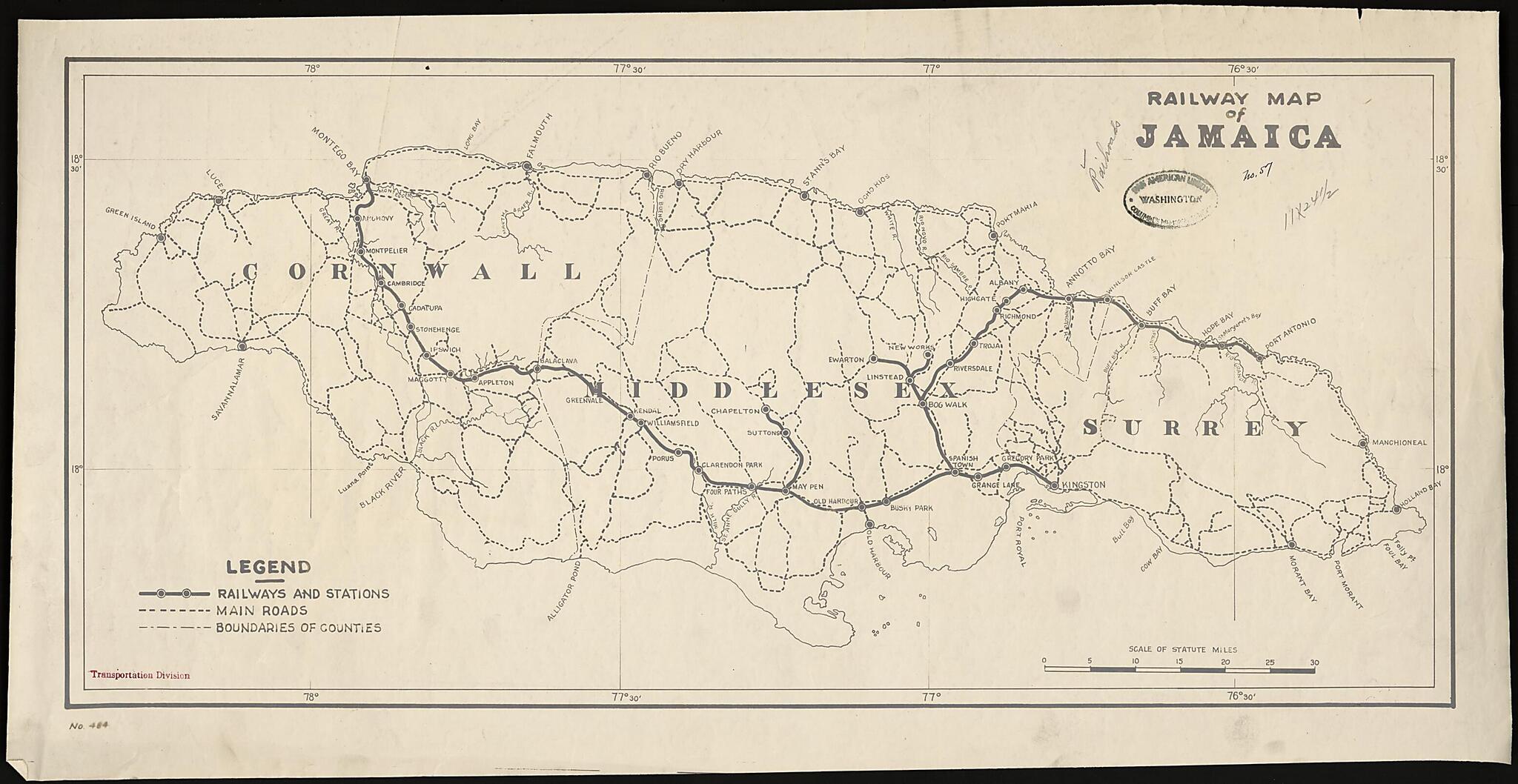
Old map of Jamaica.
-Cornwall, Middlesex, and Surrey--and their borders. The scale of the map is in statute miles (1 mile = 1.61 kilometers). The Western Jamaica Connecting Railway was built in 1845. Running from Kingston to Angels, a distance of some 23 kilometers, it was the first railroad constructed anywhere outside Europe or North America. The Jamaican railroad system was expanded throughout the 1900s, mainly for the purpose of bringing sugar and other products to the ports of Kingston, Port Antonio, and Montego Bay. Expansion of the railway in the late-19th century opened up the interior of the country to farming and the establishment of banana and citrus plantations. The map is held in the Columbus Memorial Library of the Organization of American States (OAS). After approximately 300 years of British rule, Jamaica gained its independence in 1962. It joined the OAS in 1969.
Created by Chamber of Commerce of the United States of America. Transportation and Communication Department in 1920.
- Title devised, in English, by Library staff.
- Original resource extent: 68 x 34 centimeters.
- Original resource at: Columbus Memorial Library, Organization of American States.
- Content in English.
- Description based on data extracted from World Digital Library, which may be extracted from partner institutions.
Map Subjects
1920 To 1929
Colonies
Great Britain
Jamaica
Railroads
Chamber Of Commerce Of The United States Of America. Transportation And Communication Department
1920
Map Sizing Information
- For the best legibility, order your map in the original size or larger. Most maps have intricate detail and small text that is best appreciated when the print size hasn't been reduced.
- Sizes labeled "Fits a Standard Frame" will drop right into any frame that you purchase in that size. The sizes that we offer are commonly available online and at most retail stores.
- Our standard sizes are recommendations based on the aspect ratio of the original map, but still may require some added "white space" in one dimension to fit.
- Non-standard sizes will require custom framing, and we suggest taking your print to the frame shop of your choice after you receive it for the best results.
- Custom sizes are available, simply contact us for a quote.
Below is an approximation of the scale of a few standard sizes, and how they might appear in your space.
