
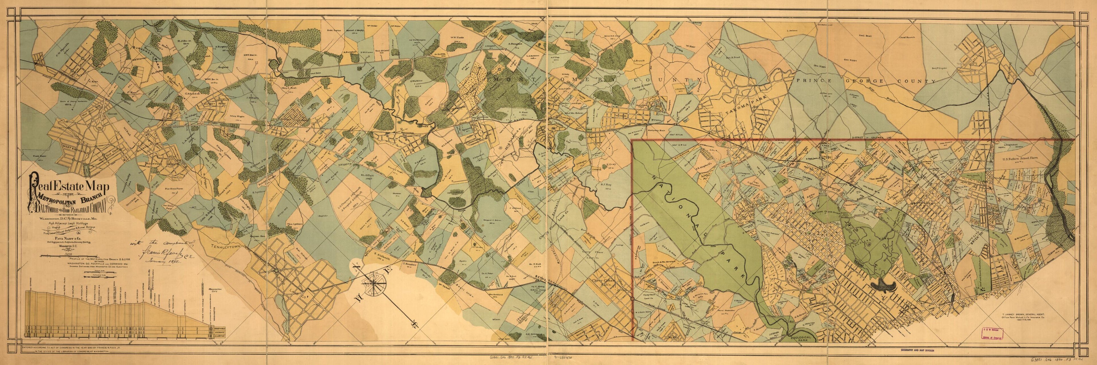
Real Estate Map of the Metropolitan Branch of the Baltimore and Ohio Railroad Company Between Washington, D.C., and Rockville, Md., and Adjacent Land Holdings : From Latest Official Authorities & Actual Surveys in 1890
- Regular price
-
$107.95 - Regular price
-
$102.95 - Sale price
-
$107.95
Shipping calculated at checkout.
Buy one map, get any other map in our collection for 50% OFF! Add to cart to see discount.
Couldn't load pickup availability
About This Map
Old map of District of Columbia, Maryland, Montgomery County, United States, Washington, Washington D.C., Washington Metropolitan Area.
Shows drainage, park lands, streets, roads, railroads, some buildings, and names of property owners. Includes railroad profile.
Created by Baltimore and Ohio Railroad Company, Fava Naeff & Co, Francis R. Fava in 1890.
Shows drainage, park lands, streets, roads, railroads, some buildings, and names of property owners. Includes railroad profile.
Created by Baltimore and Ohio Railroad Company, Fava Naeff & Co, Francis R. Fava in 1890.
- Partial cadastral map showing owners' names and acreages of larger landholdings in districts adjacent to the B&O R.R. in Washington D.C. and Montgomery County (Md.).
- "Entered according to act of Congress in the year 1890 by Francis R. Fava Jr. ... at Washington."
- Oriented with north toward the upper left.
- Includes notes and "Profile of the Metropolitan Branch B. & O.R.R. ... showing distances from Washington D.C. and elevations."
Map Sizing Information
- For the best legibility, order your map in the original size or larger. Most maps have intricate detail and small text that is best appreciated when the print size hasn't been reduced.
- Sizes labeled "Fits a Standard Frame" will drop right into any frame that you purchase in that size. The sizes that we offer are commonly available online and at most retail stores.
- Our standard sizes are recommendations based on the aspect ratio of the original map, but still may require some added "white space" in one dimension to fit.
- Non-standard sizes will require custom framing, and we suggest taking your print to the frame shop of your choice after you receive it for the best results.
- Custom sizes are available, simply contact us for a quote.
Below is an approximation of the scale of a few standard sizes, and how they might appear in your space.
