

Rebel Defences sic of Charleston Harbor, S.C., December 11th, 1864 11-11
- Regular price
-
$49.95 - Regular price
-
$29.95 - Sale price
-
$49.95
Shipping calculated at checkout.
Buy one map, get any other map in our collection for 50% OFF! Add to cart to see discount.
Couldn't load pickup availability
About This Map
Old map of Charleston, South Carolina, United States.
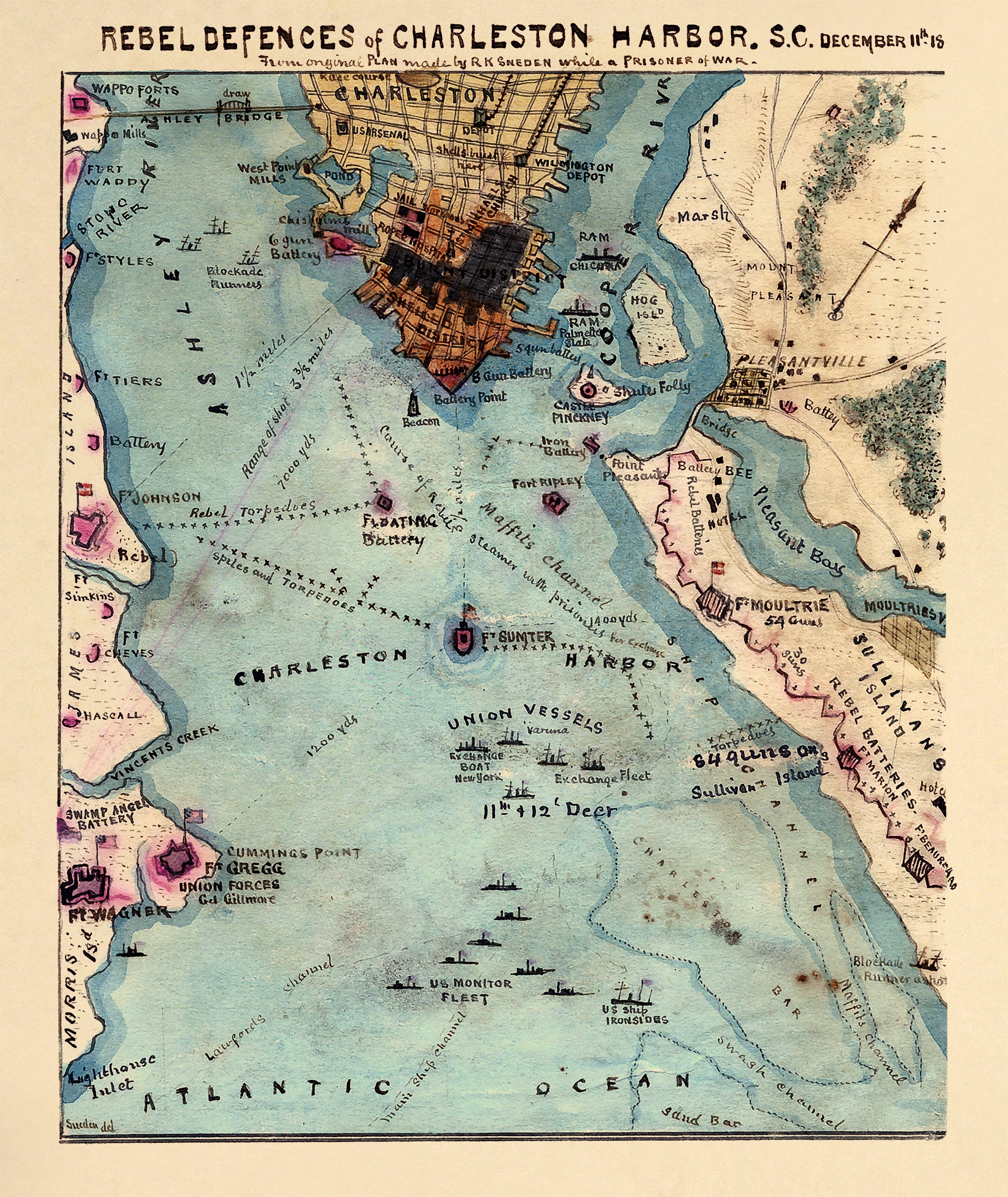
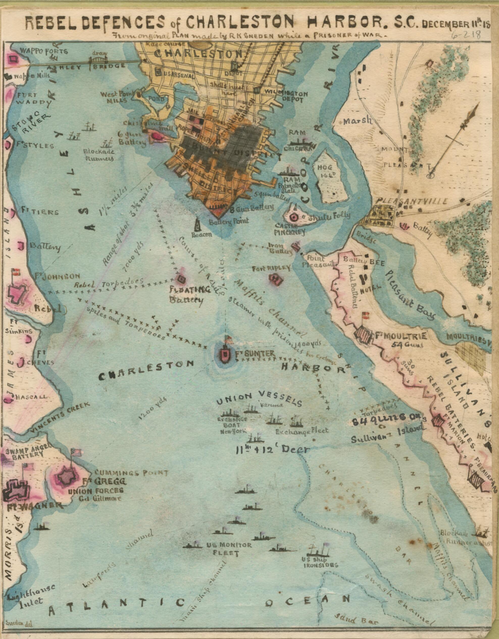
Outlines the harbor of Charleston, S.C., beginning with the convergence of the Ashley and Cooper rivers and continuing to the Atlantic Ocean. Sneden traveled through the harbor on a Confederate steamer on December 11 headed for exchange and gives in this map a detailed picture of the many Confederate forts and batteries along the harbor as well as all types of vessels, especially noting the Union vessels that were awaiting the Confederate steamer on which Sneden was riding. He indicates that the U.S. Monitor fleet backed up the Union exchange boats.
Created by Robert Knox Sneden in 11-11.
- This item is from the collections of the Virginia Historical Society; please contact the institution for more information.
- Under the title: "From original Plan made by R.K. Sneden while a Prisoner of war."
- Robert Knox Sneden scrapbook (Mss5:7 Sn237:1), Virginia Historical Society.
- In the Robert Knox Sneden diary, 1861-1865 (v. 6, p. 218).
- Manuscripts
Map Sizing Information
- For the best legibility, order your map in the original size or larger. Most maps have intricate detail and small text that is best appreciated when the print size hasn't been reduced.
- Sizes labeled "Fits a Standard Frame" will drop right into any frame that you purchase in that size. The sizes that we offer are commonly available online and at most retail stores.
- Our standard sizes are recommendations based on the aspect ratio of the original map, but still may require some added "white space" in one dimension to fit.
- Non-standard sizes will require custom framing, and we suggest taking your print to the frame shop of your choice after you receive it for the best results.
- Custom sizes are available, simply contact us for a quote.
Below is an approximation of the scale of a few standard sizes, and how they might appear in your space.

